Directions to Begnins with public transportation
The following transit lines have routes that pass near Begnins
How to get to Begnins by bus?
Click on the bus route to see step by step directions with maps, line arrival times and updated time schedules.
How to get to Begnins by train?
Click on the train route to see step by step directions with maps, line arrival times and updated time schedules.
Bus stops near Begnins
- Begnins, Poste, 3 min walk,
Train stations near Begnins
- Gland, 48 min walk,
Bus lines to Begnins
- 820, Nyon, Gare,
- 830, Gland, Gare Nord,
What are the closest stations to Begnins?
The closest stations to Begnins are:
- Begnins, Poste is 200 meters away, 3 min walk.
- Gland is 3685 meters away, 48 min walk.
Which bus lines stop near Begnins?
These bus lines stop near Begnins: 820, 830.
Which train line stops near Begnins?
RE33
What’s the nearest bus stop to Begnins?
The nearest bus stop to Begnins is Begnins, Poste. It’s a 3 min walk away.
What time is the first train to Begnins?
The RE33 is the first train that goes to Begnins. It stops nearby at 3:19 AM.
What time is the last train to Begnins?
The RE33 is the last train that goes to Begnins. It stops nearby at 12:54 AM.
What time is the first bus to Begnins?
The 820 is the first bus that goes to Begnins. It stops nearby at 6:36 AM.
What time is the last bus to Begnins?
The 820 is the last bus that goes to Begnins. It stops nearby at 10:46 PM.
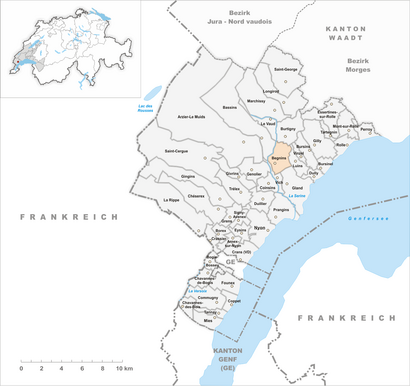
See Begnins on the map
Public Transportation to Begnins
Wondering how to get to Begnins, Switzerland? Moovit helps you find the best way to get to Begnins with step-by-step directions from the nearest public transit station.
Moovit provides free maps and live directions to help you navigate through your city. View schedules, routes, timetables, and find out how long does it take to get to Begnins in real time.
Looking for the nearest stop or station to Begnins? Check out this list of stops closest to your destination: Begnins, Poste; Gland.
Bus: 820, 830.Train: RE33, EXT, IR, IR90, R6, RE.
Want to see if there’s another route that gets you there at an earlier time? Moovit helps you find alternative routes or times. Get directions from and directions to Begnins easily from the Moovit App or Website.
We make riding to Begnins easy, which is why over 1.5 million users, including users in Begnins, trust Moovit as the best app for public transit. You don’t need to download an individual bus app or train app, Moovit is your all-in-one transit app that helps you find the best bus time or train time available.
For information on prices of bus and train, costs and ride fares to Begnins, please check the Moovit app.
Use the app to navigate to popular places including to the airport, hospital, stadium, grocery store, mall, coffee shop, school, college, and university.
Begnins Address: Grand'Rue street in Begnins
Begnins is a municipality in the district of Nyon in the canton of Vaud in Switzerland. It belongs to the wine-producing area of La Côte.Wiki
Attractions near Begnins
Forwaves Consulting,Philippe Grange,Entre Lac Et Lumière,Nutrivet Pet Food,Cdl Fair,Coiffure Meli,Manuel Perez,Pomodoro Groupe sa,Hr Gestion & Management,Le Milieu,Cabinet Médical,Catherine Raimondi - Sage-Femme à Domicile,Amme Serge-Roland,Tattoo S-R,Vgcm,Cmzimmermann SA,Atelier Conchi,Coaching et Guerison Holistique,Work Hr Consulting,Ça NE Mange Pas de PainHow to get to popular attractions in Begnins with public transit
OHCHR, Genève,Le Bateau Lavoir, Genève,Crossfit Leman, Vich,Bois De La Chapelle, Onex,Saint-Julien-En-Genevois,TPG Dole, Genève,Vacheron Constantin, Plan-Les-Ouates,Genève Gare Cornavin, Genève,Parc Jardin Anglais, Genève,Bel-Air, Genève,Manufacture Roger Dubuis, Meyrin,Mike Wong James-Fazy, Genève,Piaget, Plan-Les-Ouates,Eysins, Eysins,MEI Plan-les-Ouates, Plan-Les-Ouates,Furet, Genève,Chopard & Cie SA, Meyrin,Harmony P&G GBC, Lancy,TPG Seujet, Genève,Zara, LancyGet around Geneve by public transit!
Traveling around Geneve has never been so easy. See step by step directions as you travel to any attraction, street or major public transit station. View bus and train schedules, arrival times, service alerts and detailed routes on a map, so you know exactly how to get to anywhere in Geneve.
When traveling to any destination around Geneve use Moovit's Live Directions with Get Off Notifications to know exactly where and how far to walk, how long to wait for your line, and how many stops are left. Moovit will alert you when it's time to get off — no need to constantly re-check whether yours is the next stop.
Wondering how to use public transit in Geneve or how to pay for public transit in Geneve? Moovit public transit app can help you navigate your way with public transit easily, and at minimum cost. It includes public transit fees, ticket prices, and costs. Looking for a map of Geneve public transit lines? Moovit public transit app shows all public transit maps in Geneve with all Bus, Train, Metro, Light Rail, Ferry, Cable Car, Funicular and Gondola routes and stops on an interactive map.
Geneve has 8 transit type(s), including: Bus, Train, Metro, Light Rail, Ferry, Cable Car, Funicular and Gondola, operated by several transit agencies, including Schweizerische Bundesbahnen SBB, Nyon-St-Cergue-Morez, Société Nationale des Chemins de fer Français, TPG, Bahnersatz Jahresfahrplan, Interimsfahrplan / Horaire interimaire / Orario ad interim, SBB Infrastruktur AG Bahnersatz, Transports Publics de l'agglomération d'Annemasse, Bus Nyon-Prangins, Alpbus Fournier, CGN SA, Transports Publics Neuchâtelois SA (tc), But, PostAuto AG, Réseau Lihsa