See Belle Chasse Tunnel, New Orleans, on the map
Directions to Belle Chasse Tunnel (New Orleans) with public transportation
The following transit lines have routes that pass near Belle Chasse Tunnel
 Bus:
Bus:
Which bus line stops near Belle Chasse Tunnel?
115
See Belle Chasse Tunnel, New Orleans, on the map
Public Transit to Belle Chasse Tunnel in New Orleans
Wondering how to get to Belle Chasse Tunnel in New Orleans, United States? Moovit helps you find the best way to get to Belle Chasse Tunnel with step-by-step directions from the nearest public transit station.
Moovit provides free maps and live directions to help you navigate through your city. View schedules, routes, timetables, and find out how long does it take to get to Belle Chasse Tunnel in real time.
Bus:
Want to see if there’s another route that gets you there at an earlier time? Moovit helps you find alternative routes or times. Get directions from and directions to Belle Chasse Tunnel easily from the Moovit App or Website.
We make riding to Belle Chasse Tunnel easy, which is why over 1.5 million users, including users in New Orleans, trust Moovit as the best app for public transit. You don’t need to download an individual bus app or train app, Moovit is your all-in-one transit app that helps you find the best bus time or train time available.
For information on prices of bus and Streetcar, costs and ride fares to Belle Chasse Tunnel, please check the Moovit app.
Use the app to navigate to popular places including to the airport, hospital, stadium, grocery store, mall, coffee shop, school, college, and university.
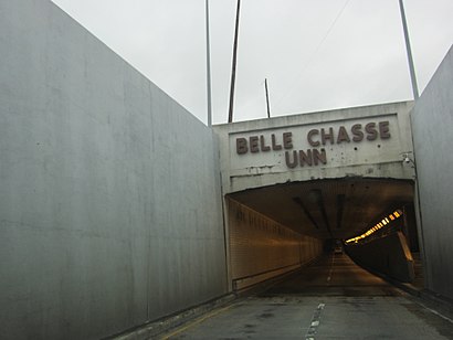
Belle Chasse Tunnel Address: Belle Chasse Hwy street in New Orleans
Attractions near Belle Chasse Tunnel
Railroad St,Delta Ice Air & Heat (Sno Block Ice),112 Alpha St,Alpha St,Wood Duck Dr,101 Warren St,CubeSmart,142 Oak Park Ct,Parkside Ct,Saigon Nails Spa,Western Union,Rouses Express (Time Saver),Time Saver 5,Belle Chasse, LA,Ashland Pl S,PEP Boys,Virginia Ct,1000 Fairfax Dr,La Morenita,MaacoHow to get to popular attractions in New Orleans with public transit
St. Charles Street Car Stop (Oak St.), New Orleans,RTA Streetcar City Park, New Orleans,The Tickle Room, New Orleans,Earhart Expressway, Metairie,Calliope Projects, New Orleans,Grand Isle Beach, New Orleans,Ursuline Academy, New Orleans,300th Block of S. Jefferson Davis, New Orleans,New Orleans DMV Office, New Orleans,Nike Factory Store, New Orleans,National Shrine of St. Ann, New Orleans,Joey K's, New Orleans,Ricrack Nola, New Orleans,Garden District, New Orleans,The NOCCA Institute, New Orleans,TCA, New Orleans,Lucky Title Auto Transfer & Notary Service, Gretna,Atchafalaya Restaurant, New Orleans,New Orleans Magazine, Metairie,Eric 'Big E' Airport Transportation Service, New OrleansGet around New Orleans by public transit!
Traveling around New Orleans has never been so easy. See step by step directions as you travel to any attraction, street or major public transit station. View bus and train schedules, arrival times, service alerts and detailed routes on a map, so you know exactly how to get to anywhere in New Orleans.
When traveling to any destination around New Orleans use Moovit's Live Directions with Get Off Notifications to know exactly where and how far to walk, how long to wait for your line, and how many stops are left. Moovit will alert you when it's time to get off — no need to constantly re-check whether yours is the next stop.
Wondering how to use public transit in New Orleans or how to pay for public transit in New Orleans? Moovit public transit app can help you navigate your way with public transit easily, and at minimum cost. It includes public transit fees, ticket prices, and costs. Looking for a map of New Orleans public transit lines? Moovit public transit app shows all public transit maps in New Orleans with all bus or Streetcar routes and stops on an interactive map.
New Orleans has 2 transit type(s), including: bus or Streetcar, operated by several transit agencies, including New Orleans RTA , New Orleans RTA , New Orleans RTA , JP Transit , Megabus, FlixBus-us and Greyhound-us