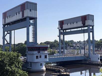
Directions to Belleville Turnpike Bridge (Kearny, Nj) with public transportation
The following transit lines have routes that pass near Belleville Turnpike Bridge
How to get to Belleville Turnpike Bridge by bus?
Click on the bus route to see step by step directions with maps, line arrival times and updated time schedules.
Bus stations near Belleville Turnpike Bridge in Kearny, Nj
- Mill St at Main St, 5 min walk,
- Washington Ave at Belleville Ave, 7 min walk,
- Ridge Rd at Belleville Tpke, 12 min walk,
Light Rail stations near Belleville Turnpike Bridge in Kearny, Nj
- Silver Lake Light Rail Station, 42 min walk,
Bus lines to Belleville Turnpike Bridge in Kearny, Nj
- 13, 13m North Newark Verona Ave Via Broad St Sta,
- 109, 109d Lyndhurst N Arlington Belleville N Newark,
- 30, Newark Penn Station,
- 76, 76p Newark Penn Station Via Lyndhrst Office Park,
What are the closest stations to Belleville Turnpike Bridge?
The closest stations to Belleville Turnpike Bridge are:
- Mill St at Main St is 373 yards away, 5 min walk.
- Washington Ave at Belleville Ave is 571 yards away, 7 min walk.
- Ridge Rd at Belleville Tpke is 992 yards away, 12 min walk.
- Silver Lake Light Rail Station is 3600 yards away, 42 min walk.
Which bus lines stop near Belleville Turnpike Bridge?
These bus lines stop near Belleville Turnpike Bridge: 13, 76.
What’s the nearest bus stop to Belleville Turnpike Bridge in Kearny, Nj?
The nearest bus stop to Belleville Turnpike Bridge in Kearny, Nj is Mill St at Main St. It’s a 5 min walk away.
What time is the first light rail to Belleville Turnpike Bridge in Kearny, Nj?
The NLR is the first light rail that goes to Belleville Turnpike Bridge in Kearny, Nj. It stops nearby at 4:10 AM.
What time is the last light rail to Belleville Turnpike Bridge in Kearny, Nj?
The NLR is the last light rail that goes to Belleville Turnpike Bridge in Kearny, Nj. It stops nearby at 1:35 AM.
What time is the first bus to Belleville Turnpike Bridge in Kearny, Nj?
The 13 is the first bus that goes to Belleville Turnpike Bridge in Kearny, Nj. It stops nearby at 3:53 AM.
What time is the last bus to Belleville Turnpike Bridge in Kearny, Nj?
The 13 is the last bus that goes to Belleville Turnpike Bridge in Kearny, Nj. It stops nearby at 2:16 AM.
How much is the bus fare to Belleville Turnpike Bridge?
The bus fare to Belleville Turnpike Bridge costs about $2.90.
How much is the train fare to Belleville Turnpike Bridge?
The train fare to Belleville Turnpike Bridge costs about $2.25 - $16.25.
See Belleville Turnpike Bridge, Kearny, Nj, on the map
Public Transit to Belleville Turnpike Bridge in Kearny, Nj
Wondering how to get to Belleville Turnpike Bridge in Kearny, Nj, United States? Moovit helps you find the best way to get to Belleville Turnpike Bridge with step-by-step directions from the nearest public transit station.
Moovit provides free maps and live directions to help you navigate through your city. View schedules, routes, timetables, and find out how long does it take to get to Belleville Turnpike Bridge in real time.
Looking for the nearest stop or station to Belleville Turnpike Bridge? Check out this list of stops closest to your destination: Mill St at Main St; Washington Ave at Belleville Ave; Ridge Rd at Belleville Tpke; Silver Lake Light Rail Station.
Bus: 13, 76, 109, 30.
Want to see if there’s another route that gets you there at an earlier time? Moovit helps you find alternative routes or times. Get directions from and directions to Belleville Turnpike Bridge easily from the Moovit App or Website.
We make riding to Belleville Turnpike Bridge easy, which is why over 1.5 million users, including users in Kearny, Nj, trust Moovit as the best app for public transit. You don’t need to download an individual bus app or train app, Moovit is your all-in-one transit app that helps you find the best bus time or train time available.
For information on prices of bus and train, costs and ride fares to Belleville Turnpike Bridge, please check the Moovit app.
Use the app to navigate to popular places including to the airport, hospital, stadium, grocery store, mall, coffee shop, school, college, and university.
Location: Kearny, Nj, New York - New Jersey
Attractions near Belleville Turnpike Bridge
Belleville Tpke and Passaic,Basic Self Defense and Compliance Hold Class,State Fair Christmas Outlet,Belleville Dial A Ride,La Caravana Grill,Cortlandt St Belle,Boat World Marina,Main Street,Empire Medical Associates,Riverside Graphics,SJP Trans,Alpine Nursery & Garden Center ,Laundry Room,Western Union,Startax,Bus 13,Made 4u Especially,JS Mobile Autobody,Washington Ave,PNC BankHow to get to popular attractions in Kearny, Nj with public transit
1501 Broadway, Manhattan,Harrison, NJ, Harrison, Nj,Palisades mall, West Nyack, Ny,1275 York Ave, Manhattan,Macy's Thanksgiving Day Parade, Manhattan,MTA Subway - High St / Brooklyn Bridge (A / C),Metropolitan Hospital, Manhattan,Resorts World Casino, Queens,West 55th St, Manhattan,Far Rockaway, NY, Queens,14th St & 8th Ave, Manhattan,Museum of Ice Cream, Manhattan,Kearny, NJ, Kearny, Nj,Long Island City, Queens,Springhill Suites by Marriott, Queens,Crowne Plaza Times Square, Manhattan,Secaucus, NJ, Secaucus, Nj,New Milford, NJ, New Milford, Nj,Pier 88 Manhattan Cruise Terminal, Manhattan,Walmart Supercenter, Secaucus, NjGet around New York - New Jersey by public transit!
Traveling around New York - New Jersey has never been so easy. See step by step directions as you travel to any attraction, street or major public transit station. View bus and train schedules, arrival times, service alerts and detailed routes on a map, so you know exactly how to get to anywhere in New York - New Jersey.
When traveling to any destination around New York - New Jersey use Moovit's Live Directions with Get Off Notifications to know exactly where and how far to walk, how long to wait for your line, and how many stops are left. Moovit will alert you when it's time to get off — no need to constantly re-check whether yours is the next stop.
Wondering how to use public transit in New York - New Jersey or how to pay for public transit in New York - New Jersey? Moovit public transit app can help you navigate your way with public transit easily, and at minimum cost. It includes public transit fees, ticket prices, and costs. Looking for a map of New York - New Jersey public transit lines? Moovit public transit app shows all public transit maps in New York - New Jersey with all Bus, Train, Subway, Light Rail, Ferry and Cable Car routes and stops on an interactive map.
New York - New Jersey has 6 transit type(s), including: Bus, Train, Subway, Light Rail, Ferry and Cable Car, operated by several transit agencies, including MTA Subway, Metro-North Railroad, LIRR, PATH, Shore Line East, MTA Bus Company, MTA New York City Transit - Express routes, MTA Bus, NJ Transit, NYC Ferry, NICE bus, Bee-Line Bus, NJ Transit Rail, Norwalk Transit District, CTTransit - Waterbury-Meriden