See Belmontas, Vilniaus, on the map
Directions to Belmontas (Vilniaus) with public transportation
The following transit lines have routes that pass near Belmontas
 Bus:
Bus:
How to get to Belmontas by bus?
Click on the bus route to see step by step directions with maps, line arrival times and updated time schedules.
Bus stations near Belmontas in Vilniaus
- Pūčkorių Atodanga,15 min walk,
- Žemasis Pavilnys,22 min walk,
- Mildos St.,28 min walk,
- Gamtininkų St.,46 min walk,
Bus lines to Belmontas in Vilniaus
- 18,Antakalnis–Dvarčionys–Parko g.,
- 31,Stotis–Pavilnys–Naujoji Vilnia,
- 58,Stotis–Dzūkų g.–Minsko pl.–Kalnėnai–Guriai–Grigaičiai,
- 67,Parko–Pramonės g.–Mickūnai,
- 74,Stotis–Subačiaus–Parko g.,
- 115,Antakalnis–Rokantiškės–Parko—Linksmoji g.,
- 13,Žemasis Pavilnys,
- 37,Žalgirio St.,
- 119,Autobusų Parkas (Metalo G.19a),
- 122,Naujoji Vilnia,
What are the closest stations to Belmontas?
The closest stations to Belmontas are:
- Pūčkorių Atodanga is 1111 meters away, 15 min walk.
- Žemasis Pavilnys is 1682 meters away, 22 min walk.
- Mildos St. is 2089 meters away, 28 min walk.
- Gamtininkų St. is 3453 meters away, 46 min walk.
Which bus line stops near Belmontas?
74
What’s the nearest bus stop to Belmontas in Vilniaus?
The nearest bus stop to Belmontas in Vilniaus is Pūčkorių Atodanga. It’s a 15 min walk away.
See Belmontas, Vilniaus, on the map
Public Transit to Belmontas in Vilniaus
Wondering how to get to Belmontas in Vilniaus, Lithuania? Moovit helps you find the best way to get to Belmontas with step-by-step directions from the nearest public transit station.
Moovit provides free maps and live directions to help you navigate through your city. View schedules, routes, timetables, and find out how long does it take to get to Belmontas in real time.
Looking for the nearest stop or station to Belmontas? Check out this list of stops closest to your destination: Pūčkorių Atodanga; Žemasis Pavilnys; Mildos St.; Gamtininkų St..
Bus:
Want to see if there’s another route that gets you there at an earlier time? Moovit helps you find alternative routes or times. Get directions from and directions to Belmontas easily from the Moovit App or Website.
We make riding to Belmontas easy, which is why over 1.5 million users, including users in Vilniaus, trust Moovit as the best app for public transit. You don’t need to download an individual bus app or train app, Moovit is your all-in-one transit app that helps you find the best bus time or train time available.
For information on prices of bus and Trolleybus, costs and ride fares to Belmontas, please check the Moovit app.
Use the app to navigate to popular places including to the airport, hospital, stadium, grocery store, mall, coffee shop, school, college, and university.
Belmontas Address: Belmontas, Vilnius, Lietuva street in Vilniaus
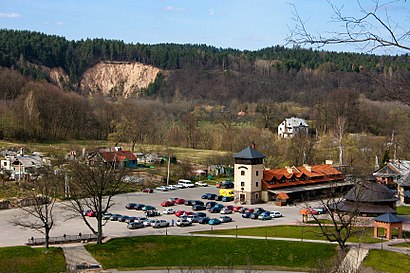
Attractions near Belmontas
Belmonto gatvė 17,Belmonto gatvė 52,Pavilnių regioninis parkas,Belmonto G.,Nuotykių parkas Belmontas,Lauko Darželis - Lauke.Lt,Pučkorių Atodanga,Rotonda,Šašlykinė „Prie Šlaito“,Pūčkorių gatvė 15,S. Batoro gatvė,A. Kojelavičiaus gatvė,S. Batoro gatvė / Pūčkorių gatvė,Pūčkorių Atodanga,Belmonto,S. Batoro gatvė,Pūčkorių gatvė,Mildos St.,A. Kojelavičiaus gatvė 1,G. Arlausko Individuali VeiklaHow to get to popular attractions in Vilniaus with public transit
Aviva Lietuva, Vilniaus,Gariūnų turgus, Vilniaus,Santariškės st., Vilniaus,VGTU - Biblioteka (Vilniaus Gedimino technikos universitetas), Vilniaus,Ledo rūmai, Vilniaus,VGTU - Transporto rūmai (Vilniaus Gedimino technikos universitetas), Vilniaus,L. Giros g. 80, Vilniaus,Quadrum, Vilniaus,VšĮ Respublikinė Vilniaus universitetinė ligoninė (Greitosios pagalbos ligoninė), Vilniaus,InMedica klinika, Vilniaus,Western Union EUROC, Vilniaus,PJazz, Vilniaus,Verkių regioninis parkas | Verkiai Regional park, Vilniaus,Vilniaus Žemynos gimnazija, Vilniaus,VRM Rūmai, Vilniaus,Hotel Zemaites Vilnius, Vilniaus,Europos Verslo Centras, Vilniaus,Ukmerges Plentas, Vilniaus,Šeškinės kalnas, Vilniaus,10 troleibusas, VilniausGet around Vilniaus by public transit!
Traveling around Vilniaus has never been so easy. See step by step directions as you travel to any attraction, street or major public transit station. View bus and train schedules, arrival times, service alerts and detailed routes on a map, so you know exactly how to get to anywhere in Vilniaus.
When traveling to any destination around Vilniaus use Moovit's Live Directions with Get Off Notifications to know exactly where and how far to walk, how long to wait for your line, and how many stops are left. Moovit will alert you when it's time to get off — no need to constantly re-check whether yours is the next stop.
Wondering how to use public transit in Vilniaus or how to pay for public transit in Vilniaus? Moovit public transit app can help you navigate your way with public transit easily, and at minimum cost. It includes public transit fees, ticket prices, and costs. Looking for a map of Vilniaus public transit lines? Moovit public transit app shows all public transit maps in Vilniaus with all bus or Trolleybus routes and stops on an interactive map.
Vilniaus has 2 transit type(s), including: bus or Trolleybus, operated by several transit agencies, including SĮ "Susisiekimo paslaugos"-Bus, SĮ "Susisiekimo paslaugos"-Cable, Lazdijų r. sav., Lietuvos transporto saugos administracija, Panevėžio autobusų parkas, Ridvija, Kauno miesto savivaldybės administracija, UAB "Kautra", AK, Kauno miesto savivaldybės administracija, GV, AP, Kautra, PA and Druskininkų sav.