How to get to Benjamin Edwards, Realtor by bus?
Click on the bus route to see step by step directions with maps, line arrival times and updated time schedules.
From Walmart, Baltimore County
43 minFrom Guinness Open Gate Brewery & Barrel House, Baltimore County
72 minFrom NSA Friendship Annex (FANX), Anne Arundel County
79 minFrom Baltimore Polytechnic Institute, Baltimore
31 minFrom Morgan State University, Baltimore
43 minFrom I-70 at Security Blvd Baltimore City Lot Park & Ride, Baltimore
39 minFrom Saint Agnes Hospital, Baltimore
41 minFrom Eastern Ave (eastern avenue and dundalk av), Baltimore
37 minFrom I-695 @ Exit 17 (Security Blvd/MD 122), Baltimore County
39 minFrom MVA Glen Burnie, Anne Arundel County
42 min
How to get to Benjamin Edwards, Realtor by train?
Click on the train route to see step by step directions with maps, line arrival times and updated time schedules.
Bus stops near Benjamin Edwards, Realtor in Baltimore
Light Rail stations near Benjamin Edwards, Realtor in Baltimore
- Mt. Vernon (Centre Street), 5 min walk,VIEW
Metro station near Benjamin Edwards, Realtor in Baltimore
- State Center Metro, 22 min walk,VIEW
Bus lines to Benjamin Edwards, Realtor in Baltimore
What are the closest stations to Benjamin Edwards, Realtor?
The closest stations to Benjamin Edwards, Realtor are:
- Eutaw St & George St Mid Sb is 30 yards away, 1 min walk.
- Centre St & Eutaw St Eb is 187 yards away, 3 min walk.
- Howard St & Franklin St Nb is 207 yards away, 3 min walk.
- Eutaw St & Saratoga St FS Nb is 245 yards away, 4 min walk.
- Howard St & Saratoga St Mid Nb is 346 yards away, 5 min walk.
- Paca St & Saratoga St FS Nb is 358 yards away, 5 min walk.
- Mt. Vernon (Centre Street) is 358 yards away, 5 min walk.
- State Center Metro is 1831 yards away, 22 min walk.
Which bus lines stop near Benjamin Edwards, Realtor?
These bus lines stop near Benjamin Edwards, Realtor: 154, 163, 54, 73, 80, 94, CITYLINK BLUE, CITYLINK SILVER.
Which train line stops near Benjamin Edwards, Realtor?
MARC (Inbound - Penn)
Which light rail line stops near Benjamin Edwards, Realtor?
LIGHT RAILLINK (Soutbound)
What’s the nearest light rail station to Benjamin Edwards, Realtor in Baltimore?
The nearest light rail station to Benjamin Edwards, Realtor in Baltimore is Mt. Vernon (Centre Street). It’s a 5 min walk away.
What’s the nearest metro station to Benjamin Edwards, Realtor in Baltimore?
The nearest metro station to Benjamin Edwards, Realtor in Baltimore is State Center Metro. It’s a 22 min walk away.
What’s the nearest bus station to Benjamin Edwards, Realtor in Baltimore?
The nearest bus station to Benjamin Edwards, Realtor in Baltimore is Eutaw St & George St Mid Sb. It’s a 1 min walk away.
What time is the first light rail to Benjamin Edwards, Realtor in Baltimore?
The LIGHT RAILLINK is the first light rail that goes to Benjamin Edwards, Realtor in Baltimore. It stops nearby at 3:53 AM.
What time is the last light rail to Benjamin Edwards, Realtor in Baltimore?
The LIGHT RAILLINK is the last light rail that goes to Benjamin Edwards, Realtor in Baltimore. It stops nearby at 1:23 AM.
What time is the first metro to Benjamin Edwards, Realtor in Baltimore?
The METRO is the first metro that goes to Benjamin Edwards, Realtor in Baltimore. It stops nearby at 5:07 AM.
What time is the last metro to Benjamin Edwards, Realtor in Baltimore?
The METRO is the last metro that goes to Benjamin Edwards, Realtor in Baltimore. It stops nearby at 12:23 AM.
What time is the first bus to Benjamin Edwards, Realtor in Baltimore?
The 54 is the first bus that goes to Benjamin Edwards, Realtor in Baltimore. It stops nearby at 3:00 AM.
What time is the last bus to Benjamin Edwards, Realtor in Baltimore?
The 73 is the last bus that goes to Benjamin Edwards, Realtor in Baltimore. It stops nearby at 3:15 AM.
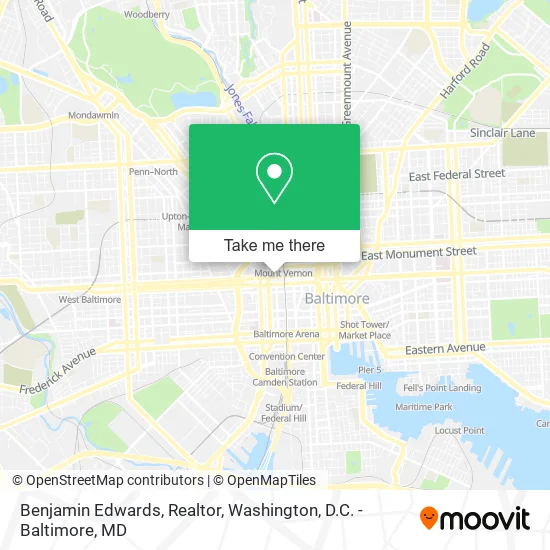
See Benjamin Edwards, Realtor, Baltimore, on the map
Public Transit to Benjamin Edwards, Realtor in Baltimore
Wondering how to get to Benjamin Edwards, Realtor in Baltimore? Moovit helps you find the best way to get to Benjamin Edwards, Realtor with step-by-step directions from the nearest public transit station.
Moovit provides free maps and live directions to help you navigate through your city. View schedules, routes, timetables, and find out how long does it take to get to Benjamin Edwards, Realtor in real time.
Looking for the nearest stop or station to Benjamin Edwards, Realtor? Check out this list of stops closest to your destination: Eutaw St & George St Mid Sb; Centre St & Eutaw St Eb; Howard St & Franklin St Nb; Eutaw St & Saratoga St FS Nb; Howard St & Saratoga St Mid Nb; Paca St & Saratoga St FS Nb; Mt. Vernon (Centre Street); State Center Metro.
Bus: 154, 163, 54, 73, 80, 94, CITYLINK BLUE, CITYLINK SILVER, CITYLINK PINK, 120, 105, 320.Train: MARC.Metro: METRO.Light Rail: LIGHT RAILLINK.
Want to see if there’s another route that gets you there at an earlier time? Moovit helps you find alternative routes or times. Get directions from and directions to Benjamin Edwards, Realtor easily from the Moovit App or Website.
We make riding to Benjamin Edwards, Realtor easy, which is why over 1.5 million users, including users in Baltimore, trust Moovit as the best app for public transit. You don’t need to download an individual bus app or train app, Moovit is your all-in-one transit app that helps you find the best bus time or train time available.
For information on prices of bus, light rail and train, costs and ride fares to Benjamin Edwards, Realtor, please check the Moovit app.
Use the app to navigate to popular places including to the airport, hospital, stadium, grocery store, mall, coffee shop, school, college, and university.
Benjamin Edwards, Realtor Address: 400 W Franklin St Baltimore, MD 21201 street in Baltimore
- BB,
- Cashbull,
- Productive Citizens,
- Homes of Greater Baltimore,
- Daremodel,
- Ori Essence Beauty,
- Divine 5 Star Cleaning Services,
- Silaca Properties,
- Maximus Emergency Services,
- D.A.W. Contracting in,
- Paca,
- Prime Health,
- Entrepreneuron,
- HMM Fence and Gates,
- Andr3ws57,
- Hardy Plumbing,
- Miracle Cleaning and Hauling,
- Julie Truscello - Cummings & Co Realtors,
- Trust Noone,
- Structoflex
Places Near Benjamin Edwards, Realtor (Baltimore)
- Pennsylvania Ave NW (3rd st and pennsylvania), Washington,
- National Mall, Washington,
- Georgetown, Washington,
- PG Mall, Prince George's County,
- Museum Of The Bible, Washington,
- Westfield Montgomery Mall, Montgomery County,
- Washington National Cathedral, Washington,
- Rock Creek Tennis Center, Washington,
- Capital One Arena, Washington,
- Marriott Marquis Washington, DC, Washington,
- Washington DC VA Medical Center, Washington,
- Warner Theatre, Washington,
- Camden Yards, Baltimore,
- Basilica of the National Shrine, Washington,
- Amazon Hq2, Arlington County,
- Sibley Memorial Hospital, Washington,
- National Museum of African American History and Culture, Washington,
- The Anthem, Washington,
- National Zoo, Washington,
- M&T Bank Stadium, Baltimore
How to get to popular places in Washington, D.C. - Baltimore, MD with public transit
Get around Baltimore by public transit!
Traveling around Baltimore has never been so easy. See step by step directions as you travel to any attraction, street or major public transit station. View bus and train schedules, arrival times, service alerts and detailed routes on a map, so you know exactly how to get to anywhere in Baltimore.
When traveling to any destination around Baltimore use Moovit's Live Directions with Get Off Notifications to know exactly where and how far to walk, how long to wait for your line, and how many stops are left. Moovit will alert you when it's time to get off — no need to constantly re-check whether yours is the next stop.
Wondering how to use public transit in Baltimore or how to pay for public transit in Baltimore? Moovit public transit app can help you navigate your way with public transit easily, and at minimum cost. It includes public transit fees, ticket prices, and costs. Looking for a map of Baltimore public transit lines? Moovit public transit app shows all public transit maps in Baltimore with all Bus, Train, Metro, Light Rail and Ferry routes and stops on an interactive map.
Washington, D.C. - Baltimore, MD has 5 transit type(s), including: Bus, Train, Metro, Light Rail and Ferry, operated by several transit agencies, including WMATA, Montgomery County Ride On, Fairfax Connector, TheBus, PRTC, DASH - Alexandria, Arlington Transit (ART), RTA of Central Maryland, MDOT MTA, MDOT MTA Light RailLink, MDOT MTA Commuter Bus, MDOT MTA Local Bus, FXBGO!, Virginia Railway Express (VRE) and MARC