How to get to Paca by bus?
Click on the bus route to see step by step directions with maps, line arrival times and updated time schedules.
From Baltimore Poly Tech High School, Baltimore
32 minFrom Good Samaritan Hospital, Baltimore
47 minFrom NSA Friendship Annex (FANX), Anne Arundel County
78 minFrom Walmart, Baltimore County
42 minFrom Sinai Hospital, Baltimore
51 minFrom Guinness Open Gate Brewery & Barrel House, Baltimore County
73 minFrom Saint Agnes Hospital, Baltimore
41 minFrom Walmart, Baltimore County
44 minFrom I-695 @ Exit 17 (Security Blvd/MD 122), Baltimore County
40 minFrom MVA Glen Burnie, Anne Arundel County
43 min
How to get to Paca by train?
Click on the train route to see step by step directions with maps, line arrival times and updated time schedules.
Bus stops near Paca in Baltimore
Light Rail stations near Paca in Baltimore
- Mt. Vernon (Centre Street), 5 min walk,VIEW
Metro station near Paca in Baltimore
- Lexington Market Metro, 7 min walk,VIEW
Bus lines to Paca in Baltimore
What are the closest stations to Paca?
The closest stations to Paca are:
- Eutaw St & George St Mid Sb is 102 yards away, 2 min walk.
- Centre St & Eutaw St Eb is 223 yards away, 3 min walk.
- Paca St & Saratoga St FS Nb is 325 yards away, 4 min walk.
- Howard St & Franklin St Nb is 332 yards away, 4 min walk.
- Eutaw St & Saratoga St FS Nb is 370 yards away, 5 min walk.
- Mt. Vernon (Centre Street) is 387 yards away, 5 min walk.
- Lexington Market Metro is 554 yards away, 7 min walk.
Which bus lines stop near Paca?
These bus lines stop near Paca: 154, 163, 73, 80, 94, CITYLINK BLUE, CITYLINK SILVER.
Which train line stops near Paca?
MARC (Inbound - Penn)
Which light rail line stops near Paca?
LIGHT RAILLINK (Northbound)
What’s the nearest light rail station to Paca in Baltimore?
The nearest light rail station to Paca in Baltimore is Mt. Vernon (Centre Street). It’s a 5 min walk away.
What’s the nearest metro station to Paca in Baltimore?
The nearest metro station to Paca in Baltimore is Lexington Market Metro. It’s a 7 min walk away.
What’s the nearest bus station to Paca in Baltimore?
The nearest bus station to Paca in Baltimore is Eutaw St & George St Mid Sb. It’s a 2 min walk away.
What time is the first light rail to Paca in Baltimore?
The LIGHT RAILLINK is the first light rail that goes to Paca in Baltimore. It stops nearby at 3:53 AM.
What time is the last light rail to Paca in Baltimore?
The LIGHT RAILLINK is the last light rail that goes to Paca in Baltimore. It stops nearby at 1:23 AM.
What time is the first metro to Paca in Baltimore?
The METRO is the first metro that goes to Paca in Baltimore. It stops nearby at 5:07 AM.
What time is the last metro to Paca in Baltimore?
The METRO is the last metro that goes to Paca in Baltimore. It stops nearby at 12:23 AM.
What time is the first bus to Paca in Baltimore?
The 54 is the first bus that goes to Paca in Baltimore. It stops nearby at 3:00 AM.
What time is the last bus to Paca in Baltimore?
The 73 is the last bus that goes to Paca in Baltimore. It stops nearby at 3:16 AM.
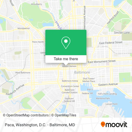
See Paca, Baltimore, on the map
Public Transit to Paca in Baltimore
Wondering how to get to Paca in Baltimore? Moovit helps you find the best way to get to Paca with step-by-step directions from the nearest public transit station.
Moovit provides free maps and live directions to help you navigate through your city. View schedules, routes, timetables, and find out how long does it take to get to Paca in real time.
Looking for the nearest stop or station to Paca? Check out this list of stops closest to your destination: Eutaw St & George St Mid Sb; Centre St & Eutaw St Eb; Paca St & Saratoga St FS Nb; Howard St & Franklin St Nb; Eutaw St & Saratoga St FS Nb; Mt. Vernon (Centre Street); Lexington Market Metro.
Bus: 154, 163, 73, 80, 94, CITYLINK BLUE, CITYLINK SILVER, 54, CITYLINK PINK, 40, 150, 120, 105.Train: MARC.Metro: METRO.Light Rail: LIGHT RAILLINK.
Want to see if there’s another route that gets you there at an earlier time? Moovit helps you find alternative routes or times. Get directions from and directions to Paca easily from the Moovit App or Website.
We make riding to Paca easy, which is why over 1.5 million users, including users in Baltimore, trust Moovit as the best app for public transit. You don’t need to download an individual bus app or train app, Moovit is your all-in-one transit app that helps you find the best bus time or train time available.
For information on prices of bus, light rail and train, costs and ride fares to Paca, please check the Moovit app.
Use the app to navigate to popular places including to the airport, hospital, stadium, grocery store, mall, coffee shop, school, college, and university.
Paca Address: 515 N Paca St Baltimore, MD 21201 street in Baltimore
- LENS CRAFTERS,
- Sears Home Services - Appliance Repair,
- JSH Home Improvement S,
- Bimbin Traders,
- Maximus Emergency Services,
- Silaca Properties,
- Ori Essence Beauty,
- Daremodel,
- Divine 5 Star Cleaning Services,
- Benjamin Edwards, Realtor,
- Blush,
- Glow Spot,
- A Daabah African Hair Braiding,
- Pretty Shades of You,
- Chase Quality Professionals,
- Wellness Reset,
- Thomas Sports Agency,
- Prime Clean Company,
- C C Riggin Landscaping,
- Fortunate Home Improvement
Places Near Paca (Baltimore)
- Sibley Memorial Hospital, Washington,
- Georgetown, Washington,
- PG Mall, Prince George's County,
- The Anthem, Washington,
- Pennsylvania Ave NW (3rd st and pennsylvania), Washington,
- Rock Creek Tennis Center, Washington,
- Amazon Hq2, Arlington County,
- National Zoo, Washington,
- Camden Yards, Baltimore,
- Westfield Montgomery Mall, Montgomery County,
- Warner Theatre, Washington,
- Washington DC VA Medical Center, Washington,
- Marriott Marquis Washington, DC, Washington,
- National Mall, Washington,
- Basilica of the National Shrine, Washington,
- M&T Bank Stadium, Baltimore,
- Washington National Cathedral, Washington,
- National Museum of African American History and Culture, Washington,
- Museum Of The Bible, Washington,
- Capital One Arena, Washington
How to get to popular places in Washington, D.C. - Baltimore, MD with public transit
Get around Baltimore by public transit!
Traveling around Baltimore has never been so easy. See step by step directions as you travel to any attraction, street or major public transit station. View bus and train schedules, arrival times, service alerts and detailed routes on a map, so you know exactly how to get to anywhere in Baltimore.
When traveling to any destination around Baltimore use Moovit's Live Directions with Get Off Notifications to know exactly where and how far to walk, how long to wait for your line, and how many stops are left. Moovit will alert you when it's time to get off — no need to constantly re-check whether yours is the next stop.
Wondering how to use public transit in Baltimore or how to pay for public transit in Baltimore? Moovit public transit app can help you navigate your way with public transit easily, and at minimum cost. It includes public transit fees, ticket prices, and costs. Looking for a map of Baltimore public transit lines? Moovit public transit app shows all public transit maps in Baltimore with all Bus, Train, Metro, Light Rail and Ferry routes and stops on an interactive map.
Washington, D.C. - Baltimore, MD has 5 transit type(s), including: Bus, Train, Metro, Light Rail and Ferry, operated by several transit agencies, including WMATA, Montgomery County Ride On, Fairfax Connector, TheBus, PRTC, DASH - Alexandria, Arlington Transit (ART), RTA of Central Maryland, MDOT MTA, MDOT MTA Light RailLink, MDOT MTA Commuter Bus, MDOT MTA Local Bus, FXBGO!, Virginia Railway Express (VRE) and MARC