Directions to Bennington Battle Monument with public transportation
The following transit lines have routes that pass near Bennington Battle Monument
How to get to Bennington Battle Monument by bus?
Click on the bus route to see step by step directions with maps, line arrival times and updated time schedules.
Bus stations near Bennington Battle Monument
- Monument Avenue / Elm St.,16 min walk,
- Mace Building/Holden Mill,23 min walk,
- Wal-Mart,32 min walk,
Bus lines to Bennington Battle Monument
- GREEN LINE,Bus Terminal at 215 Pleasant St.,
- BLUE LINE,Bus Terminal at 215 Pleasant St.,
- LIGHT GREEN LINE,Light Green Line,
- RED LINE,Red Line,
What are the closest stations to Bennington Battle Monument?
The closest stations to Bennington Battle Monument are:
- Monument Avenue / Elm St. is 1278 yards away, 16 min walk.
- Mace Building/Holden Mill is 1925 yards away, 23 min walk.
- Wal-Mart is 2687 yards away, 32 min walk.
Which bus lines stop near Bennington Battle Monument?
These bus lines stop near Bennington Battle Monument: 13, ORANGE LINE, PURPLE LINE.
See Bennington Battle Monument on the map
Public Transportation to Bennington Battle Monument
Wondering how to get to Bennington Battle Monument, United States? Moovit helps you find the best way to get to Bennington Battle Monument with step-by-step directions from the nearest public transit station.
Moovit provides free maps and live directions to help you navigate through your city. View schedules, routes, timetables, and find out how long does it take to get to Bennington Battle Monument in real time.
Looking for the nearest stop or station to Bennington Battle Monument? Check out this list of stops closest to your destination: Monument Avenue / Elm St.; Mace Building/Holden Mill; Wal-Mart.
Bus:13ORANGE LINEPURPLE LINEGREEN LINEBLUE LINELIGHT GREEN LINERED LINE
Want to see if there’s another route that gets you there at an earlier time? Moovit helps you find alternative routes or times. Get directions from and directions to Bennington Battle Monument easily from the Moovit App or Website.
We make riding to Bennington Battle Monument easy, which is why over 1.5 million users, including users in Bennington, trust Moovit as the best app for public transit. You don’t need to download an individual bus app or train app, Moovit is your all-in-one transit app that helps you find the best bus time or train time available.
For information on prices of bus, costs and ride fares to Bennington Battle Monument, please check the Moovit app.
Use the app to navigate to popular places including to the airport, hospital, stadium, grocery store, mall, coffee shop, school, college, and university.
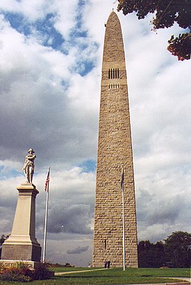
Bennington Battle Monument Address: Monument Circle street in Bennington
Attractions near Bennington Battle Monument
Monument Square,Historic Marker: Bennington Battle Monument,Seth Warner Statue,Old Bennington Historic District,Historic Marker: Ethan Allen,Mt Anthony Country Club,Old Bennington,Bennington Center-Old First Church Cemetery,Historic Marker: Vermont's Colonial Shrine,Old First Church,Monument Elementary School,Catholic Cemetery,Bennington School Incorporated,Jedediah Dewey House,The Grille At Mt Anthony Country Club,Bennington Museum Genealogical Library,Bennington Historical Museum,Historical Marker: The "Corkscrew" Railroad,Price Chopper,WalmartHow to get to popular attractions in Bennington with public transit
South Side Inn, Chittenden,Sucker Pond, Bennington,Grey Fox Inn And Resort, Lamoille,Trapp Family Lodge, Lamoille,All Systems Septic Design, Orleans,Sweet Resources Group, Rutland,Daggi's Reptiles, Windsor,Epiphany Tattoo Studio & Body Piercing, Lamoille,BMO Harris Bank,Jericho Corners Cemetery, Chittenden,Vertek, Chittenden,VT-DLC/Arlington Varie, Bennington,Highlight Burlington, Chittenden,Sterling Market / Johnson Post Office, Lamoille,Frikintech, Chittenden,Saint Albans Amateur Radio Club,General Store,Hazen Union School, Caledonia,National Life Group (Rousse, Edmond Natl Life of Vermont),Superfine Custom EmbroideryGet around Bennington by public transit!
Traveling around Bennington has never been so easy. See step by step directions as you travel to any attraction, street or major public transit station. View bus and train schedules, arrival times, service alerts and detailed routes on a map, so you know exactly how to get to anywhere in Bennington.
When traveling to any destination around Bennington use Moovit's Live Directions with Get Off Notifications to know exactly where and how far to walk, how long to wait for your line, and how many stops are left. Moovit will alert you when it's time to get off — no need to constantly re-check whether yours is the next stop.
Wondering how to use public transit in Bennington or how to pay for public transit in Bennington? Moovit public transit app can help you navigate your way with public transit easily, and at minimum cost. It includes public transit fees, ticket prices, and costs. Looking for a map of Bennington public transit lines? Moovit public transit app shows all public transit maps in Bennington with all bus routes and stops on an interactive map.
Bennington has 1 transit type(s), including: bus, operated by several transit agencies, including Green Mountain Transit, Wilmington MOOver, Advance Transit, Vermont Translines, Rockingham MOOver, The Bus (Marble Valley Regional Transit District), Green Mountain Express, Rural Community Transportation, Addison County Transit Resources, Stagecoach Transportation Services, Amtrak, Greyhound-us and FlixBus-us