How to get to Benucci Architect Giorgio by bus?
Click on the bus route to see step by step directions with maps, line arrival times and updated time schedules.
From Bruno Buozzi Street, Campi Bisenzio
52 minFrom Farewell Chapels of Misericordia of Antella, Bagno a Ripoli
55 minFrom Pavilion 16, Florence
41 minFrom Intrend, Sesto Fiorentino
52 minFrom San Mauro a Signa, Signa
62 minFrom Firenze North Service Area, Sesto Fiorentino
65 minFrom I Ragli Farm, San Casciano In Val Di Pesa
46 minFrom Florence North A1 Toll Gate, Campi Bisenzio
66 minFrom 11 August Avenue, Florence
40 minFrom Santa Maria Annunziata Hospital, Bagno a Ripoli
48 min
How to get to Benucci Architect Giorgio by train?
Click on the train route to see step by step directions with maps, line arrival times and updated time schedules.
Bus stops near Benucci Architect Giorgio in Florence
Light Rail stations near Benucci Architect Giorgio in Florence
Train station near Benucci Architect Giorgio in Florence
- Florence Santa Maria Novella, 27 min walk,VIEW
Bus lines to Benucci Architect Giorgio in Florence
- C1, Parterre,VIEW
- 12, San Miniato Square,VIEW
- 18, Tavarnuzze First of May,VIEW
- 36, Cascine Del Riccio,VIEW
- 37, Orti Oricellari Station,VIEW
- 39, Florence Bus Station,VIEW
- 50G, Grosseto Station,VIEW
- 131, Tozzi Street,VIEW
- 131, Florence Bus Station,VIEW
- 131, Poggibonsi Railway Station,VIEW
- 131R, Florence Bus Station,VIEW
- 131R, Salceto,VIEW
- 365 A, Paisiello,VIEW
- 368 A, Mercatale Don Minluni 2,VIEW
- 370 A, Montefiridolfi,VIEW
- 371 A, Vittorio Veneto Terminal,VIEW
- 372 A, Vittorio Veneto Terminal,VIEW
- 373, Montespertoli Holocaust Memorial,VIEW
- 13, Orti Oricellari Station,VIEW
- 11, La Gora,VIEW
What are the closest stations to Benucci Architect Giorgio?
The closest stations to Benucci Architect Giorgio are:
- Roman Gate is 8 meters away, 1 min walk.
- Petrarca Porta Romana is 77 meters away, 2 min walk.
- Calza Serragli is 169 meters away, 3 min walk.
- Imperial from Castiglione is 368 meters away, 5 min walk.
- Foscolo Pindemonte is 391 meters away, 6 min walk.
- Unit is 1918 meters away, 25 min walk.
- Alamanni-Station (Santa Maria Novella) is 1985 meters away, 26 min walk.
- Florence Santa Maria Novella is 2017 meters away, 27 min walk.
Which bus lines stop near Benucci Architect Giorgio?
These bus lines stop near Benucci Architect Giorgio: 11, 13, 368 A, 37, 370 A, 373.
Which train line stops near Benucci Architect Giorgio?
R (Prato/Firenze)
What’s the nearest light rail station to Benucci Architect Giorgio in Florence?
The nearest light rail station to Benucci Architect Giorgio in Florence is Unit. It’s a 25 min walk away.
What’s the nearest train station to Benucci Architect Giorgio in Florence?
The nearest train station to Benucci Architect Giorgio in Florence is Florence Santa Maria Novella. It’s a 27 min walk away.
What’s the nearest bus station to Benucci Architect Giorgio in Florence?
The nearest bus station to Benucci Architect Giorgio in Florence is Roman Gate. It’s a 1 min walk away.
What time is the first light rail to Benucci Architect Giorgio in Florence?
The T2 is the first light rail that goes to Benucci Architect Giorgio in Florence. It stops nearby at 4:49 AM.
What time is the last light rail to Benucci Architect Giorgio in Florence?
The T2 is the last light rail that goes to Benucci Architect Giorgio in Florence. It stops nearby at 12:49 AM.
What time is the first train to Benucci Architect Giorgio in Florence?
The R is the first train that goes to Benucci Architect Giorgio in Florence. It stops nearby at 4:32 AM.
What time is the last train to Benucci Architect Giorgio in Florence?
The R is the last train that goes to Benucci Architect Giorgio in Florence. It stops nearby at 12:40 AM.
What time is the first bus to Benucci Architect Giorgio in Florence?
The 11 is the first bus that goes to Benucci Architect Giorgio in Florence. It stops nearby at 6:05 AM.
What time is the last bus to Benucci Architect Giorgio in Florence?
The 11 is the last bus that goes to Benucci Architect Giorgio in Florence. It stops nearby at 12:23 AM.
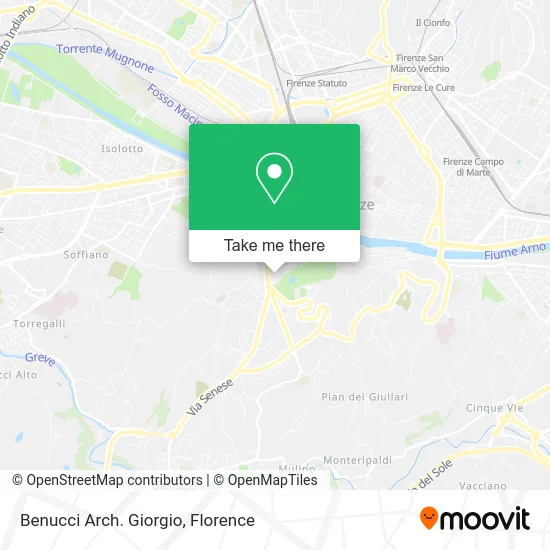
See Benucci Architect Giorgio, Florence, on the map
Public Transit to Benucci Architect Giorgio in Florence
Wondering how to get to Benucci Architect Giorgio in Florence? Moovit helps you find the best way to get to Benucci Architect Giorgio with step-by-step directions from the nearest public transit station.
Moovit provides free maps and live directions to help you navigate through your city. View schedules, routes, timetables, and find out how long does it take to get to Benucci Architect Giorgio in real time.
Looking for the nearest stop or station to Benucci Architect Giorgio? Check out this list of stops closest to your destination: Roman Gate; Petrarca Porta Romana; Calza Serragli; Imperial from Castiglione; Foscolo Pindemonte; Unit; Alamanni-Station (Santa Maria Novella); Florence Santa Maria Novella.
Bus: 11, 13, 368 A, 37, 370 A, 373, C1, 12, 18, 36, 38, 42.Train: R.
Want to see if there’s another route that gets you there at an earlier time? Moovit helps you find alternative routes or times. Get directions from and directions to Benucci Architect Giorgio easily from the Moovit App or Website.
We make riding to Benucci Architect Giorgio easy, which is why over 1.5 million users, including users in Florence, trust Moovit as the best app for public transit. You don’t need to download an individual bus app or train app, Moovit is your all-in-one transit app that helps you find the best bus time or train time available.
For information on prices of bus, light rail and train, costs and ride fares to Benucci Architect Giorgio, please check the Moovit app.
Use the app to navigate to popular places including to the airport, hospital, stadium, grocery store, mall, coffee shop, school, college, and university.
Benucci Architect Giorgio Address: Via dei Serragli, 133 50125 Firenze street in Florence
- Fratelli Mazzini,
- Ross&Thomas,
- Romano Viviani,
- Natali Paolo,
- Incandela Domenico,
- Fernandes by Franca Fernandes & Co.,
- Gesualdo Antonio,
- Textile Art Restoration Laboratory by Fallerini Valentina,
- Fabio Boschi,
- Parking Lot,
- Muse,
- Shoes,
- Body Maintenance by Ilaria Caldarelli Baldestein,
- Romana Street 135R,
- Toccafondi Auto Body Shop,
- Halal,
- Lottini / Lorena,
- Di Piazza Chiara,
- Rossi / Giancarlo Dry Cleaning Laundry,
- Ser Condominium
Places Near Benucci Architect Giorgio (Florence)
- Tobacco Manufacture, Florence,
- Campi Bisenzio, Campi Bisenzio,
- Viola Park, Bagno a Ripoli,
- Verdi Theater, Florence,
- Wanny Palace, Florence,
- I Gigli, Campi Bisenzio,
- Santa Maria Nuova Hospital, Florence,
- Artemio Franchi Municipal Stadium, Florence,
- Mandela Forum (Nelson Mandela Forum), Florence,
- Cascine Park, Florence,
- Asmana, Campi Bisenzio,
- Michelangelo Square, Florence,
- Torregalli Hospital Scandicci *, Scandicci,
- Santa Maria Novella Station, Florence,
- IKEA Florence, Sesto Fiorentino,
- Piero Palagi Hospital Facility-Florence, Florence,
- Michelangelo Square, Florence,
- Nelson Mandela Forum, Florence,
- Field of Mars, Florence,
- OOO, Florence
How to get to popular places in Florence with public transit
Get around Florence by public transit!
Traveling around Florence has never been so easy. See step by step directions as you travel to any attraction, street or major public transit station. View bus and train schedules, arrival times, service alerts and detailed routes on a map, so you know exactly how to get to anywhere in Florence.
When traveling to any destination around Florence use Moovit's Live Directions with Get Off Notifications to know exactly where and how far to walk, how long to wait for your line, and how many stops are left. Moovit will alert you when it's time to get off — no need to constantly re-check whether yours is the next stop.
Wondering how to use public transit in Florence or how to pay for public transit in Florence? Moovit public transit app can help you navigate your way with public transit easily, and at minimum cost. It includes public transit fees, ticket prices, and costs. Looking for a map of Florence public transit lines? Moovit public transit app shows all public transit maps in Florence with all Bus, Train, Light Rail, Ferry and Funicular routes and stops on an interactive map.
Florence has 5 transit type(s), including: Bus, Train, Light Rail, Ferry and Funicular, operated by several transit agencies, including Florence Urban - Tuscan Bus Lines, GEST, Livorno and Province - Tuscan Bus Lines, Arezzo, Florence and Provinces - Tuscan Bus Lines, Prato and Province - Tuscan Bus Lines, Lucca and Province - Tuscan Bus Lines, Massa, Carrara and Province - Tuscan Bus Lines, Pisa and Province - Tuscan Bus Lines, Grosseto, Siena and Provinces - Tuscan Bus Lines, Arezzo, Siena and Provinces - Tuscan Bus Lines, Florence and Province - Tuscan Bus Lines, Pistoia and Province - Tuscan Bus Lines, Siena and Province - Tuscan Bus Lines, Arezzo and Province - Tuscan Bus Lines and Trenitalia