Berģi stop - Monday schedule
| Line | Direction | Time |
|---|---|---|
| 31 | Berģuciems | 5:35 AM |
| 28 | Langstiņi | 5:41 AM |
| 29 | Vecmīlgrāvis | 5:45 AM |
| 31 | Berģuciems | 5:57 AM |
| 28 | Langstiņi | 6:16 AM |
| 31 | Berģuciems | 6:19 AM |
| 29 | Vecmīlgrāvis | 6:20 AM |
| 31 | Berģuciems | 6:35 AM |
| 28 | Langstiņi | 6:48 AM |
| 31 | Berģuciems | 6:51 AM |
| 29 | Vecmīlgrāvis | 6:55 AM |
| 31 | Berģuciems | 7:06 AM |
| 31 | Berģuciems | 7:20 AM |
| 28 | Langstiņi | 7:22 AM |
| 29 | Vecmīlgrāvis | 7:25 AM |
| 31 | Berģuciems | 7:44 AM |
| 29 | Vecmīlgrāvis | 7:55 AM |
| 28 | Langstiņi | 7:56 AM |
| 31 | Berģuciems | 8:09 AM |
| 29 | Vecāķi | 8:25 AM |
| 31 | Berģuciems | 8:30 AM |
| 28 | Langstiņi | 8:36 AM |
| 31 | Berģuciems | 8:51 AM |
| 29 | Vecmīlgrāvis | 8:55 AM |
| 28 | Langstiņi | 9:11 AM |
See Berģi, Rīga, on the map
Directions to Berģi (Rīga) with public transportation
The following transit lines have routes that pass near Berģi
 Bus:
Bus: - Cable Car:
How to get to Berģi by bus?
Click on the bus route to see step by step directions with maps, line arrival times and updated time schedules.
Bus stations near Berģi in Rīga
- Berģi,3 min walk,
Bus lines to Berģi in Rīga
- 28,Langstiņi,
- 29,Vecāķi,
- 31,Centrāltirgus,
What are the closest stations to Berģi?
The closest stations to Berģi are:
- Berģi is 185 meters away, 3 min walk.
Which bus lines stop near Berģi?
These bus lines stop near Berģi: 28, 29.
Which cable car line stops near Berģi?
31
What’s the nearest bus stop to Berģi in Rīga?
The nearest bus stop to Berģi in Rīga is Berģi. It’s a 3 min walk away.
What time is the first bus to Berģi in Rīga?
The 28 is the first bus that goes to Berģi in Rīga. It stops nearby at 5:40 AM.
What time is the last bus to Berģi in Rīga?
The 28 is the last bus that goes to Berģi in Rīga. It stops nearby at 11:44 PM.
What time is the first cable car to Berģi in Rīga?
The 31 is the first cable car that goes to Berģi in Rīga. It stops nearby at 5:34 AM.
What time is the last cable car to Berģi in Rīga?
The 31 is the last cable car that goes to Berģi in Rīga. It stops nearby at 12:37 AM.
See Berģi, Rīga, on the map
Public transit to Berģi stop in Rīga
Looking for directions to Berģi in Rīga, Latvia?
Download the Moovit App to find the current schedule and step-by-step directions for Bus, Cable Car or Light Rail routes that pass through Berģi.
Looking for the nearest stops closest to Berģi ? Check out this list of closest stops to your destination: Berģi.
Bus:Cable Car:
We make riding on public transit to Berģi easy, which is why over 1.5 million users, including users in Rīga trust Moovit as the best app for public transit.
Use the app to navigate to popular places including to the airport, hospital, stadium, grocery store, mall, coffee shop, school, college, and university.
The first line to this stop is 31, at 5:35 AM, and the last line is 31 at 12:16 AM.
480 Brīvības gatve, Latvia
This stop serves Rīgas satiksme and Rīgas satiksme’s lines
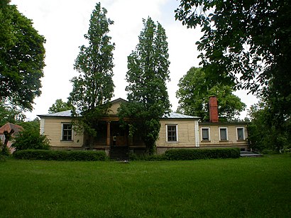
Berģi is a neighbourhood of Riga, the capital of Latvia. The Ethnographic Open-Air Museum is located here.Wiki
Bus stop near Berģi
BerģiPopular public transit stations in Rīga
Piedrujas Iela,Slokas Iela,93.Vidusskola,Zasulauka Depo,Martas Rinkas Iela,Baldones Iela,Pavasara Gatve,Tallinas Iela,Eglaines Iela/Dole,Āgenskalna Tirgus,Plēksnes Iela,Pļavnieku Kapi,Līgeri,Čiekurkalna Stacija,Jukuma Vācieša Iela,Ziemeļupe,Mikus Iela,Ulbrokas Vidusskola,Voleru Iela 35,Āgenskalna PriedesGet around Rīga by public transit!
Traveling around Rīga has never been so easy. See step by step directions as you travel to any attraction, street or major public transit station. View bus and train schedules, arrival times, service alerts and detailed routes on a map, so you know exactly how to get to anywhere in Rīga.
When traveling to any destination around Rīga use Moovit's Live Directions with Get Off Notifications to know exactly where and how far to walk, how long to wait for your line, and how many stops are left. Moovit will alert you when it's time to get off — no need to constantly re-check whether yours is the next stop.
Wondering how to use public transit in Rīga or how to pay for public transit in Rīga? Moovit public transit app can help you navigate your way with public transit easily, and at minimum cost. It includes public transit fees, ticket prices, and costs. Looking for a map of Rīga public transit lines? Moovit public transit app shows all public transit maps in Rīga with all bus, cable car or light rail routes and stops on an interactive map.
Rīga has 3 transit type(s), including: bus, cable car or light rail, operated by several transit agencies, including Rīgas satiksme, Rīgas satiksme and Rīgas satiksme