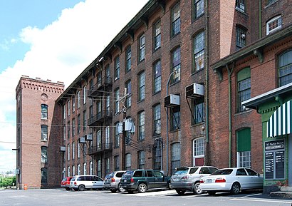
See Berkeley Mill Village, Boston, on the map
Directions to Berkeley Mill Village (Boston) with public transportation
The following transit lines have routes that pass near Berkeley Mill Village
 Bus:
Bus:
How to get to Berkeley Mill Village by bus?
Click on the bus route to see step by step directions with maps, line arrival times and updated time schedules.
Bus stations near Berkeley Mill Village in Boston
- Mendon FS Martin,1 min walk,
Bus lines to Berkeley Mill Village in Boston
- 75,Pawtucket Transit Center,
What are the closest stations to Berkeley Mill Village?
The closest stations to Berkeley Mill Village are:
- Mendon FS Martin is 26 yards away, 1 min walk.
Which bus line stops near Berkeley Mill Village?
75
What’s the nearest bus stop to Berkeley Mill Village in Boston?
The nearest bus stop to Berkeley Mill Village in Boston is Mendon FS Martin. It’s a 1 min walk away.
See Berkeley Mill Village, Boston, on the map
Public Transit to Berkeley Mill Village in Boston
Wondering how to get to Berkeley Mill Village in Boston, United States? Moovit helps you find the best way to get to Berkeley Mill Village with step-by-step directions from the nearest public transit station.
Moovit provides free maps and live directions to help you navigate through your city. View schedules, routes, timetables, and find out how long does it take to get to Berkeley Mill Village in real time.
Looking for the nearest stop or station to Berkeley Mill Village? Check out this list of stops closest to your destination: Mendon FS Martin.
Bus:
Want to see if there’s another route that gets you there at an earlier time? Moovit helps you find alternative routes or times. Get directions from and directions to Berkeley Mill Village easily from the Moovit App or Website.
We make riding to Berkeley Mill Village easy, which is why over 1.5 million users, including users in Boston, trust Moovit as the best app for public transit. You don’t need to download an individual bus app or train app, Moovit is your all-in-one transit app that helps you find the best bus time or train time available.
For information on prices of bus, costs and ride fares to Berkeley Mill Village, please check the Moovit app.
Use the app to navigate to popular places including to the airport, hospital, stadium, grocery store, mall, coffee shop, school, college, and university.
Location: Boston
Attractions near Berkeley Mill Village
1,Berkeley,Davenports,The Boys And Girls Club Baseball Field,Davenport's Restaurant,It's My Health Wellcare,7 Martin St,2 Bill St,The Boys And Girls Club,YMCA Cumberland ri,Boys & Girls Club Cumberland,It's My Health,Bill St,Bill Street,14 James J McKee Way,Stockton Turner,Joe's Auto Service,Fournier and Coleman Auto Glass,Albert Joseph Salon,Valley Falls Fire District OfficeHow to get to popular attractions in Boston with public transit
Tavern in the Square, Boston,Apple Providence Place,Everett, Everett,Starbucks,Cambridge Common, Cambridge,Cafeteria Boston, Boston,Clerys, Boston,Barrington, RI,Walmart Supercenter, Worcester,Ruggles Station, Boston,BJ's Wholesale Club, Haverhill,Target,Brown University,East Providence, RI,Boston Medical Center, Boston,Boston Sail Loft, Boston,Windsor Village at Waltham, Waltham,Stella, Boston,Hyatt Boston Harbor, Boston,Bunker Hill Community College, BostonGet around Boston by public transit!
Traveling around Boston has never been so easy. See step by step directions as you travel to any attraction, street or major public transit station. View bus and train schedules, arrival times, service alerts and detailed routes on a map, so you know exactly how to get to anywhere in Boston.
When traveling to any destination around Boston use Moovit's Live Directions with Get Off Notifications to know exactly where and how far to walk, how long to wait for your line, and how many stops are left. Moovit will alert you when it's time to get off — no need to constantly re-check whether yours is the next stop.
Wondering how to use public transit in Boston or how to pay for public transit in Boston? Moovit public transit app can help you navigate your way with public transit easily, and at minimum cost. It includes public transit fees, ticket prices, and costs. Looking for a map of Boston public transit lines? Moovit public transit app shows all public transit maps in Boston with all bus routes and stops on an interactive map.
Boston has 1 transit type(s), including: bus, operated by several transit agencies, including MBTA, MBTA, MBTA, Southeastern Regional Transit Authority, MetroWest Regional Transit Authority, Rhode Island Public Transit Authority, WRTA, Lowell Regional Transit Authority, Merrimack Valley Transit, Montachusett Regional Transit Authority, Cape Cod Regional Transit Authority, Brockton Area Transit Authority, Cape Cod Regional Transit Authority, Martha's Vineyard Transit Authority and the WAVE - Nantucket Regional Transit Authority