Directions to Bernstein Photo (Newton) with public transportation
The following transit lines have routes that pass near Bernstein Photo
 Bus: 52, GREEN LINE D SHUTTLE, GREEN LINE D SHUTTLE, GREEN LINE D SHUTTLE, GREEN LINE D SHUTTLE.
- Train: FRAMINGHAM/WORCESTER.
- Subway: GREEN LINE D.
How to get to Bernstein Photo by bus?
Click on the bus route to see step by step directions with maps, line arrival times and updated time schedules.
From Rochambeau, Boston
38 minFrom Copley MBTA Station, Boston
37 minFrom Courtyard by Marriott Brookline, Brookline
53 minFrom Old South Church, Boston
37 minFrom Westin Copley Place Hotel Boston, Boston
36 minFrom Takeda Pharmaceuticals, Cambridge
54 minFrom Boston Marathon Finish Line, Boston
37 minFrom Highland Ave Somerville MA, Somerville
76 minFrom Massachusetts College Of Pharmacy And Health Science, Boston
49 minFrom MBTA Jackson Square Station, Boston
86 min
How to get to Bernstein Photo by train?
Click on the train route to see step by step directions with maps, line arrival times and updated time schedules.
From Rochambeau, Boston
71 minFrom Copley MBTA Station, Boston
64 minFrom Old South Church, Boston
65 minFrom Westin Copley Place Hotel Boston, Boston
63 minFrom Boston Marathon Finish Line, Boston
64 minFrom Massachusetts College Of Pharmacy And Health Science, Boston
156 minFrom MBTA Jackson Square Station, Boston
164 min
How to get to Bernstein Photo by subway?
Click on the subway route to see step by step directions with maps, line arrival times and updated time schedules.
From Rochambeau, Boston
40 minFrom Copley MBTA Station, Boston
36 minFrom Courtyard by Marriott Brookline, Brookline
37 minFrom Old South Church, Boston
37 minFrom Westin Copley Place Hotel Boston, Boston
38 minFrom Takeda Pharmaceuticals, Cambridge
59 minFrom Boston Marathon Finish Line, Boston
37 minFrom Highland Ave Somerville MA, Somerville
75 minFrom Massachusetts College Of Pharmacy And Health Science, Boston
53 minFrom MBTA Jackson Square Station, Boston
56 min
Bus stops near Bernstein Photo in Newton
Subway station near Bernstein Photo in Newton
- Newton Centre, 23 min walk,VIEW
Train station near Bernstein Photo in Newton
- Newtonville, 39 min walk,VIEW
Bus lines to Bernstein Photo in Newton
- 52, Dedham Mall,VIEW
- GREEN LINE D SHUTTLE, Newton Highlands - Kenmore,VIEW
- GREEN LINE D SHUTTLE, Newton Highlands - Fenway,VIEW
- GREEN LINE D SHUTTLE, Riverside - Brookline Village,VIEW
- GREEN LINE D SHUTTLE, Riverside - Brookline Hills,VIEW
- GREEN LINE D SHUTTLE, Riverside - Reservoir,VIEW
- GREEN LINE D SHUTTLE, Newton Highlands - Kenmore via Saint Mary's Street,VIEW
- GREEN LINE D SHUTTLE, Riverside - Kenmore,VIEW
- GREEN LINE D SHUTTLE, Newton Highlands - Brookline Hills,VIEW
- GREEN LINE D SHUTTLE, Riverside - Fenway,VIEW
- GREEN LINE D SHUTTLE, Riverside - Kenmore via Saint Mary's Street,VIEW
- GREEN LINE D SHUTTLE, Newton Highlands - Reservoir,VIEW
- GREEN LINE D SHUTTLE, Riverside - Kenmore (Shuttle),VIEW
- 59, Needham Junction Via Needham St,VIEW
What are the closest stations to Bernstein Photo?
The closest stations to Bernstein Photo are:
- Centre St @ Beacon St is 225 yards away, 3 min walk.
- Newton Centre - Langley Rd @ Braeland Ave is 589 yards away, 8 min walk.
- Walnut St @ Berwick Rd is 1004 yards away, 12 min walk.
- Newton Centre is 1941 yards away, 23 min walk.
- Newtonville is 3282 yards away, 39 min walk.
Which bus line stops near Bernstein Photo?
52 (Charles River Loop)
Which train line stops near Bernstein Photo?
FRAMINGHAM/WORCESTER (#521 | Worcester)
Which subway line stops near Bernstein Photo?
GREEN LINE D (Riverside)
What’s the nearest subway station to Bernstein Photo in Newton?
The nearest subway station to Bernstein Photo in Newton is Newton Centre. It’s a 23 min walk away.
What’s the nearest bus station to Bernstein Photo in Newton?
The nearest bus station to Bernstein Photo in Newton is Centre St @ Beacon St. It’s a 3 min walk away.
What time is the first subway to Bernstein Photo in Newton?
The GREEN LINE D is the first subway that goes to Bernstein Photo in Newton. It stops nearby at 4:50 AM.
What time is the last subway to Bernstein Photo in Newton?
The GREEN LINE D is the last subway that goes to Bernstein Photo in Newton. It stops nearby at 2:41 AM.
What time is the first train to Bernstein Photo in Newton?
The FRAMINGHAM/WORCESTER is the first train that goes to Bernstein Photo in Newton. It stops nearby at 5:25 AM.
What time is the last train to Bernstein Photo in Newton?
The FRAMINGHAM/WORCESTER is the last train that goes to Bernstein Photo in Newton. It stops nearby at 12:17 AM.
What time is the first bus to Bernstein Photo in Newton?
The 59 is the first bus that goes to Bernstein Photo in Newton. It stops nearby at 6:17 AM.
What time is the last bus to Bernstein Photo in Newton?
The 59 is the last bus that goes to Bernstein Photo in Newton. It stops nearby at 8:08 PM.
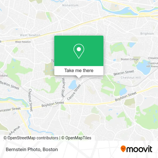
See Bernstein Photo, Newton, on the map
Public Transit to Bernstein Photo in Newton
Wondering how to get to Bernstein Photo in Newton? Moovit helps you find the best way to get to Bernstein Photo with step-by-step directions from the nearest public transit station.
Moovit provides free maps and live directions to help you navigate through your city. View schedules, routes, timetables, and find out how long does it take to get to Bernstein Photo in real time.
Looking for the nearest stop or station to Bernstein Photo? Check out this list of stops closest to your destination: Centre St @ Beacon St; Newton Centre - Langley Rd @ Braeland Ave; Walnut St @ Berwick Rd; Newton Centre; Newtonville.
Bus: 52, GREEN LINE D SHUTTLE, GREEN LINE D SHUTTLE, GREEN LINE D SHUTTLE, GREEN LINE D SHUTTLE, GREEN LINE D SHUTTLE, 59.Train: FRAMINGHAM/WORCESTER.Subway: GREEN LINE D.
Want to see if there’s another route that gets you there at an earlier time? Moovit helps you find alternative routes or times. Get directions from and directions to Bernstein Photo easily from the Moovit App or Website.
We make riding to Bernstein Photo easy, which is why over 1.7 million users, including users in Newton, trust Moovit as the best app for public transit. You don’t need to download an individual bus app or train app, Moovit is your all-in-one transit app that helps you find the best bus time or train time available.
For information on prices of subway, bus and train, costs and ride fares to Bernstein Photo, please check the Moovit app.
Use the app to navigate to popular places including to the airport, hospital, stadium, grocery store, mall, coffee shop, school, college, and university.
Bernstein Photo Address: 876 Beacon St Newton Center, MA 02459 street in Newton
- GW Marketing Services,
- Beacon Street Plumbing,
- Boston Real Estate - Alexander Lisek,
- Desimone R E,
- End Unit,
- Many Faces of FBC,
- Book of Intentions Ministries and Activities,
- Trinity Catholic MacKenzie Center,
- Pathway To Possible,
- Marc Trust,
- Webfish,
- Paragon Financial Advisors,
- LS Oak Nbarrel,
- Locksmith Newton Ma,
- Diane Basemera,
- Cheryl J Alpert,
- View Testimonials,
- NE Moves Mortgage,
- Rutman IP,
- Alison Dunn Real Estate
Places Near Bernstein Photo (Newton)
- Quincy Market, Boston,
- Museum Of Science, Boston,
- Cheers, Boston,
- North End, Boston,
- Castle Island, Boston,
- Seaport District, Boston,
- Wilbur Theatre, Boston,
- Td Garden, Boston,
- Mgm Music Hall, Boston,
- Isabella Stewart Gardner Museum, Boston,
- Boston Children's Hospital, Boston,
- Boston Medical Center, Boston,
- Wang Theater, Boston,
- House Of Blues, Boston,
- Prudential Center, Boston,
- Faneuil Hall, Boston,
- Leader Bank Pavilion (Leader Bank Pavillion), Boston,
- Boston Common, Boston,
- Massachusetts General Hospital, Boston,
- Boston Convention & Exhibition Center, Boston
How to get to popular places in Boston with public transit
Get around Newton by public transit!
Traveling around Newton has never been so easy. See step by step directions as you travel to any attraction, street or major public transit station. View bus and train schedules, arrival times, service alerts and detailed routes on a map, so you know exactly how to get to anywhere in Newton.
When traveling to any destination around Newton use Moovit's Live Directions with Get Off Notifications to know exactly where and how far to walk, how long to wait for your line, and how many stops are left. Moovit will alert you when it's time to get off — no need to constantly re-check whether yours is the next stop.
Wondering how to use public transit in Newton or how to pay for public transit in Newton? Moovit public transit app can help you navigate your way with public transit easily, and at minimum cost. It includes public transit fees, ticket prices, and costs. Looking for a map of Newton public transit lines? Moovit public transit app shows all public transit maps in Newton with all Bus, Train, Subway and Ferry routes and stops on an interactive map.
Boston has 4 transit type(s), including: Bus, Train, Subway and Ferry, operated by several transit agencies, including MBTA, Southeastern Regional Transit Authority, MetroWest Regional Transit Authority, Rhode Island Public Transit Authority, WRTA, Lowell Regional Transit Authority, Merrimack Valley Transit, Montachusett Regional Transit Authority, Cape Cod Regional Transit Authority, Brockton Area Transit Authority, Martha's Vineyard Transit Authority, the WAVE - Nantucket Regional Transit Authority, GATRA, Cape Ann Transportation Authority and Massport