Directions to Beth Tzedek Memorial Park (Toronto) with public transportation
The following transit lines have routes that pass near Beth Tzedek Memorial Park
How to get to Beth Tzedek Memorial Park by bus?
Click on the bus route to see step by step directions with maps, line arrival times and updated time schedules.
How to get to Beth Tzedek Memorial Park by subway?
Click on the subway route to see step by step directions with maps, line arrival times and updated time schedules.
Subway stations near Beth Tzedek Memorial Park in Toronto
- Sheppard - Yonge, 4 min walk,
Bus stations near Beth Tzedek Memorial Park in Toronto
- 5720 Bathurst St, 5 min walk,
- Antibes Dr at Bathurst St, 8 min walk,
- Finch Ave West at Bathurst St, 11 min walk,
Bus lines to Beth Tzedek Memorial Park in Toronto
- 7, Greenwin Village Rd at Bathurst St,
- 160, Wilson Station,
- 307, Exhibition Loop,
- 307S, Bathurst St at Bloor St West,
- 125, Finch Station,
- 125S, Antibes Dr at Bathurst St,
- 36, Finch West Station,
- 36B, Humberwood Blvd Loop at View Green Cres,
- 36S, Finch Ave West at Signet Dr West Side,
- 336, Woodbine Race Track Loop - Main Entrance,
- 939B, Finch West Station,
What are the closest stations to Beth Tzedek Memorial Park?
The closest stations to Beth Tzedek Memorial Park are:
- Sheppard - Yonge is 239 meters away, 4 min walk.
- 5720 Bathurst St is 321 meters away, 5 min walk.
- Antibes Dr at Bathurst St is 537 meters away, 8 min walk.
- Finch Ave West at Bathurst St is 778 meters away, 11 min walk.
Which bus lines stop near Beth Tzedek Memorial Park?
These bus lines stop near Beth Tzedek Memorial Park: 125, 160, 7.
Which subway line stops near Beth Tzedek Memorial Park?
1
What’s the nearest subway station to Beth Tzedek Memorial Park in Toronto?
The nearest subway station to Beth Tzedek Memorial Park in Toronto is Sheppard - Yonge. It’s a 4 min walk away.
What’s the nearest bus stop to Beth Tzedek Memorial Park in Toronto?
The nearest bus stop to Beth Tzedek Memorial Park in Toronto is 5720 Bathurst St. It’s a 5 min walk away.
What time is the first subway to Beth Tzedek Memorial Park in Toronto?
The 1 is the first subway that goes to Beth Tzedek Memorial Park in Toronto. It stops nearby at 5:31 AM.
What time is the last subway to Beth Tzedek Memorial Park in Toronto?
The 4 is the last subway that goes to Beth Tzedek Memorial Park in Toronto. It stops nearby at 2:33 AM.
What time is the first bus to Beth Tzedek Memorial Park in Toronto?
The 307 is the first bus that goes to Beth Tzedek Memorial Park in Toronto. It stops nearby at 3:04 AM.
What time is the last bus to Beth Tzedek Memorial Park in Toronto?
The 307 is the last bus that goes to Beth Tzedek Memorial Park in Toronto. It stops nearby at 3:35 AM.
How much is the subway fare to Beth Tzedek Memorial Park?
The subway fare to Beth Tzedek Memorial Park costs about $3.20.
How much is the bus fare to Beth Tzedek Memorial Park?
The bus fare to Beth Tzedek Memorial Park costs about $3.20 - $4.25.
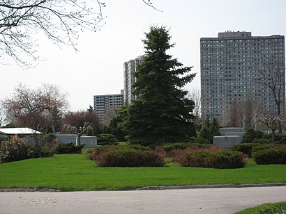
See Beth Tzedek Memorial Park, Toronto, on the map
Public Transit to Beth Tzedek Memorial Park in Toronto
Wondering how to get to Beth Tzedek Memorial Park in Toronto, Canada? Moovit helps you find the best way to get to Beth Tzedek Memorial Park with step-by-step directions from the nearest public transit station.
Moovit provides free maps and live directions to help you navigate through your city. View schedules, routes, timetables, and find out how long does it take to get to Beth Tzedek Memorial Park in real time.
Looking for the nearest stop or station to Beth Tzedek Memorial Park? Check out this list of stops closest to your destination: Sheppard - Yonge; 5720 Bathurst St; Antibes Dr at Bathurst St; Finch Ave West at Bathurst St.
Bus: 125, 160, 7, 307, 307S, 125S, 36, 36B, 36S, 336, 939B.Subway: 1, 4.
Want to see if there’s another route that gets you there at an earlier time? Moovit helps you find alternative routes or times. Get directions from and directions to Beth Tzedek Memorial Park easily from the Moovit App or Website.
We make riding to Beth Tzedek Memorial Park easy, which is why over 1.5 million users, including users in Toronto, trust Moovit as the best app for public transit. You don’t need to download an individual bus app or train app, Moovit is your all-in-one transit app that helps you find the best bus time or train time available.
For information on prices of bus and subway, costs and ride fares to Beth Tzedek Memorial Park, please check the Moovit app.
Use the app to navigate to popular places including to the airport, hospital, stadium, grocery store, mall, coffee shop, school, college, and university.
Beth Tzedek Memorial Park Address: 5822 Bathurst St. street in Toronto
Attractions near Beth Tzedek Memorial Park
Perfect Fit for You,Opposite 100 Antibes Dr,Clean N Care,North Six Painting,Beth Tzedec Memorial Park,Boyzaudio,Esther Shiner Stadium,5720 Bathurst Street,North York Civic Soccer Fields Park,Westminster Cemetery Mausoleum & Crematorium,Gcdemolition,Diamond Clean,One Kenton Alzheimer Centre of Excellence,Got To Half It Baby,4 Ailsa Craig Court,Mytidylady,Niagra Falls Casino,Nairi Moving,Sustainable Living Inc,MB MasonryHow to get to popular attractions in Toronto with public transit
Hwy 401 at Bayview, Toronto,Uxbridge GO Bus, Uxbridge,Avenue Road, Toronto,Toronto Botanical Gardens Complex, Toronto,Toronto City Hall, Toronto,Vaughan Metropolitan Centre Station, Vaughan,AGO, Toronto,King City, King,425 Bloor Street East, Toronto,Ed Mirvish Theatre, Toronto,Lawrence Avenue East, Toronto,Sugar Beach, Toronto,CN Tower, Toronto,200 Church Street, Toronto,Canada's Wonderland, Vaughan,Finch GO Bus Terminal, Toronto,145 Queen Street West, Toronto,Alliston, Ontario, New Tecumseth,African Lion Safari, Mississauga,Casa Loma, TorontoGet around Toronto by public transit!
Traveling around Toronto has never been so easy. See step by step directions as you travel to any attraction, street or major public transit station. View bus and train schedules, arrival times, service alerts and detailed routes on a map, so you know exactly how to get to anywhere in Toronto.
When traveling to any destination around Toronto use Moovit's Live Directions with Get Off Notifications to know exactly where and how far to walk, how long to wait for your line, and how many stops are left. Moovit will alert you when it's time to get off — no need to constantly re-check whether yours is the next stop.
Wondering how to use public transit in Toronto or how to pay for public transit in Toronto? Moovit public transit app can help you navigate your way with public transit easily, and at minimum cost. It includes public transit fees, ticket prices, and costs. Looking for a map of Toronto public transit lines? Moovit public transit app shows all public transit maps in Toronto with all Bus, Train, Subway, Streetcar and Ferry routes and stops on an interactive map.
Toronto has 5 transit type(s), including: Bus, Train, Subway, Streetcar and Ferry, operated by several transit agencies, including TTC, TTC Streetcar, Toronto Subway, GO Transit Bus, GO Transit, Amtrak, York Region Transit, Grand River Transit, Guelph Transit, grt, Hamilton Street Railway, MiWay, Brampton Transit, Burlington Transit, Oakville Transit