See Beulah Baptist Church, Alexandria, on the map
Directions to Beulah Baptist Church (Alexandria) with public transportation
The following transit lines have routes that pass near Beulah Baptist Church
 Bus:
Bus: - Train:
- Metro:
How to get to Beulah Baptist Church by bus?
Click on the bus route to see step by step directions with maps, line arrival times and updated time schedules.
How to get to Beulah Baptist Church by train?
Click on the train route to see step by step directions with maps, line arrival times and updated time schedules.
How to get to Beulah Baptist Church by metro?
Click on the metro route to see step by step directions with maps, line arrival times and updated time schedules.
Bus stations near Beulah Baptist Church in Alexandria
- Gibbon St & Columbus St,7 min walk,
- S Washington St+Church St,12 min walk,
Bus lines to Beulah Baptist Church in Alexandria
- 34,Lee Center Via N Fairfax St & S Royal St,
- 10A,South To Huntington,
- 10B,North To Ballston,
- 11Y,South To Mt Vernon,
What are the closest stations to Beulah Baptist Church?
The closest stations to Beulah Baptist Church are:
- Gibbon St & Columbus St is 462 yards away, 7 min walk.
- S Washington St+Church St is 856 yards away, 12 min walk.
Which bus lines stop near Beulah Baptist Church?
These bus lines stop near Beulah Baptist Church: 10A, 10B, AT7.
Which train line stops near Beulah Baptist Church?
PALMETTO
Which metro lines stop near Beulah Baptist Church?
These metro lines stop near Beulah Baptist Church: METRORAIL BLUE LINE, METRORAIL YELLOW LINE.
What’s the nearest bus stop to Beulah Baptist Church in Alexandria?
The nearest bus stop to Beulah Baptist Church in Alexandria is Gibbon St & Columbus St. It’s a 7 min walk away.
See Beulah Baptist Church, Alexandria, on the map
Public Transit to Beulah Baptist Church in Alexandria
Wondering how to get to Beulah Baptist Church in Alexandria, United States? Moovit helps you find the best way to get to Beulah Baptist Church with step-by-step directions from the nearest public transit station.
Moovit provides free maps and live directions to help you navigate through your city. View schedules, routes, timetables, and find out how long does it take to get to Beulah Baptist Church in real time.
Looking for the nearest stop or station to Beulah Baptist Church? Check out this list of stops closest to your destination: Gibbon St & Columbus St; S Washington St+Church St.
Bus:Train:Metro:
Want to see if there’s another route that gets you there at an earlier time? Moovit helps you find alternative routes or times. Get directions from and directions to Beulah Baptist Church easily from the Moovit App or Website.
We make riding to Beulah Baptist Church easy, which is why over 1.5 million users, including users in Alexandria, trust Moovit as the best app for public transit. You don’t need to download an individual bus app or train app, Moovit is your all-in-one transit app that helps you find the best bus time or train time available.
For information on prices of bus, metro and train, costs and ride fares to Beulah Baptist Church, please check the Moovit app.
Use the app to navigate to popular places including to the airport, hospital, stadium, grocery store, mall, coffee shop, school, college, and university.
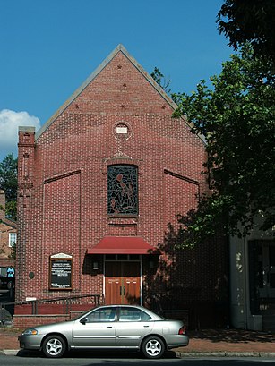
Beulah Baptist Church Address: South Washington Street street in Alexandria
Attractions near Beulah Baptist Church
Beauty by El Shaddai,S Washington Wolfe St,Washington St Wolfe St,Professionals Garage Door Repair,Barber Group,Nova Acupuncture,Danielle Hoffman - Licensed Master Esthetician,Dr. Erica N. Campbell M.D.,Southwest Salon,Buca Room,Trattoria da Franco (Trattoria De Franco),Genuine Water Bagels,600 Wolfe St,A Great Massage,Family Therapy Center Of Old Town,Ethiopian Airlines,VA-236,S Washington and Duke,Duke St and George Washington Memorial Pkwy,Duke and WashingtonHow to get to popular attractions in Alexandria with public transit
BWI Rental Car Facility, Anne Arundel County,Buffalo Wild Wings, Anne Arundel County,Damascus, MD, Montgomery County,Arlington Rooftop Bar & Grill, Arlington County,Cross Street Market, Baltimore,Hyatt Regency Reston, Fairfax County,Teaism Penn Quarter, Washington,Peking Gourmet Inn, Fairfax County,Hard Rock Cafe Washington DC, Washington,Fogo de Chao, Washington,Bureau of Engraving and Printing, Washington,Earth Treks Climbing Center, Montgomery County,The Ugly Mug, Washington,Gordon Biersch Brewery Restaurant, Fairfax County,Bistrot Du Coin, Washington,White Flint Metro Station, Montgomery County,Hank's Oyster Bar, Washington,Herndon, Virginia, Fairfax County,Renaissance Baltimore Harborplace Hotel, Baltimore,O'Sullivan's Irish Pub & Restaurant, Arlington CountyGet around Alexandria by public transit!
Traveling around Alexandria has never been so easy. See step by step directions as you travel to any attraction, street or major public transit station. View bus and train schedules, arrival times, service alerts and detailed routes on a map, so you know exactly how to get to anywhere in Alexandria.
When traveling to any destination around Alexandria use Moovit's Live Directions with Get Off Notifications to know exactly where and how far to walk, how long to wait for your line, and how many stops are left. Moovit will alert you when it's time to get off — no need to constantly re-check whether yours is the next stop.
Wondering how to use public transit in Alexandria or how to pay for public transit in Alexandria? Moovit public transit app can help you navigate your way with public transit easily, and at minimum cost. It includes public transit fees, ticket prices, and costs. Looking for a map of Alexandria public transit lines? Moovit public transit app shows all public transit maps in Alexandria with all bus, metro or train routes and stops on an interactive map.
Alexandria has 3 transit type(s), including: bus, metro or train, operated by several transit agencies, including WMATA, WMATA, Montgomery County Ride On, Fairfax Connector, TheBus, DC Circulator, MDOT MTA, Marc, MDOT MTA, MDOT MTA, Virginia Railway Express (VRE), PRTC, DASH - Alexandria, Arlington Transit (ART) and DC Streetcar