Directions to Beverly Glen Pl (Los Angeles) with public transportation
The following transit lines have routes that pass near Beverly Glen Pl
How to get to Beverly Glen Pl by bus?
Click on the bus route to see step by step directions with maps, line arrival times and updated time schedules.
Bus stops near Beverly Glen Pl in Los Angeles
- Sunset / Beverly Glen, 44 min walk,
- Sepulveda / Skirball Center, 84 min walk,
Bus lines to Beverly Glen Pl in Los Angeles
- 2, Westwood / UCLA,
- 233, Pacoima,
- 761, Sylmar Metrolink Station,
What are the closest stations to Beverly Glen Pl?
The closest stations to Beverly Glen Pl are:
- Sunset / Beverly Glen is 3711 yards away, 44 min walk.
- Sepulveda / Skirball Center is 7163 yards away, 84 min walk.
Which bus line stops near Beverly Glen Pl?
2/302
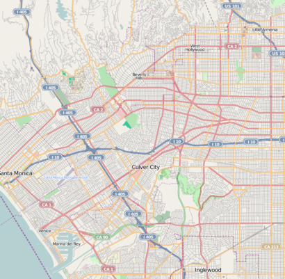
See Beverly Glen Pl, Los Angeles, on the map
Public Transit to Beverly Glen Pl in Los Angeles
Wondering how to get to Beverly Glen Pl in Los Angeles, United States? Moovit helps you find the best way to get to Beverly Glen Pl with step-by-step directions from the nearest public transit station.
Moovit provides free maps and live directions to help you navigate through your city. View schedules, routes, timetables, and find out how long does it take to get to Beverly Glen Pl in real time.
Looking for the nearest stop or station to Beverly Glen Pl? Check out this list of stops closest to your destination: Sunset / Beverly Glen; Sepulveda / Skirball Center.
Bus: 2/302, 2, 233, 761.
Want to see if there’s another route that gets you there at an earlier time? Moovit helps you find alternative routes or times. Get directions from and directions to Beverly Glen Pl easily from the Moovit App or Website.
We make riding to Beverly Glen Pl easy, which is why over 1.5 million users, including users in Los Angeles, trust Moovit as the best app for public transit. You don’t need to download an individual bus app or train app, Moovit is your all-in-one transit app that helps you find the best bus time or train time available.
For information on prices of bus, costs and ride fares to Beverly Glen Pl, please check the Moovit app.
Use the app to navigate to popular places including to the airport, hospital, stadium, grocery store, mall, coffee shop, school, college, and university.
Beverly Glen Pl Address: Los Angeles, CA 90077 street in Los Angeles
Attractions near Beverly Glen Pl
Beverly Glen Playgroup,2346 N Beverly Glen Blvd,Bel Air-Beverly Crest,N Beverly Glen Blvd,2518 N Beverly Glen Blvd,Beverly Glen,1819 Angelo Dr,Beverly Glen,2627 N Beverly Glen Blvd,1663 N Beverly Glen Blvd,NFL Football,2708 N Beverly Glen Blvd,2708 Angelo Dr,1515 N Beverly Glen Blvd,Benedict Canyon,2829 N Beverly Glen Blvd,Fernbush Ln,1277 N Beverly Glen Blvd,Soodi & Roy,Anthony PlHow to get to popular attractions in Los Angeles with public transit
Alamo Inn & Suites, Anaheim,Sideshow Collectibles, Thousand Oaks,Fontana Superior Court, Fontana,Valley View High School, Moreno Valley,Dyrdek Enterprises (Fantasy Factory), Boyle Heights, La,Super King Market, Van Nuys, La,Fair Oaks Ranch,I-210 at Azusa Ave, Azusa,Rosecrans And Santa Gertrudes, La Mirada,Fillmore, California, Fillmore,Montecito Heights, CA, Highland Park, La,Pacific Electric Trail - Route 66 Trailhead, Rancho Cucamonga,Metrolink Lancaster Station, Lancaster,South Pasadena Water Tower, South Pasadena,Santa Monica And Fairfax, West Hollywood,Bavarian Village Apartments, Torrance,Mistress, Venice, La,Nickelodeon Studios, Hollywood, La,Kaiser Permanente Orange County Anaheim, Anaheim,St John's Pleasant Valley Hospital, CamarilloGet around Los Angeles by public transit!
Traveling around Los Angeles has never been so easy. See step by step directions as you travel to any attraction, street or major public transit station. View bus and train schedules, arrival times, service alerts and detailed routes on a map, so you know exactly how to get to anywhere in Los Angeles.
When traveling to any destination around Los Angeles use Moovit's Live Directions with Get Off Notifications to know exactly where and how far to walk, how long to wait for your line, and how many stops are left. Moovit will alert you when it's time to get off — no need to constantly re-check whether yours is the next stop.
Wondering how to use public transit in Los Angeles or how to pay for public transit in Los Angeles? Moovit public transit app can help you navigate your way with public transit easily, and at minimum cost. It includes public transit fees, ticket prices, and costs. Looking for a map of Los Angeles public transit lines? Moovit public transit app shows all public transit maps in Los Angeles with all Bus, Train, Subway, Light Rail, Ferry and Funicular routes and stops on an interactive map.
Los Angeles has 6 transit type(s), including: Bus, Train, Subway, Light Rail, Ferry and Funicular, operated by several transit agencies, including Metro - Los Angeles, Metrolink Trains, METRO, Long Beach Transit, LADOT, OCTA, Foothill Transit, Big Blue Bus, Riverside Transit Agency, LAX FlyAway, Airporter Shuttle, Playa Vista Shuttle, Amtrak, OMNITRANS, Pasadena Transit