See Black's Beach, San Diego, on the map
Directions to Black's Beach (San Diego) with public transportation
The following transit lines have routes that pass near Black's Beach
 Bus:
Bus:
How to get to Black's Beach by bus?
Click on the bus route to see step by step directions with maps, line arrival times and updated time schedules.
Bus stations near Black's Beach in San Diego
- La Jolla Shores Dr & Inyaha Ln,22 min walk,
Bus lines to Black's Beach in San Diego
- 30,Utc/Va Med Ctr,
What are the closest stations to Black's Beach?
The closest stations to Black's Beach are:
- La Jolla Shores Dr & Inyaha Ln is 1823 yards away, 22 min walk.
Which bus lines stop near Black's Beach?
These bus lines stop near Black's Beach: 101, 30.
See Black's Beach, San Diego, on the map
Public Transit to Black's Beach in San Diego
Wondering how to get to Black's Beach in San Diego, United States? Moovit helps you find the best way to get to Black's Beach with step-by-step directions from the nearest public transit station.
Moovit provides free maps and live directions to help you navigate through your city. View schedules, routes, timetables, and find out how long does it take to get to Black's Beach in real time.
Looking for the nearest stop or station to Black's Beach? Check out this list of stops closest to your destination: La Jolla Shores Dr & Inyaha Ln.
Bus:
Want to see if there’s another route that gets you there at an earlier time? Moovit helps you find alternative routes or times. Get directions from and directions to Black's Beach easily from the Moovit App or Website.
We make riding to Black's Beach easy, which is why over 1.5 million users, including users in San Diego, trust Moovit as the best app for public transit. You don’t need to download an individual bus app or train app, Moovit is your all-in-one transit app that helps you find the best bus time or train time available.
For information on prices of bus, costs and ride fares to Black's Beach, please check the Moovit app.
Use the app to navigate to popular places including to the airport, hospital, stadium, grocery store, mall, coffee shop, school, college, and university.
Black's Beach Address: 2800 Torrey Pines Scenic Dr street in San Diego
Attractions near Black's Beach
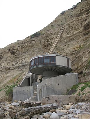
Torrey Pines City Beach,scripps ucsd ecology reserve,La Jolla Cliffs,Scripps Coastal Reserve,UCSD Surfing Black's Beach,San Diego-La Jolla Underwater Park,La Jolla Cave Landing,9400 La Jolla Farms Road,Brookmead Lane at Black Gold Road,Scripps Coastal Reserve,Mushroom House,The Bell Pavillion (Mushroom House),Casa Di Oro,Reisung Enterprises,Greentree Lane La Jolla Farms Road,La Jolla California Institute Of Religion,Cucina Caprese,University Lutheran Church,8901 La Jolla Shores Drive,N Torrey Pines RdHow to get to popular attractions in San Diego with public transit
Wonderland Ocean Pub, San Diego,San Diego Superior Court - North County Regional Center, Vista,Jake's Del Mar, Del Mar,Thermo Fisher Scientific, Carlsbad,Miracosta College, Oceanside,Rancho Peñasquitos, San Diego,Yakyudori Yakitori & Ramen, San Diego,Self-Realization Fellowship Hermitage & Meditation Gardens, Encinitas,Costco Gas, San Marcos,Harrah's Southern California Casino & Resort,The Preuss School - UCSD, San Diego,Pho Cow Cali Express, San Diego,The Old Spaghetti Factory, San Diego,Islands Restaurant, San Diego,Helix High School, La Mesa,Casa Guadalajara, San Diego,Edwards San Marcos 18, San Marcos,The Buffet @ Valley View Casino,MK 15 Close In Weapon System (CIWS) "C" School, San Diego,Lucha Libre, San DiegoGet around San Diego by public transit!
Traveling around San Diego has never been so easy. See step by step directions as you travel to any attraction, street or major public transit station. View bus and train schedules, arrival times, service alerts and detailed routes on a map, so you know exactly how to get to anywhere in San Diego.
When traveling to any destination around San Diego use Moovit's Live Directions with Get Off Notifications to know exactly where and how far to walk, how long to wait for your line, and how many stops are left. Moovit will alert you when it's time to get off — no need to constantly re-check whether yours is the next stop.
Wondering how to use public transit in San Diego or how to pay for public transit in San Diego? Moovit public transit app can help you navigate your way with public transit easily, and at minimum cost. It includes public transit fees, ticket prices, and costs. Looking for a map of San Diego public transit lines? Moovit public transit app shows all public transit maps in San Diego with all bus routes and stops on an interactive map.
San Diego has 1 transit type(s), including: bus, operated by several transit agencies, including MTS-Cable, North County Transit District-Tram, North County Transit District-Rail, MTS-Bus, MTS-Ferry, North County Transit District-Bus, San Diego International Airport, Amtrak, FlixBus-us and Greyhound-us