Directions to Blackstone Block (Boston) with public transportation
The following transit lines have routes that pass near Blackstone Block
How to get to Blackstone Block by bus?
Click on the bus route to see step by step directions with maps, line arrival times and updated time schedules.
How to get to Blackstone Block by train?
Click on the train route to see step by step directions with maps, line arrival times and updated time schedules.
How to get to Blackstone Block by subway?
Click on the subway route to see step by step directions with maps, line arrival times and updated time schedules.
Bus stops near Blackstone Block in Boston
- Congress St @ Haymarket Sta, 3 min walk,
- New Sudbury @ Congress St, 4 min walk,
Subway stations near Blackstone Block in Boston
- Haymarket, 5 min walk,
Bus lines to Blackstone Block in Boston
- ORANGE LINE SHUTTLE, Sullivan (Shuttle),
- RED LINE SHUTTLE, Harvard (Shuttle),
- RED LINE SHUTTLE, Kendall/MIT (Shuttle),
- 4, North Station,
- 15, Mattapan Via Nubian & Fields Corner,
- 39, Haymarket Via Forest Hills,
- 57, Haymarket Via Kenmore,
- 92, Sullivan,
- 93, Sullivan Via Navy Yard,
- 426, Haymarket Via Cliftondale,
- 428, Oaklandvale Via Cliftondale (Express),
- 450, Salem Depot,
- RED LINE SHUTTLE, Jfk/Umass (Shuttle),
- 354, Burlington (Express) Via Woburn,
What are the closest stations to Blackstone Block?
The closest stations to Blackstone Block are:
- Congress St @ Haymarket Sta is 152 yards away, 3 min walk.
- New Sudbury @ Congress St is 260 yards away, 4 min walk.
- Haymarket is 325 yards away, 5 min walk.
Which bus lines stop near Blackstone Block?
These bus lines stop near Blackstone Block: 426, 92, 93, SL5.
Which train lines stop near Blackstone Block?
These train lines stop near Blackstone Block: FITCHBURG LINE, FRAMINGHAM/WORCESTER LINE, MIDDLEBOROUGH/LAKEVILLE LINE.
Which subway lines stop near Blackstone Block?
These subway lines stop near Blackstone Block: GREEN LINE D, GREEN LINE E, ORANGE LINE.
What’s the nearest subway station to Blackstone Block in Boston?
The nearest subway station to Blackstone Block in Boston is Haymarket. It’s a 5 min walk away.
What’s the nearest bus stop to Blackstone Block in Boston?
The nearest bus stop to Blackstone Block in Boston is Congress St @ Haymarket Sta. It’s a 3 min walk away.
See Blackstone Block, Boston, on the map
Public Transit to Blackstone Block in Boston
Wondering how to get to Blackstone Block in Boston, United States? Moovit helps you find the best way to get to Blackstone Block with step-by-step directions from the nearest public transit station.
Moovit provides free maps and live directions to help you navigate through your city. View schedules, routes, timetables, and find out how long does it take to get to Blackstone Block in real time.
Looking for the nearest stop or station to Blackstone Block? Check out this list of stops closest to your destination: Congress St @ Haymarket Sta; New Sudbury @ Congress St; Haymarket.
Bus: 426, 92, 93, SL5, ORANGE LINE SHUTTLE, RED LINE SHUTTLE, RED LINE SHUTTLE, 4, 15, RED LINE SHUTTLE, 354.Train: FITCHBURG LINE, FRAMINGHAM/WORCESTER LINE, MIDDLEBOROUGH/LAKEVILLE LINE.Subway: GREEN LINE D, GREEN LINE E, ORANGE LINE, GREEN LINE B, GREEN LINE C.
Want to see if there’s another route that gets you there at an earlier time? Moovit helps you find alternative routes or times. Get directions from and directions to Blackstone Block easily from the Moovit App or Website.
We make riding to Blackstone Block easy, which is why over 1.5 million users, including users in Boston, trust Moovit as the best app for public transit. You don’t need to download an individual bus app or train app, Moovit is your all-in-one transit app that helps you find the best bus time or train time available.
For information on prices of bus, subway and train, costs and ride fares to Blackstone Block, please check the Moovit app.
Use the app to navigate to popular places including to the airport, hospital, stadium, grocery store, mall, coffee shop, school, college, and university.
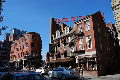
Blackstone Block Address: Marshall Street (Union Street) street in Boston
Attractions near Blackstone Block
Union Oyster House,Margaritaville,Green Dragon Tavern,Saus Restaurant,33 Union St,Paddy O's,Union St,Hennessy's Upstairs Rock Club,Hennessey's,Creek Square,the point,The Tap,Atrium Lounge,Marshall St,The Bell In Hand,New England Holocaust Memorial,Swartz & Swartz, P.C.,The Boston Stone,Carmen Park,Ebenezer Hancock HouseHow to get to popular attractions in Boston with public transit
75 Federal St, Boston,Beacon st., Brookline,The 'Quin House, Boston,Galleria Mall, Cambridge,Quincy Center Station, Quincy,Tremont St, Boston,Chelsea Station, Chelsea,700 Atlantic Avenue, Boston,Park Plaza Castle, Boston,Everett, MA, Everett,75 Francis Street, Boston,Milton, MA, Milton,Peabody, MA, Peabody,Chelmsford,North Shore Community College, Danvers,Embassy Suites by Hilton Boston at Logan Airport, Boston,Curry College, Milton,Hyatt Place Medford, Medford,MBTA-Aquarium, Boston,South Bay Mall, BostonGet around Boston by public transit!
Traveling around Boston has never been so easy. See step by step directions as you travel to any attraction, street or major public transit station. View bus and train schedules, arrival times, service alerts and detailed routes on a map, so you know exactly how to get to anywhere in Boston.
When traveling to any destination around Boston use Moovit's Live Directions with Get Off Notifications to know exactly where and how far to walk, how long to wait for your line, and how many stops are left. Moovit will alert you when it's time to get off — no need to constantly re-check whether yours is the next stop.
Wondering how to use public transit in Boston or how to pay for public transit in Boston? Moovit public transit app can help you navigate your way with public transit easily, and at minimum cost. It includes public transit fees, ticket prices, and costs. Looking for a map of Boston public transit lines? Moovit public transit app shows all public transit maps in Boston with all Bus, Train, Subway and Ferry routes and stops on an interactive map.
Boston has 4 transit type(s), including: Bus, Train, Subway and Ferry, operated by several transit agencies, including MBTA, Southeastern Regional Transit Authority, MetroWest Regional Transit Authority, Rhode Island Public Transit Authority, WRTA, Lowell Regional Transit Authority, Merrimack Valley Transit, Montachusett Regional Transit Authority, Cape Cod Regional Transit Authority, Brockton Area Transit Authority, Martha's Vineyard Transit Authority, the WAVE - Nantucket Regional Transit Authority, GATRA, Cape Ann Transportation Authority, Massport