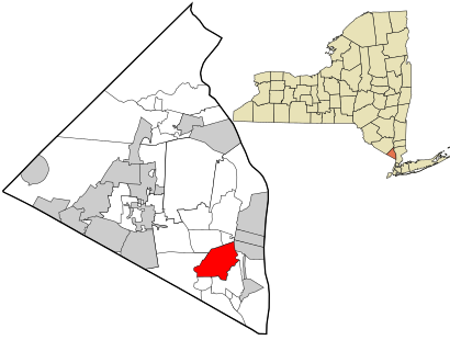
See Blauvelt, Blauvelt, Ny, on the map
Directions to Blauvelt (Blauvelt, Ny) with public transportation
The following transit lines have routes that pass near Blauvelt
 Train:
Train stations near Blauvelt in Blauvelt, Ny
- Nanuet,95 min walk,
What are the closest stations to Blauvelt?
The closest stations to Blauvelt are:
- Nanuet is 8112 yards away, 95 min walk.
Which train line stops near Blauvelt?
PVL
See Blauvelt, Blauvelt, Ny, on the map
Public Transit to Blauvelt in Blauvelt, Ny
Wondering how to get to Blauvelt in Blauvelt, Ny, United States? Moovit helps you find the best way to get to Blauvelt with step-by-step directions from the nearest public transit station.
Moovit provides free maps and live directions to help you navigate through your city. View schedules, routes, timetables, and find out how long does it take to get to Blauvelt in real time.
Looking for the nearest stop or station to Blauvelt? Check out this list of stops closest to your destination: Nanuet.
Train:
Want to see if there’s another route that gets you there at an earlier time? Moovit helps you find alternative routes or times. Get directions from and directions to Blauvelt easily from the Moovit App or Website.
We make riding to Blauvelt easy, which is why over 1.5 million users, including users in Blauvelt, Ny, trust Moovit as the best app for public transit. You don’t need to download an individual bus app or train app, Moovit is your all-in-one transit app that helps you find the best bus time or train time available.
For information on prices of train, subway and bus, costs and ride fares to Blauvelt, please check the Moovit app.
Use the app to navigate to popular places including to the airport, hospital, stadium, grocery store, mall, coffee shop, school, college, and university.
Blauvelt Address: Erie Street East street in Blauvelt, Ny
Attractions near Blauvelt
1,Blauveltville,Greenbush,10913,Western Hwy,8 Erie St E ,11 Erie St E,18 Terrace Dr (Terrace Ln),Jim Chimney Inc,Western Hayes,553 Western Hwy,Pet Butler,1,Greenbush Church,Blauvelt Volunteer Fire Company,CS Deli,62 Erie St W,Nine Dragons Martial Arts,A Special Touch,Erie St WHow to get to popular attractions in Blauvelt, Ny with public transit
Red Rooster, Manhattan,Avenue, Manhattan,Jersey Shore University Medical Center, Neptune, Nj,Jing Fong Restaurant 金豐大酒樓, Manhattan,Barrage, Manhattan,Brass Monkey, Manhattan,Norwalk, CT, Norwalk, Ct,Joe's Shanghai 鹿嗚春, Manhattan,Nan Xiang Xiao Long Bao, Queens,Doughnut Plant, Manhattan,MTA Subway - 42nd St / Bryant Park (B / D/F / M/7), Manhattan,The Meatball Shop,MTA Subway - Fulton St (A / C/J / Z/2 / 3/4 / 5), Manhattan,Ulysses Folk House, Manhattan,Smith Haven Mall, Lake Grove, Ny,Harrah's Resort Hotel & Casino, Atlantic City, Nj,Dos Toros Taquería, Manhattan,Top of The Standard, Manhattan,Rattle N Hum, Manhattan,Dinosaur Bar-B-Que, ManhattanGet around Blauvelt, Ny by public transit!
Traveling around Blauvelt, Ny has never been so easy. See step by step directions as you travel to any attraction, street or major public transit station. View bus and train schedules, arrival times, service alerts and detailed routes on a map, so you know exactly how to get to anywhere in Blauvelt, Ny.
When traveling to any destination around Blauvelt, Ny use Moovit's Live Directions with Get Off Notifications to know exactly where and how far to walk, how long to wait for your line, and how many stops are left. Moovit will alert you when it's time to get off — no need to constantly re-check whether yours is the next stop.
Wondering how to use public transit in Blauvelt, Ny or how to pay for public transit in Blauvelt, Ny? Moovit public transit app can help you navigate your way with public transit easily, and at minimum cost. It includes public transit fees, ticket prices, and costs. Looking for a map of Blauvelt, Ny public transit lines? Moovit public transit app shows all public transit maps in Blauvelt, Ny with all train, subway or bus routes and stops on an interactive map.
Blauvelt, Ny has 3 transit type(s), including: train, subway or bus, operated by several transit agencies, including MTA Subway, Metro-North Railroad, LIRR, PATH, Shore Line East, MTA Bus Company, MTA New York City Transit - Express routes, MTA Bus, NJ Transit, NYC Ferry, NICE bus, Bee-Line Bus, NJ Transit Rail, NJ Transit Rail and Norwalk Transit District