Directions to Bocsit Medical Delivery Service (Cambridge) with public transportation
The following transit lines have routes that pass near Bocsit Medical Delivery Service
 Bus: 350, 77, 78, 83, R1.
- Train: FITCHBURG, RED LINE.
- Subway: RED LINE, GREEN LINE B, GREEN LINE C, GREEN LINE E.
How to get to Bocsit Medical Delivery Service by bus?
Click on the bus route to see step by step directions with maps, line arrival times and updated time schedules.
From South Bay Mall, Boston
84 minFrom Warren Tavern, Boston
75 minFrom Seaport District, Boston
108 minFrom South Bay Center, Boston
85 minFrom Moxy Hotel, Boston
67 minFrom Boston Latin Academy, Boston
90 minFrom City Hall To Go, Boston
103 minFrom Boston Marriott Long Wharf Hotel Boston, Boston
91 minFrom Old Town Trolley Tours of Boston, Boston
65 minFrom Brighton District Court, Boston
62 min
How to get to Bocsit Medical Delivery Service by train?
Click on the train route to see step by step directions with maps, line arrival times and updated time schedules.
How to get to Bocsit Medical Delivery Service by subway?
Click on the subway route to see step by step directions with maps, line arrival times and updated time schedules.
From South Bay Mall, Boston
49 minFrom Warren Tavern, Boston
49 minFrom Seaport District, Boston
52 minFrom South Bay Center, Boston
49 minFrom Moxy Hotel, Boston
37 minFrom Boston Latin Academy, Boston
70 minFrom City Hall To Go, Boston
53 minFrom Boston Marriott Long Wharf Hotel Boston, Boston
44 minFrom Old Town Trolley Tours of Boston, Boston
38 minFrom Brighton District Court, Boston
85 min
Bus stops near Bocsit Medical Delivery Service in Cambridge
Train station near Bocsit Medical Delivery Service in Cambridge
- Porter, 11 min walk,VIEW
Subway station near Bocsit Medical Delivery Service in Cambridge
- Medford/Tufts Station, 16 min walk,VIEW
Bus lines to Bocsit Medical Delivery Service in Cambridge
- 62, Alewife - Bedford VA,VIEW
- 67, Alewife via Arlington Center - Turkey Hill via Arlington Center,VIEW
- 76, Alewife - Lincoln Lab via Hanscom Airport,VIEW
- 350, Alewife via Mall Rd - North Burlington via Mall Rd,VIEW
- FITCHBURG LINE SHUTTLE, Littleton/Route 495 - Alewife (Local),VIEW
- FITCHBURG LINE SHUTTLE, Littleton/Route 495 - Alewife (Express),VIEW
- RED LINE SHUTTLE, Alewife - Park Street,VIEW
- RED LINE SHUTTLE, Alewife - Kendall/MIT via Porter (Express),VIEW
- RED LINE SHUTTLE, Alewife - Harvard via Brattle Street,VIEW
- RED LINE SHUTTLE, Alewife - Davis,VIEW
- RED LINE SHUTTLE, Alewife - Kendall/MIT,VIEW
- RED LINE SHUTTLE, Alewife - Harvard via Holyoke Street,VIEW
- R1, Rev Bus - R1,VIEW
- R2, Rev Bus - R2 Inbound,VIEW
- 74, Harvard - Belmont Center,VIEW
- 78, Harvard - Arlmont Village,VIEW
- FLIXBUS 2610, NYC - Boston,VIEW
- FLIXBUS 2619, Boston - NYC - Philadelphia,VIEW
- 83, Central Square,VIEW
What are the closest stations to Bocsit Medical Delivery Service?
The closest stations to Bocsit Medical Delivery Service are:
- Alewife is 267 yards away, 4 min walk.
- Alewife Station (Depart) is 276 yards away, 4 min walk.
- Concord Ave @ Smith Pl is 519 yards away, 7 min walk.
- Cambridge (Ma) is 911 yards away, 11 min walk.
- Porter is 911 yards away, 11 min walk.
- Medford/Tufts Station is 1358 yards away, 16 min walk.
- Rindge Ave @ Russell Field is 1417 yards away, 17 min walk.
Which bus lines stop near Bocsit Medical Delivery Service?
These bus lines stop near Bocsit Medical Delivery Service: 350, 77, 78, 83.
Which train line stops near Bocsit Medical Delivery Service?
FITCHBURG (#409 | Wachusett)
Which subway line stops near Bocsit Medical Delivery Service?
RED LINE (Alewife)
What’s the nearest subway station to Bocsit Medical Delivery Service in Cambridge?
The nearest subway station to Bocsit Medical Delivery Service in Cambridge is Medford/Tufts Station. It’s a 16 min walk away.
What’s the nearest train station to Bocsit Medical Delivery Service in Cambridge?
The nearest train station to Bocsit Medical Delivery Service in Cambridge is Porter. It’s a 11 min walk away.
What’s the nearest bus station to Bocsit Medical Delivery Service in Cambridge?
The nearest bus stations to Bocsit Medical Delivery Service in Cambridge are Alewife and Alewife Station (Depart). The closest one is a 4 min walk away.
What time is the first subway to Bocsit Medical Delivery Service in Cambridge?
The GREEN LINE E is the first subway that goes to Bocsit Medical Delivery Service in Cambridge. It stops nearby at 4:57 AM.
What time is the last subway to Bocsit Medical Delivery Service in Cambridge?
The GREEN LINE E is the last subway that goes to Bocsit Medical Delivery Service in Cambridge. It stops nearby at 2:41 AM.
What time is the first train to Bocsit Medical Delivery Service in Cambridge?
The FITCHBURG is the first train that goes to Bocsit Medical Delivery Service in Cambridge. It stops nearby at 5:41 AM.
What time is the last train to Bocsit Medical Delivery Service in Cambridge?
The FITCHBURG is the last train that goes to Bocsit Medical Delivery Service in Cambridge. It stops nearby at 12:17 AM.
What time is the first bus to Bocsit Medical Delivery Service in Cambridge?
The 62 is the first bus that goes to Bocsit Medical Delivery Service in Cambridge. It stops nearby at 5:10 AM.
What time is the last bus to Bocsit Medical Delivery Service in Cambridge?
The 83 is the last bus that goes to Bocsit Medical Delivery Service in Cambridge. It stops nearby at 1:28 AM.
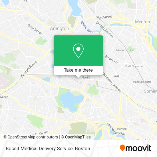
See Bocsit Medical Delivery Service, Cambridge, on the map
Public Transit to Bocsit Medical Delivery Service in Cambridge
Wondering how to get to Bocsit Medical Delivery Service in Cambridge? Moovit helps you find the best way to get to Bocsit Medical Delivery Service with step-by-step directions from the nearest public transit station.
Moovit provides free maps and live directions to help you navigate through your city. View schedules, routes, timetables, and find out how long does it take to get to Bocsit Medical Delivery Service in real time.
Looking for the nearest stop or station to Bocsit Medical Delivery Service? Check out this list of stops closest to your destination: Alewife; Alewife Station (Depart); Concord Ave @ Smith Pl; Cambridge (Ma); Porter; Medford/Tufts Station; Rindge Ave @ Russell Field.
Bus: 350, 77, 78, 83, R1, R2, 62, 67, 76, FITCHBURG LINE SHUTTLE, 74, FLIXBUS 2610, FLIXBUS 2619.Train: FITCHBURG, RED LINE.Subway: RED LINE, GREEN LINE B, GREEN LINE C, GREEN LINE E.
Want to see if there’s another route that gets you there at an earlier time? Moovit helps you find alternative routes or times. Get directions from and directions to Bocsit Medical Delivery Service easily from the Moovit App or Website.
We make riding to Bocsit Medical Delivery Service easy, which is why over 1.7 million users, including users in Cambridge, trust Moovit as the best app for public transit. You don’t need to download an individual bus app or train app, Moovit is your all-in-one transit app that helps you find the best bus time or train time available.
For information on prices of bus, subway and train, costs and ride fares to Bocsit Medical Delivery Service, please check the Moovit app.
Use the app to navigate to popular places including to the airport, hospital, stadium, grocery store, mall, coffee shop, school, college, and university.
Bocsit Medical Delivery Service Address: 100 Cambridgepark Dr Ste 5 street in Cambridge
- Perkinelmer,
- Toast,
- Stanley Garage Door & Gate Repair Cambridge,
- Urbane at Alewife,
- Top Mix Bar & Kitchen,
- Vecna Cares Charitable Trust,
- Vanu,
- AmpUp,
- Tsi,
- Officeteam,
- Imagineer Customer Experience,
- Mothership,
- Oxy Systems,
- FedEx,
- Beacon Learning,
- Odara Transport,
- WFM na It Helpdesk,
- Boston Scientific Corporation,
- Penton Media,
- Peet's Coffee
Places Near Bocsit Medical Delivery Service (Cambridge)
- Isabella Stewart Gardner Museum, Boston,
- Museum Of Science, Boston,
- Cheers, Boston,
- Castle Island, Boston,
- Mgm Music Hall, Boston,
- Wilbur Theatre, Boston,
- Boston Common, Boston,
- Quincy Market, Boston,
- North End, Boston,
- Massachusetts General Hospital, Boston,
- Prudential Center, Boston,
- Faneuil Hall, Boston,
- Boston Convention & Exhibition Center, Boston,
- House Of Blues, Boston,
- Leader Bank Pavilion (Leader Bank Pavillion), Boston,
- Td Garden, Boston,
- Boston Medical Center, Boston,
- Boston Children's Hospital, Boston,
- Wang Theater, Boston,
- Seaport District, Boston
How to get to popular places in Boston with public transit
Get around Cambridge by public transit!
Traveling around Cambridge has never been so easy. See step by step directions as you travel to any attraction, street or major public transit station. View bus and train schedules, arrival times, service alerts and detailed routes on a map, so you know exactly how to get to anywhere in Cambridge.
When traveling to any destination around Cambridge use Moovit's Live Directions with Get Off Notifications to know exactly where and how far to walk, how long to wait for your line, and how many stops are left. Moovit will alert you when it's time to get off — no need to constantly re-check whether yours is the next stop.
Wondering how to use public transit in Cambridge or how to pay for public transit in Cambridge? Moovit public transit app can help you navigate your way with public transit easily, and at minimum cost. It includes public transit fees, ticket prices, and costs. Looking for a map of Cambridge public transit lines? Moovit public transit app shows all public transit maps in Cambridge with all Bus, Train, Subway and Ferry routes and stops on an interactive map.
Boston has 4 transit type(s), including: Bus, Train, Subway and Ferry, operated by several transit agencies, including MBTA, Southeastern Regional Transit Authority, MetroWest Regional Transit Authority, Rhode Island Public Transit Authority, WRTA, Lowell Regional Transit Authority, Merrimack Valley Transit, Montachusett Regional Transit Authority, Cape Cod Regional Transit Authority, Brockton Area Transit Authority, Martha's Vineyard Transit Authority, the WAVE - Nantucket Regional Transit Authority, GATRA, Cape Ann Transportation Authority and Massport