How to get to Bodegas Bonart by bus?
Click on the bus route to see step by step directions with maps, line arrival times and updated time schedules.
From SEDESOL, Aguascalientes
50 minFrom Fracc Jesús Gómez Portugal, Aguascalientes
50 minFrom Central de Autobuses de Aguascalientes, Aguascalientes
37 minFrom Panteon Jardines Eternos, Aguascalientes
33 minFrom Cañada Honda, Aguascalientes
51 minFrom Avenida Héroe de Nacozari Sur, Aguascalientes
47 minFrom Fracc. Villas de la Cantera, Aguascalientes
68 minFrom Ex Ejido Ojocaliente, Aguascalientes
49 minFrom Fracc. Las Arboledas, Aguascalientes
30 minFrom Fraccionamiento El Cobano, Aguascalientes
45 min
Bus stops near Bodegas Bonart in Aguascalientes
Bus lines to Bodegas Bonart in Aguascalientes
What are the closest stations to Bodegas Bonart?
The closest stations to Bodegas Bonart are:
- Avenida Paseo De Las Maravillas, 300 is 201 meters away, 3 min walk.
- Licenciado Miguel De La Madrid, 1010 is 450 meters away, 6 min walk.
- Siglo Xxi, 107 is 780 meters away, 11 min walk.
Which bus lines stop near Bodegas Bonart?
These bus lines stop near Bodegas Bonart: RUTA 04, RUTA 38.
What’s the nearest bus station to Bodegas Bonart in Aguascalientes?
The nearest bus station to Bodegas Bonart in Aguascalientes is Avenida Paseo De Las Maravillas, 300. It’s a 3 min walk away.
What time is the first bus to Bodegas Bonart in Aguascalientes?
The RUTA 50 is the first bus that goes to Bodegas Bonart in Aguascalientes. It stops nearby at 5:49 AM.
What time is the last bus to Bodegas Bonart in Aguascalientes?
The RUTA 50 is the last bus that goes to Bodegas Bonart in Aguascalientes. It stops nearby at 10:48 PM.
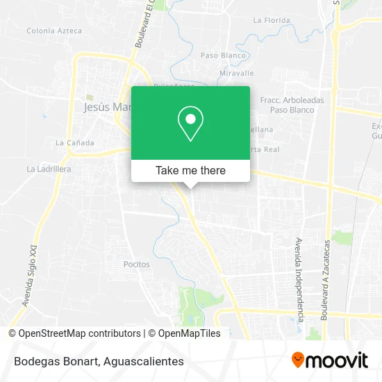
See Bodegas Bonart, Aguascalientes, on the map
Public Transit to Bodegas Bonart in Aguascalientes
Wondering how to get to Bodegas Bonart in Aguascalientes? Moovit helps you find the best way to get to Bodegas Bonart with step-by-step directions from the nearest public transit station.
Moovit provides free maps and live directions to help you navigate through your city. View schedules, routes, timetables, and find out how long does it take to get to Bodegas Bonart in real time.
Looking for the nearest stop or station to Bodegas Bonart? Check out this list of stops closest to your destination: Avenida Paseo De Las Maravillas; Licenciado Miguel De La Madrid; Siglo Xxi.
Bus: RUTA 04, RUTA 38, RUTA 11, RUTA 33, RUTA 06, RUTA 50.
Want to see if there’s another route that gets you there at an earlier time? Moovit helps you find alternative routes or times. Get directions from and directions to Bodegas Bonart easily from the Moovit App or Website.
We make riding to Bodegas Bonart easy, which is why over 1.5 million users, including users in Aguascalientes, trust Moovit as the best app for public transit. You don’t need to download an individual bus app or train app, Moovit is your all-in-one transit app that helps you find the best bus time or train time available.
For information on prices of bus, costs and ride fares to Bodegas Bonart, please check the Moovit app.
Use the app to navigate to popular places including to the airport, hospital, stadium, grocery store, mall, coffee shop, school, college, and university.
Bodegas Bonart Address: Bodegas Bonart, Avenida Paseo de las Maravillas 326, Corral de Barrancos, 20900 Jesús María, Aguasc street in Aguascalientes
- Tigre Negro Norte,
- Welder House,
- Carnicería Santo Toribio,
- Consultorio Dental Dental Solutions,
- Top Hill School,
- Universidad Cuauhtemoc Plantel Aguascalientes,
- Plaza Maravillas,
- Terraza Baldia,
- Grupo de Familia al Anon Vive y Deja Vivir,
- Catania Spazio,
- Santa Francisca Cenaduria y Antojitos,
- Um Osler,
- Arabian,
- Nozomi Sushi,
- Villa Jengibre,
- Nostro Pizza&Vino,
- Nixtamal,
- Compass Ags,
- Tavola Pasta House,
- Los Hijos del Zeamahiz
Places Near Bodegas Bonart (Aguascalientes)
- Agropecuario, Aguascalientes,
- Universidad Autónoma de Aguascalientes, Aguascalientes,
- clinica 3 uaa, Aguascalientes,
- Villas de Nuestra Señora de la Asunción, Aguascalientes,
- Imss Clinica 1, Aguascalientes,
- Centro Comercial Altaria, Aguascalientes,
- Aeropuerto de Aguascalientes S.A. de C.V., Aguascalientes,
- Isla San Marcos, Aguascalientes,
- La Isla San Marcos, Aguascalientes,
- Centro, Aguascalientes,
- Jesús María, Aguascalientes,
- Parque Las Tres Centurias, Aguascalientes,
- ESPACIOS, Aguascalientes,
- Villasuncion, Aguascalientes,
- Terminal De Combis, Aguascalientes,
- Blvd. Luis Donaldo Colosio, Aguascalientes,
- Hospital Imss No. 3, Aguascalientes,
- Nuevo Hospital Hidalgo, Aguascalientes,
- Ciudad industrial, Aguascalientes,
- Central De Autobuses, Aguascalientes
How to get to popular places in Aguascalientes with public transit
Get around Aguascalientes by public transit!
Traveling around Aguascalientes has never been so easy. See step by step directions as you travel to any attraction, street or major public transit station. View bus and train schedules, arrival times, service alerts and detailed routes on a map, so you know exactly how to get to anywhere in Aguascalientes.
When traveling to any destination around Aguascalientes use Moovit's Live Directions with Get Off Notifications to know exactly where and how far to walk, how long to wait for your line, and how many stops are left. Moovit will alert you when it's time to get off — no need to constantly re-check whether yours is the next stop.
Wondering how to use public transit in Aguascalientes or how to pay for public transit in Aguascalientes? Moovit public transit app can help you navigate your way with public transit easily, and at minimum cost. It includes public transit fees, ticket prices, and costs. Looking for a map of Aguascalientes public transit lines? Moovit public transit app shows all public transit maps in Aguascalientes with all bus routes and stops on an interactive map.
Aguascalientes has 1 transit type(s), including: bus, operated by several transit agencies, including Coordinación General de Movilidad