See Borgorose on the map
Directions to Borgorose with public transportation
The following transit lines have routes that pass near Borgorose
 Bus:
Bus:
How to get to Borgorose by bus?
Click on the bus route to see step by step directions with maps, line arrival times and updated time schedules.
Bus stations near Borgorose
- Borgorose (P.Zza Del Municipio),5 min walk,
Bus lines to Borgorose
- COTRAL,Rieti - Bs.Piet - Gam - S.Elp - B.Rose,
- COTRAL,4st.S.Anatol - S.Anatolia - B.Rose,
- COTRAL,B.Rose - S.Anatol - 4st.S.Anatolia,
- COTRAL,Roma - A24 - Mandela Fs - Borgorose,
- COTRAL,Borgorose | Piazza Municipio - Rieti | Stazione Fs,
- COTRAL,Rieti - Osp - P.Salto - S.Luc - B.Rose,
- COTRAL,Borgorose - Valle Salto A24 - Carsoli A24 - Carsoli,
- COTRAL,L'aquila - Borgorose,
- COTRAL,Roma - A24 - Mandela FS - Carsoli - A24 - Corvaro - Valle Salto - Borgorose,
- COTRAL,Borgorose - Tivoli - A24 - Roma Pm,
- COTRAL,Borgorose - Superstrada - Rieti,
- COTRAL,Borgorose - L'aquila,
- COTRAL,Fiumata - Pescorocchiano - B.Rose,
- COTRAL,Fiumata - Osp - Leofreni - B.Rose,
- COTRAL,Roma - A24 - Borgorose,
- COTRAL,B.Ro - S.Elp - S.Luc.F - Gam - Fiumata,
- COTRAL,B.Ro - Pescor - Leofr - Pace - Fiumata,
- COTRAL,B.Ro - S.Elp - Gam - Bs.Pie - Rieti Fs,
- COTRAL,Borgorose - Corvaro,
- COTRAL,Avezz - V.Salt - Corvaro - Borgorose,
What are the closest stations to Borgorose?
The closest stations to Borgorose are:
- Borgorose (P.Zza Del Municipio) is 298 meters away, 5 min walk.
Which bus line stops near Borgorose?
COTRAL
What’s the nearest bus stop to Borgorose?
The nearest bus stop to Borgorose is Borgorose (P.Zza Del Municipio). It’s a 5 min walk away.
See Borgorose on the map
Public Transportation to Borgorose
Wondering how to get to Borgorose, Italy? Moovit helps you find the best way to get to Borgorose with step-by-step directions from the nearest public transit station.
Moovit provides free maps and live directions to help you navigate through your city. View schedules, routes, timetables, and find out how long does it take to get to Borgorose in real time.
Looking for the nearest stop or station to Borgorose? Check out this list of stops closest to your destination: Borgorose (P.Zza Del Municipio).
Bus:
Want to see if there’s another route that gets you there at an earlier time? Moovit helps you find alternative routes or times. Get directions from and directions to Borgorose easily from the Moovit App or Website.
We make riding to Borgorose easy, which is why over 1.5 million users, including users in Borgorose, trust Moovit as the best app for public transit. You don’t need to download an individual bus app or train app, Moovit is your all-in-one transit app that helps you find the best bus time or train time available.
For information on prices of bus, costs and ride fares to Borgorose, please check the Moovit app.
Use the app to navigate to popular places including to the airport, hospital, stadium, grocery store, mall, coffee shop, school, college, and university.
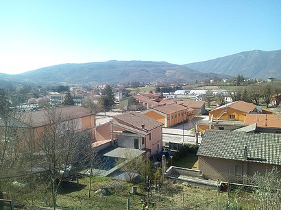
Location: Borgorose, Rome and Lazio
Attractions near Borgorose
Borgocollefegato,Via dello Stadio,Viale degli Eroi,Strada Provinciale 25,Via degli Atleti,Piazza Municipio,Carabinieri, Borgorose,1,Farmacia Borgorose,municipio di borgorose,Via Marsicana 6,Pizzeria Country Road,Country Road,Via Giuseppe Mazzini 14,Viale Giuseppe Mazzini,Via dei Salici,Via dei Tulipani,Via Santa Anastasia,Via della Gioventù,Strada Provinciale Borgorose GrottiHow to get to popular attractions in Borgorose with public transit
Capgemini, Roma,Spagna, Roma,Teatro Di Marcello, Roma,Staz.ne Tiburtina, Roma,Laghetto Di Villa Ada, Roma,Villa Mirafiori, Roma,Teatro Argentina, Roma,Basilica di San Pietro in Vaticano (Basilica Sancti Petri),Trastevere, Roma,Castro Laurenziano, Roma,Viale XXI Aprile, Roma,Centro Commerciale La Romanina, Roma,Piazza San Pietro,Stazione San Lorenzo, Roma,Trullo, Roma,Ippodromo Delle Capannelle, Roma,Centro Commerciale ""I Granai"", Roma,Stazione Tiburtina, Roma,Ospedale San Pietro Fatebenefratelli, Roma,Ospedale Santo Spirito In Sassia, RomaGet around Borgorose by public transit!
Traveling around Borgorose has never been so easy. See step by step directions as you travel to any attraction, street or major public transit station. View bus and train schedules, arrival times, service alerts and detailed routes on a map, so you know exactly how to get to anywhere in Borgorose.
When traveling to any destination around Borgorose use Moovit's Live Directions with Get Off Notifications to know exactly where and how far to walk, how long to wait for your line, and how many stops are left. Moovit will alert you when it's time to get off — no need to constantly re-check whether yours is the next stop.
Wondering how to use public transit in Borgorose or how to pay for public transit in Borgorose? Moovit public transit app can help you navigate your way with public transit easily, and at minimum cost. It includes public transit fees, ticket prices, and costs. Looking for a map of Borgorose public transit lines? Moovit public transit app shows all public transit maps in Borgorose with all bus routes and stops on an interactive map.
Borgorose has 1 transit type(s), including: bus, operated by several transit agencies, including ATAC, ATAC, Cotral, Trenitalia, ATAC, ATAC, Roma TPL, Navette, Autoservizi Troiani, Seatour, Autolinee Troiani, CSC Mobilità, BIS, Terravision and ATRAL