See Borough of Haddonfield on the map
Directions to Borough of Haddonfield with public transportation
The following transit lines have routes that pass near Borough of Haddonfield
 Bus:
Bus: - Train:
- Subway:
How to get to Borough of Haddonfield by bus?
Click on the bus route to see step by step directions with maps, line arrival times and updated time schedules.
How to get to Borough of Haddonfield by subway?
Click on the subway route to see step by step directions with maps, line arrival times and updated time schedules.
Bus stations near Borough of Haddonfield
- Kings Hwy E at Haddon Ave S,2 min walk,
- Ellis St at Snowden Ave#,4 min walk,
Subway stations near Borough of Haddonfield
- Woodcrest,27 min walk,
Train stations near Borough of Haddonfield
- Cherry Hill,61 min walk,
Bus lines to Borough of Haddonfield
- 455,Paulsboro,
- 457,Moorestown Mall,
- 451,Camden Wrtc,
What are the closest stations to Borough of Haddonfield?
The closest stations to Borough of Haddonfield are:
- Kings Hwy E at Haddon Ave S is 100 yards away, 2 min walk.
- Ellis St at Snowden Ave# is 293 yards away, 4 min walk.
- Woodcrest is 2212 yards away, 27 min walk.
- Cherry Hill is 5229 yards away, 61 min walk.
Which bus lines stop near Borough of Haddonfield?
These bus lines stop near Borough of Haddonfield: 455, 457.
Which subway line stops near Borough of Haddonfield?
PATCO
What’s the nearest subway station to Borough of Haddonfield?
The nearest subway station to Borough of Haddonfield is Woodcrest. It’s a 27 min walk away.
What’s the nearest bus stop to Borough of Haddonfield?
The nearest bus stop to Borough of Haddonfield is Kings Hwy E at Haddon Ave S. It’s a 2 min walk away.
What time is the first subway to Borough of Haddonfield?
The PATCO is the first subway that goes to Borough of Haddonfield. It stops nearby at 3:03 AM.
What time is the last subway to Borough of Haddonfield?
The PATCO is the last subway that goes to Borough of Haddonfield. It stops nearby at 2:58 AM.
What time is the first train to Borough of Haddonfield?
The ACRL is the first train that goes to Borough of Haddonfield. It stops nearby at 5:15 AM.
What time is the last train to Borough of Haddonfield?
The ACRL is the last train that goes to Borough of Haddonfield. It stops nearby at 1:18 AM.
What time is the first bus to Borough of Haddonfield?
The 457 is the first bus that goes to Borough of Haddonfield. It stops nearby at 5:44 AM.
What time is the last bus to Borough of Haddonfield?
The 455 is the last bus that goes to Borough of Haddonfield. It stops nearby at 11:02 PM.
How much is the bus fare to Borough of Haddonfield?
The bus fare to Borough of Haddonfield costs about $2.00.
How much is the subway fare to Borough of Haddonfield?
The subway fare to Borough of Haddonfield costs about $1.40 - $3.00.
See Borough of Haddonfield on the map
Public Transportation to Borough of Haddonfield
Wondering how to get to Borough of Haddonfield, United States? Moovit helps you find the best way to get to Borough of Haddonfield with step-by-step directions from the nearest public transit station.
Moovit provides free maps and live directions to help you navigate through your city. View schedules, routes, timetables, and find out how long does it take to get to Borough of Haddonfield in real time.
Looking for the nearest stop or station to Borough of Haddonfield? Check out this list of stops closest to your destination: Kings Hwy E at Haddon Ave S; Ellis St at Snowden Ave#; Woodcrest; Cherry Hill.
Bus:Train:Subway:
Want to see if there’s another route that gets you there at an earlier time? Moovit helps you find alternative routes or times. Get directions from and directions to Borough of Haddonfield easily from the Moovit App or Website.
We make riding to Borough of Haddonfield easy, which is why over 1.5 million users, including users in Haddonfield, trust Moovit as the best app for public transit. You don’t need to download an individual bus app or train app, Moovit is your all-in-one transit app that helps you find the best bus time or train time available.
For information on prices of bus and subway, costs and ride fares to Borough of Haddonfield, please check the Moovit app.
Use the app to navigate to popular places including to the airport, hospital, stadium, grocery store, mall, coffee shop, school, college, and university.
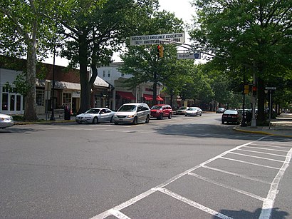
Borough of Haddonfield Address: 15 N Haddon Ave Haddonfield, NJ 08033 street in Haddonfield
Attractions near Borough of Haddonfield
Sealed with A Kiss of Haddonfield, NJ - the Original Since 1997,Mertz Harold DDS,Lawn Care Services in Cherry Hill,Gertrude Hawk Chocolates,The Little Shop,Kolovos Dimitri Esq.,Scelsi & Associates,Baseck Training,Stuart Law,Intelysis,Hot Dawgs,Lisa Wolschina & Associates - Keller Williams Haddonfield,Urban House Salon,The Mug Club,PXL House,Brilliant Environmental Services LLC,Shred Nations,Expert Event Management & Multimedia,The Delaware Valley School of Etiquette,SjypaHow to get to popular attractions in Haddonfield with public transit
Hyatt Regency Princeton,Croydon, PA, Croydon,West Oak Lane, Philadelphia,Voyeur, Philadelphia,Norristown, Norristown,Five Points Intersection,NJT - Princeton Junction Station (NEC), Princeton Junction,The College of New Jersey, Ewing,Hamilton, NJ, Hamilton Square,Aloft Philadelphia Airport, Philadelphia,Iron Abbey, Horsham,Iron Hill Brewery & Restaurant, West Chester,SEPTA Conshohocken Station, Conshohocken,Williamstown, NJ, Williamstown,NJT - Hamilton Station (NEC),Butcher and Singer, Philadelphia,McCarter Theatre, Princeton,Honey's Sit 'n Eat, Philadelphia,Sampan, Philadelphia,Mercer County Community CollegeGet around Haddonfield by public transit!
Traveling around Haddonfield has never been so easy. See step by step directions as you travel to any attraction, street or major public transit station. View bus and train schedules, arrival times, service alerts and detailed routes on a map, so you know exactly how to get to anywhere in Haddonfield.
When traveling to any destination around Haddonfield use Moovit's Live Directions with Get Off Notifications to know exactly where and how far to walk, how long to wait for your line, and how many stops are left. Moovit will alert you when it's time to get off — no need to constantly re-check whether yours is the next stop.
Wondering how to use public transit in Haddonfield or how to pay for public transit in Haddonfield? Moovit public transit app can help you navigate your way with public transit easily, and at minimum cost. It includes public transit fees, ticket prices, and costs. Looking for a map of Haddonfield public transit lines? Moovit public transit app shows all public transit maps in Haddonfield with all bus or subway routes and stops on an interactive map.
Haddonfield has 2 transit type(s), including: bus or subway, operated by several transit agencies, including SEPTA Subway, SEPTA Trolley, SEPTA Rail, SEPTA, SEPTA, NJ TRANSIT RAIL-Rail, NJ TRANSIT RAIL-Tram, NJ TRANSIT BUS, Port Authority Transit Corporation, Navy Yard, Penn Transit, Drexel University, Pottstown Area Rapid Transit (PART), Fullington Tours and Chescobus