Botanic Gardens stop - Saturday schedule
| Line | Direction | Time |
|---|---|---|
| 24 | Merrion Square | 3:26 AM |
| 24 | Merrion Square | 3:57 AM |
| 24 | Merrion Square | 4:27 AM |
| 24 | Merrion Square | 4:57 AM |
| 24 | Merrion Square | 5:12 AM |
| 24 | Merrion Square | 5:32 AM |
| 24 | Merrion Square | 5:52 AM |
| 23 | Merrion Square | 6:14 AM |
| 24 | Merrion Square | 6:24 AM |
| 23 | Merrion Square | 6:46 AM |
| 24 | Merrion Square | 6:54 AM |
| 23 | Merrion Square | 7:16 AM |
| 24 | Merrion Square | 7:26 AM |
| 23 | Merrion Square | 7:47 AM |
| 24 | Merrion Square | 7:56 AM |
| 23 | Merrion Square | 8:17 AM |
| 24 | Merrion Square | 8:28 AM |
| 23 | Merrion Square | 8:48 AM |
| 24 | Merrion Square | 8:53 AM |
| 23 | Merrion Square | 9:08 AM |
| 24 | Merrion Square | 9:14 AM |
| 23 | Merrion Square | 9:28 AM |
| 24 | Merrion Square | 9:34 AM |
| 23 | Merrion Square | 9:49 AM |
| 24 | Merrion Square | 9:54 AM |
Directions to Botanic Gardens stop (Dublin) with public transit
The following transit lines have routes that pass near Botanic Gardens
 Bus: 23, 24, E1, E2, DUBLIN CITY SOUTH, WESTMORELAND STREET - ASHBOURNE, ASHBOURNE KELLY'S.
- Train: COMMUTER, RAIL.
How to get to Botanic Gardens stop by bus?
Click on the bus route to see step by step directions with maps, line arrival times and updated time schedules.
How to get to Botanic Gardens stop by train?
Click on the train route to see step by step directions with maps, line arrival times and updated time schedules.
Light Rail stations near Botanic Gardens station in Dublin
- Phibsborough, 2 min walk,
Bus stops near Botanic Gardens stop in Dublin
- Glasnevin, Botanic Gardens, 2 min walk,
- Mobhi Road, 4 min walk,
- De Courcy Sq, 10 min walk,
- Stella Avenue, 10 min walk,
Train stations near Botanic Gardens station in Dublin
- Drumcondra, 14 min walk,
Bus lines to Botanic Gardens stop in Dublin
- 23, Charlestown,
- 24, Merrion Square,
- DUBLIN CITY SOUTH, WESTMORELAND STREET - ASHBOURNE, ASHBOURNE KELLY'S, Tudor Grove,
- E1, Ballywaltrim,
- E2, Dun Laoghaire,
- F1, Tallaght,
- F2, Rossmore Road,
- F3, Limekiln Avenue,
- 40D, Parnell St,
- 19, St Pappin's Road,
What are the closest stations to Botanic Gardens?
The closest stations to Botanic Gardens are:
- Phibsborough station is 134 meters away, 2 min walk.
- Glasnevin, Botanic Gardens stop is 150 meters away, 2 min walk.
- Mobhi Road stop is 259 meters away, 4 min walk.
- De Courcy Sq stop is 760 meters away, 10 min walk.
- Stella Avenue stop is 766 meters away, 10 min walk.
- Drumcondra station is 1069 meters away, 14 min walk.
Which bus lines stop near Botanic Gardens?
These bus lines stop near Botanic Gardens: 23, 24, E1, E2.
Which train lines stop near Botanic Gardens?
These train lines stop near Botanic Gardens: COMMUTER, RAIL.
What’s the nearest light rail station to Botanic Gardens in Dublin?
The nearest light rail station to Botanic Gardens in Dublin is Phibsborough. It’s a 2 min walk away.
What’s the nearest train station to Botanic Gardens in Dublin?
The nearest train station to Botanic Gardens in Dublin is Drumcondra. It’s a 14 min walk away.
What’s the nearest bus station to Botanic Gardens in Dublin?
The nearest bus station to Botanic Gardens in Dublin is Glasnevin, Botanic Gardens. It’s a 2 min walk away.
What time is the first light rail to Botanic Gardens in Dublin?
The GREEN is the first light rail that goes to Botanic Gardens in Dublin. It stops nearby at 5:33 AM.
What time is the last light rail to Botanic Gardens in Dublin?
The GREEN is the last light rail that goes to Botanic Gardens in Dublin. It stops nearby at 12:59 AM.
What time is the first train to Botanic Gardens in Dublin?
The RAIL is the first train that goes to Botanic Gardens in Dublin. It stops nearby at 5:30 AM.
What time is the last train to Botanic Gardens in Dublin?
The RAIL is the last train that goes to Botanic Gardens in Dublin. It stops nearby at 11:53 PM.
What time is the first bus to Botanic Gardens in Dublin?
The E1 is the first bus that goes to Botanic Gardens in Dublin. It stops nearby at 3:00 AM.
What time is the last bus to Botanic Gardens in Dublin?
The E1 is the last bus that goes to Botanic Gardens in Dublin. It stops nearby at 3:38 AM.
Botanic Gardens station
 Taken by Anonymous
See Botanic Gardens stop, Dublin, on the map
Public transit to Botanic Gardens stop (ID: 183) in Dublin
Looking for directions to Botanic Gardens in Dublin, Ireland?
Download the Moovit App to find the current schedule and step-by-step directions for Bus, Train or Light Rail routes that pass through Botanic Gardens.
Looking for the nearest stops closest to Botanic Gardens ? Check out this list of closest stops to your destination: Phibsborough; Glasnevin; Mobhi Road; De Courcy Sq; Stella Avenue; Drumcondra.
Bus: 23, 24, E1, E2, DUBLIN CITY SOUTH, WESTMORELAND STREET - ASHBOURNE, ASHBOURNE KELLY'S, F1, F2, F3, 40D, 19.Train: COMMUTER, RAIL.
We make riding on public transit to Botanic Gardens easy, which is why over 1.7 billion users, including users in Dublin trust Moovit as the best app for public transit.
Use the app to navigate to popular places including to the airport, hospital, stadium, grocery store, mall, coffee shop, school, college, and university.
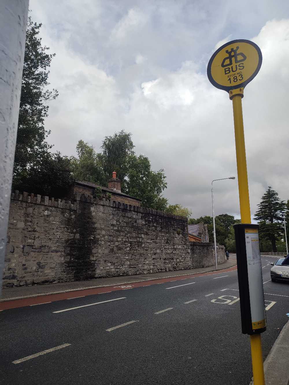
Botanic Gardens stop’s code is 183
The first line to this stop is 24, at 3:26 AM, and the last line is 24 at 11:35 PM.
181 Botanic Road, Dublin, Ireland
This stop serves Bus Átha Cliath – Dublin Bus’s lines
Popular routes from Botanic Gardens stop, Dublin
- Phibsborough
Light Rail station near Botanic Gardens station
- Glasnevin, Botanic Gardens,
- Mobhi Road,
- De Courcy Sq,
- Stella Avenue
Bus stops near Botanic Gardens stop
- Drumcondra
Train station near Botanic Gardens station
- Greystones, Rathdown Road (Blacklion Manor),
- Oscar Square,
- Liffey Valley Golf,
- Kylemore Luas,
- Beaumont Avenue,
- Knocknacarragh, Western Distributor Road Galway,
- Heather Road,
- Terenure Lbry,
- Foxborough Park,
- Glenfarne Rd,
- Painestown,
- Carrigtwohill,
- Clondalkin / Fonthill,
- St Patricks Cathdrl,
- St Attracta Road,
- Ashfield House,
- Sandford Road,
- Blackrock CH,
- Merrion Road,
- Athlone Stn
Popular public transit stations in Dublin
Get around Dublin by public transit!
Traveling around Dublin has never been so easy. See step by step directions as you travel to any attraction, street or major public transit station. View bus and train schedules, arrival times, service alerts and detailed routes on a map, so you know exactly how to get to anywhere in Dublin.
When traveling to any destination around Dublin use Moovit's Live Directions with Get Off Notifications to know exactly where and how far to walk, how long to wait for your line, and how many stops are left. Moovit will alert you when it's time to get off — no need to constantly re-check whether yours is the next stop.
Wondering how to use public transit in Dublin or how to pay for public transit in Dublin? Moovit public transit app can help you navigate your way with public transit easily, and at minimum cost. It includes public transit fees, ticket prices, and costs. Looking for a map of Dublin public transit lines? Moovit public transit app shows all public transit maps in Dublin with all Bus, Train and Light Rail routes and stops on an interactive map.
Ireland has 3 transit type(s), including: Bus, Train and Light Rail, operated by several transit agencies, including Luas, Bus Átha Cliath – Dublin Bus, Bus Éireann, Go-Ahead Ireland, Nitelink, Dublin Bus, Citylink, City Direct, Kenneally's Bus Service, Aircoach, TFI Local Link Mayo, Irish Rail, Express Bus, JJ/Bernard Kavanagh, Dublin Coach and Kearns Transport