Directions to Boulevard Poniatowski (Paris) with public transportation
The following transit lines have routes that pass near Boulevard Poniatowski
How to get to Boulevard Poniatowski by bus?
Click on the bus route to see step by step directions with maps, line arrival times and updated time schedules.
How to get to Boulevard Poniatowski by metro?
Click on the metro route to see step by step directions with maps, line arrival times and updated time schedules.
Metro stations near Boulevard Poniatowski in Paris
- Michel Bizot, 1 min walk,
- Cour Saint-Emilion, 4 min walk,
- Porte de Charenton, 7 min walk,
- Daumesnil (Félix Eboué), 12 min walk,
Bus stations near Boulevard Poniatowski in Paris
- Terroirs de France, 2 min walk,
- Porte de Charenton, 3 min walk,
- Pont National - Quai de Bercy, 11 min walk,
Bus lines to Boulevard Poniatowski in Paris
- 109, Terroirs de France,
- 111, Voisin - République,
- 77, Joinville-Le-Pont RER,
- N35, Ecole Vétérinaire de Maisons-Alfort - Métro,
- 87, Gare de Lyon,
- 24, Panthéon,
- N32, Gare de Lyon,
- N130, Gare de Lyon - Van Gogh,
What are the closest stations to Boulevard Poniatowski?
The closest stations to Boulevard Poniatowski are:
- Michel Bizot is 30 meters away, 1 min walk.
- Terroirs de France is 80 meters away, 2 min walk.
- Porte de Charenton is 219 meters away, 3 min walk.
- Cour Saint-Emilion is 238 meters away, 4 min walk.
- Pont National - Quai de Bercy is 784 meters away, 11 min walk.
- Daumesnil (Félix Eboué) is 875 meters away, 12 min walk.
Which metro line stops near Boulevard Poniatowski?
8
Which bus lines stop near Boulevard Poniatowski?
These bus lines stop near Boulevard Poniatowski: 111, 46, 62, 71, 87, 89.
Which light rail line stops near Boulevard Poniatowski?
T3A
What’s the nearest metro station to Boulevard Poniatowski in Paris?
The nearest metro station to Boulevard Poniatowski in Paris is Michel Bizot. It’s a 1 min walk away.
What’s the nearest bus stop to Boulevard Poniatowski in Paris?
The nearest bus stop to Boulevard Poniatowski in Paris is Terroirs de France. It’s a 2 min walk away.
What time is the first light rail to Boulevard Poniatowski in Paris?
The T3A is the first light rail that goes to Boulevard Poniatowski in Paris. It stops nearby at 6:36 AM.
What time is the last light rail to Boulevard Poniatowski in Paris?
The T3A is the last light rail that goes to Boulevard Poniatowski in Paris. It stops nearby at 1:12 AM.
What time is the first metro to Boulevard Poniatowski in Paris?
The 6 is the first metro that goes to Boulevard Poniatowski in Paris. It stops nearby at 5:30 AM.
What time is the last metro to Boulevard Poniatowski in Paris?
The 6 is the last metro that goes to Boulevard Poniatowski in Paris. It stops nearby at 1:11 AM.
What time is the first bus to Boulevard Poniatowski in Paris?
The N35 is the first bus that goes to Boulevard Poniatowski in Paris. It stops nearby at 3:06 AM.
What time is the last bus to Boulevard Poniatowski in Paris?
The N130 is the last bus that goes to Boulevard Poniatowski in Paris. It stops nearby at 4:17 AM.
See Boulevard Poniatowski, Paris, on the map
Public Transit to Boulevard Poniatowski in Paris
Wondering how to get to Boulevard Poniatowski in Paris, France? Moovit helps you find the best way to get to Boulevard Poniatowski with step-by-step directions from the nearest public transit station.
Moovit provides free maps and live directions to help you navigate through your city. View schedules, routes, timetables, and find out how long does it take to get to Boulevard Poniatowski in real time.
Looking for the nearest stop or station to Boulevard Poniatowski? Check out this list of stops closest to your destination: Michel Bizot; Terroirs de France; Porte de Charenton; Cour Saint-Emilion; Pont National - Quai de Bercy; Daumesnil (Félix Eboué).
Metro: 8, 14, T3A, 6.Bus: 111, 46, 62, 71, 87, 89, 109, 77, N35.Light Rail: T3A.
Want to see if there’s another route that gets you there at an earlier time? Moovit helps you find alternative routes or times. Get directions from and directions to Boulevard Poniatowski easily from the Moovit App or Website.
We make riding to Boulevard Poniatowski easy, which is why over 1.5 million users, including users in Paris, trust Moovit as the best app for public transit. You don’t need to download an individual bus app or train app, Moovit is your all-in-one transit app that helps you find the best bus time or train time available.
For information on prices of metro, bus, light rail and RER, costs and ride fares to Boulevard Poniatowski, please check the Moovit app.
Use the app to navigate to popular places including to the airport, hospital, stadium, grocery store, mall, coffee shop, school, college, and university.
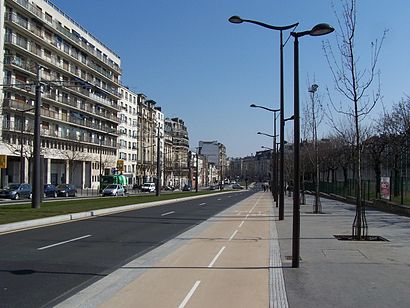
Boulevard Poniatowski Address: Boulevard Poniatowski, 75012 Paris, France street in Paris
Attractions near Boulevard Poniatowski
Station Baron Le Roy [T3a],Arrêt Porte de Charenton [87,111,N35],Station Porte de Charenton [T3a],Espace Charenton,Arrêt Baron Le Roy [111],Rue Théodore-Hamont,20 Boulevard Poniatowski,9 Allée des Vergers,Centre sportif Léo Lagrange,Arrêt Charenton - Jardiniers [87],68 Boulevards des Maréchaux,Centres D'Hébergement Et de Réinsertion Sociale Arfog Lafayette,21 Avenue du Général Michel Bizot,12112-Charenton Jardinier,Cimetière Valmy,Tsm,Série,Iberocoach,Boulevard Périphérique,Usp NettoyageHow to get to popular attractions in Paris with public transit
MRM Paris, Clichy,Stade de France A To J, Saint-Denis,Poissy, Poissy,Saint-Denis, Saint-Denis,Pullman Roissy CDG, Roissy-En-France,Meudon, Meudon,Bures-sur-Yvette, Bures-Sur-Yvette,Cinéma L'Alcazar, Asnieres-Sur-Seine,Gare de Gagny, Gagny,SFR Rive Défense, Nanterre,INSEAD, Fontainebleau,Court Philippe Chatrier, Paris,Vanves, Vanves,Rambouillet, Rambouillet,Senlis, Senlis,Aéroport Charles de Gaulle, Roissy-En-France,Sceaux, Sceaux,Stade de France K To Z, Saint-Denis,Pont de Billancourt, Issy-Les-Moulineaux,Parc Des Buttes-Chaumont, ParisGet around Paris by public transit!
Traveling around Paris has never been so easy. See step by step directions as you travel to any attraction, street or major public transit station. View bus and train schedules, arrival times, service alerts and detailed routes on a map, so you know exactly how to get to anywhere in Paris.
When traveling to any destination around Paris use Moovit's Live Directions with Get Off Notifications to know exactly where and how far to walk, how long to wait for your line, and how many stops are left. Moovit will alert you when it's time to get off — no need to constantly re-check whether yours is the next stop.
Wondering how to use public transit in Paris or how to pay for public transit in Paris? Moovit public transit app can help you navigate your way with public transit easily, and at minimum cost. It includes public transit fees, ticket prices, and costs. Looking for a map of Paris public transit lines? Moovit public transit app shows all public transit maps in Paris with all Bus, Train, Metro, Light Rail, RER and Funicular routes and stops on an interactive map.
Paris has 6 transit type(s), including: Bus, Train, Metro, Light Rail, RER and Funicular, operated by several transit agencies, including RATP, RER, RER Bus de remplacement, Train, Train Bus de remplacement, Tramway Bus de remplacement, TER, Tramway, ADP, Noctilien, Magical Shuttle, Apolo 7, Argenteuil - Boucles de Seine, Autobus du Fort, Autocars Dominique