See Boynton Beach Tri-rail Station, Miami, on the map
Directions to Boynton Beach Tri-rail Station (Miami) with public transportation
The following transit lines have routes that pass near Boynton Beach Tri-rail Station
 Bus:
Bus: - Train:
How to get to Boynton Beach Tri-rail Station by bus?
Click on the bus route to see step by step directions with maps, line arrival times and updated time schedules.
How to get to Boynton Beach Tri-rail Station by train?
Click on the train route to see step by step directions with maps, line arrival times and updated time schedules.
Which bus lines stop near Boynton Beach Tri-rail Station?
These bus lines stop near Boynton Beach Tri-rail Station: 70, 71.
Which train line stops near Boynton Beach Tri-rail Station?
TRIRAIL
See Boynton Beach Tri-rail Station, Miami, on the map
Public Transit to Boynton Beach Tri-rail Station in Miami
Wondering how to get to Boynton Beach Tri-rail Station in Miami, United States? Moovit helps you find the best way to get to Boynton Beach Tri-rail Station with step-by-step directions from the nearest public transit station.
Moovit provides free maps and live directions to help you navigate through your city. View schedules, routes, timetables, and find out how long does it take to get to Boynton Beach Tri-rail Station in real time.
Bus:Train:
Want to see if there’s another route that gets you there at an earlier time? Moovit helps you find alternative routes or times. Get directions from and directions to Boynton Beach Tri-rail Station easily from the Moovit App or Website.
We make riding to Boynton Beach Tri-rail Station easy, which is why over 1.5 million users, including users in Miami, trust Moovit as the best app for public transit. You don’t need to download an individual bus app or train app, Moovit is your all-in-one transit app that helps you find the best bus time or train time available.
For information on prices of bus and train, costs and ride fares to Boynton Beach Tri-rail Station, please check the Moovit app.
Use the app to navigate to popular places including to the airport, hospital, stadium, grocery store, mall, coffee shop, school, college, and university.
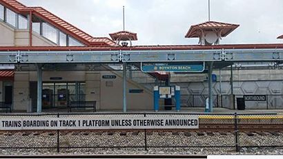
Boynton Beach Tri-rail Station Address: 2800 High Ridge Rd street in Miami
Attractions near Boynton Beach Tri-rail Station
Downtown Boynton Beach,Tri-Rail - Boynton Beach Station,Boynton Beach Station,NOBO Brewing Company,Strictly Shades,I-95 south key west Bound,2610 NW 2nd St,Zicaro's Plumbing Services,Warm Hearts Pet Rescue,Ecm air conditioning,Euro Granite and Stone,Preppy Pet Suites,Florida Flooring,Autorama Wraps,Steel Knuckle Customs,Nonprofits First Inc,Early Learning Coalition of Palm Beach County,Children's Services Council of Palm Beach County,2620 NW 1st St,WoodKingHow to get to popular attractions in Miami with public transit
Haulover Beach Park, Miami Beach,Surfside Beach, Miami Beach,Walmart Supercenter, Plantation,B Ocean Resort, Fort Lauderdale, Fort Lauderdale,Palm Beach County Convention Center, West Palm Beach,Chili's Grill & Bar, Kendale Lakes-Tamiami,Miami Biltmore Hotel, Miami,Pottery Barn, Boca Raton,Citrix Systems, Inc, Fort Lauderdale,Novecento, Miami,LIV Miami, Miami Beach,Deerfield Beach, Deerfield Beach,Downtown at The Gardens, Riviera Beach,Target, Fort Lauderdale,Lauderdale-By-The-Sea, Fort Lauderdale,Apple The Galleria, Fort Lauderdale,The Diplomat Beach Resort, Hollywood,Florida Atlantic University, Boca Raton,Coral Sky Amphitheatre, Royal Palm Beach-West Jupiter,Lester's Diner, Fort LauderdaleGet around Miami by public transit!
Traveling around Miami has never been so easy. See step by step directions as you travel to any attraction, street or major public transit station. View bus and train schedules, arrival times, service alerts and detailed routes on a map, so you know exactly how to get to anywhere in Miami.
When traveling to any destination around Miami use Moovit's Live Directions with Get Off Notifications to know exactly where and how far to walk, how long to wait for your line, and how many stops are left. Moovit will alert you when it's time to get off — no need to constantly re-check whether yours is the next stop.
Wondering how to use public transit in Miami or how to pay for public transit in Miami? Moovit public transit app can help you navigate your way with public transit easily, and at minimum cost. It includes public transit fees, ticket prices, and costs. Looking for a map of Miami public transit lines? Moovit public transit app shows all public transit maps in Miami with all bus or train routes and stops on an interactive map.
Miami has 2 transit type(s), including: bus or train, operated by several transit agencies, including Miami-Dade Transit, Miami-Dade Transit, Miami Dade Transit-Rail, Tri-Rail, Miami-Dade Transit, Broward County Transit, Palm Tran, Brightline, Brightline, MARTY, City of Homestead Trolley, Key West Transit, Treasure Coast Connector, GoLine IRT and Amtrak