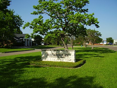
See Braeswood Place, Houston, on the map
Directions to Braeswood Place (Houston) with public transportation
The following transit lines have routes that pass near Braeswood Place
 Bus:
Bus:
How to get to Braeswood Place by bus?
Click on the bus route to see step by step directions with maps, line arrival times and updated time schedules.
Bus stations near Braeswood Place in Houston
- Kirby Dr @ Glen Haven Blvd,3 min walk,
- Braeswood Blvd @ Kirby Dr,7 min walk,
Light Rail stations near Braeswood Place in Houston
- Tmc Transit Center,13 min walk,
Bus lines to Braeswood Place in Houston
- 41,Eastwood Tc - Eastbound,
- 4,Eastwood Tc - Eastbound,
- 68,Tmc Tc - Eastbound,
What are the closest stations to Braeswood Place?
The closest stations to Braeswood Place are:
- Kirby Dr @ Glen Haven Blvd is 170 yards away, 3 min walk.
- Braeswood Blvd @ Kirby Dr is 544 yards away, 7 min walk.
- Tmc Transit Center is 1106 yards away, 13 min walk.
Which bus lines stop near Braeswood Place?
These bus lines stop near Braeswood Place: 4, 41.
What’s the nearest light rail station to Braeswood Place in Houston?
The nearest light rail station to Braeswood Place in Houston is Tmc Transit Center. It’s a 13 min walk away.
What’s the nearest bus stop to Braeswood Place in Houston?
The nearest bus stop to Braeswood Place in Houston is Kirby Dr @ Glen Haven Blvd. It’s a 3 min walk away.
What time is the first light rail to Braeswood Place in Houston?
The 700 is the first light rail that goes to Braeswood Place in Houston. It stops nearby at 4:31 AM.
What time is the last light rail to Braeswood Place in Houston?
The 700 is the last light rail that goes to Braeswood Place in Houston. It stops nearby at 1:12 AM.
What time is the first bus to Braeswood Place in Houston?
The 41 is the first bus that goes to Braeswood Place in Houston. It stops nearby at 5:16 AM.
What time is the last bus to Braeswood Place in Houston?
The 4 is the last bus that goes to Braeswood Place in Houston. It stops nearby at 12:56 AM.
How much is the bus fare to Braeswood Place?
The bus fare to Braeswood Place costs about $1.25.
See Braeswood Place, Houston, on the map
Public Transit to Braeswood Place in Houston
Wondering how to get to Braeswood Place in Houston, United States? Moovit helps you find the best way to get to Braeswood Place with step-by-step directions from the nearest public transit station.
Moovit provides free maps and live directions to help you navigate through your city. View schedules, routes, timetables, and find out how long does it take to get to Braeswood Place in real time.
Looking for the nearest stop or station to Braeswood Place? Check out this list of stops closest to your destination: Kirby Dr @ Glen Haven Blvd; Braeswood Blvd @ Kirby Dr; Tmc Transit Center.
Bus:
Want to see if there’s another route that gets you there at an earlier time? Moovit helps you find alternative routes or times. Get directions from and directions to Braeswood Place easily from the Moovit App or Website.
We make riding to Braeswood Place easy, which is why over 1.5 million users, including users in Houston, trust Moovit as the best app for public transit. You don’t need to download an individual bus app or train app, Moovit is your all-in-one transit app that helps you find the best bus time or train time available.
For information on prices of bus, costs and ride fares to Braeswood Place, please check the Moovit app.
Use the app to navigate to popular places including to the airport, hospital, stadium, grocery store, mall, coffee shop, school, college, and university.
Location: Houston
Attractions near Braeswood Place
Pride Portraits,Camerata Ventapane,Versatile Arc Fabrication,Houston Executive,Kimpton Apartments,Riyaaz Qawwali,Crawfish Chris,Personal Paparazzi Photography,Kirby Dr,Zap Medical Services,Om&Me Massage,Kirby Condominiums,Dr Shinian Cao,Board of Law Examiners Representation Board of Law Examiners,Tejas Reserve,Jr's Recovery,Maria Jose Tabush,The Rice School,Ja Trucking,Olive ScaciatiHow to get to popular attractions in Houston with public transit
Beltway 8 & Hwy 59, Houston,FKM, Houston,George R. Brown Convention Center, Houston,Hwy 249 Tomball Parkway / Sam Houston Tollway, Houston,Pappadeaux Seafood Kitchen, Houston,Bechtel OG&C, Houston,Intersection of 610 and South Post Oak Rd, Houston,45 South HOV Lane, Houston,United Airlines In-Flight Training Center, Houston,Lupe Tortilla Mexican Restaurant, Houston,METRO Hiram Clarke Transit Center, Houston,Memorial Hermann Memorial City Medical Center, Houston,Hwy 6 & Richmond, Houston,Texas Children's Hospital - West Tower, Houston,Barnaby's Cafe, Houston,TC Jester & Beltway 8,Intersection of I-45 and W Little York Rd, Houston,Pappasito's Cantina, Houston,Fiesta,Kashmere Gardens, HoustonGet around Houston by public transit!
Traveling around Houston has never been so easy. See step by step directions as you travel to any attraction, street or major public transit station. View bus and train schedules, arrival times, service alerts and detailed routes on a map, so you know exactly how to get to anywhere in Houston.
When traveling to any destination around Houston use Moovit's Live Directions with Get Off Notifications to know exactly where and how far to walk, how long to wait for your line, and how many stops are left. Moovit will alert you when it's time to get off — no need to constantly re-check whether yours is the next stop.
Wondering how to use public transit in Houston or how to pay for public transit in Houston? Moovit public transit app can help you navigate your way with public transit easily, and at minimum cost. It includes public transit fees, ticket prices, and costs. Looking for a map of Houston public transit lines? Moovit public transit app shows all public transit maps in Houston with all bus routes and stops on an interactive map.
Houston has 1 transit type(s), including: bus, operated by several transit agencies, including METRO, METRO, Greyhound-us, FlixBus-us and Megabus