How to get to Bread To Go by bus?
Click on the bus route to see step by step directions with maps, line arrival times and updated time schedules.
From SAP Campus, Walldorf
125 minFrom Agaplesion Bethanien Krankenhaus Heidelberg, Südstadt
94 minFrom SAP Headquarters, Walldorf
129 minFrom Thermen & Badewelt Sinsheim, Sinsheim
96 minFrom SAP Walldorf P18, Walldorf
132 minFrom Universitätsklinikum Heidelberg-Notaufnahme, Neuenheim
100 minFrom Luxor Filmpalast, Bahnstadt
93 minFrom Thingstätte, Handschuhsheim
108 minFrom Neuenheimer Feld, Neuenheim
93 min
How to get to Bread To Go by train?
Click on the train route to see step by step directions with maps, line arrival times and updated time schedules.
Bus stop near Bread To Go in Verwaltungsverband Elsenztal
- Mönchzell, Kirche, 8 min walk,VIEW
Train stations near Bread To Go in Verwaltungsverband Elsenztal
Light Rail stations near Bread To Go in Verwaltungsverband Elsenztal
- Neidenstein, Bahnhof, 61 min walk,VIEW
Bus lines to Bread To Go in Verwaltungsverband Elsenztal
What are the closest stations to Bread To Go?
The closest stations to Bread To Go are:
- Mönchzell, Kirche is 540 meters away, 8 min walk.
- Eschelbronn, Bahnhof is 2621 meters away, 34 min walk.
- Meckesheim, Bahnhof is 3267 meters away, 42 min walk.
- Neidenstein, Bahnhof is 4780 meters away, 61 min walk.
Which train line stops near Bread To Go?
S8 (Aglasterhausen)
Which bus lines stop near Bread To Go?
These bus lines stop near Bread To Go: 743, 754, 796.
What’s the nearest bus station to Bread To Go in Verwaltungsverband Elsenztal?
The nearest bus station to Bread To Go in Verwaltungsverband Elsenztal is Mönchzell, Kirche. It’s a 8 min walk away.
What time is the first light rail to Bread To Go in Verwaltungsverband Elsenztal?
The S51 is the first light rail that goes to Bread To Go in Verwaltungsverband Elsenztal. It stops nearby at 4:44 AM.
What time is the last light rail to Bread To Go in Verwaltungsverband Elsenztal?
The S51 is the last light rail that goes to Bread To Go in Verwaltungsverband Elsenztal. It stops nearby at 12:08 AM.
What time is the first train to Bread To Go in Verwaltungsverband Elsenztal?
The S8 is the first train that goes to Bread To Go in Verwaltungsverband Elsenztal. It stops nearby at 4:44 AM.
What time is the last train to Bread To Go in Verwaltungsverband Elsenztal?
The S7 is the last train that goes to Bread To Go in Verwaltungsverband Elsenztal. It stops nearby at 1:10 AM.
What time is the first bus to Bread To Go in Verwaltungsverband Elsenztal?
The 743 is the first bus that goes to Bread To Go in Verwaltungsverband Elsenztal. It stops nearby at 4:45 AM.
What time is the last bus to Bread To Go in Verwaltungsverband Elsenztal?
The 7950 is the last bus that goes to Bread To Go in Verwaltungsverband Elsenztal. It stops nearby at 12:09 AM.
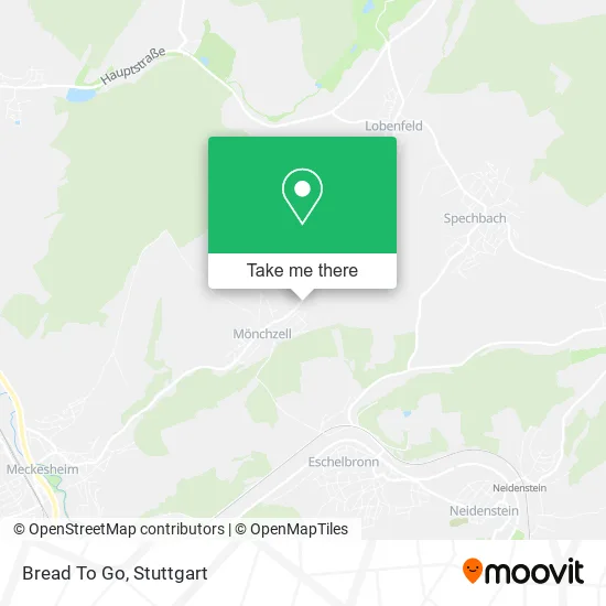
See Bread To Go, Verwaltungsverband Elsenztal, on the map
Public Transit to Bread To Go in Verwaltungsverband Elsenztal
Wondering how to get to Bread To Go in Verwaltungsverband Elsenztal? Moovit helps you find the best way to get to Bread To Go with step-by-step directions from the nearest public transit station.
Moovit provides free maps and live directions to help you navigate through your city. View schedules, routes, timetables, and find out how long does it take to get to Bread To Go in real time.
Looking for the nearest stop or station to Bread To Go? Check out this list of stops closest to your destination: Mönchzell; Eschelbronn; Meckesheim; Neidenstein.
Train: S8, RE7, S7, RE10B, RB79.Bus: 743, 754, 796, 748, 7950.
Want to see if there’s another route that gets you there at an earlier time? Moovit helps you find alternative routes or times. Get directions from and directions to Bread To Go easily from the Moovit App or Website.
We make riding to Bread To Go easy, which is why over 1.5 million users, including users in Verwaltungsverband Elsenztal, trust Moovit as the best app for public transit. You don’t need to download an individual bus app or train app, Moovit is your all-in-one transit app that helps you find the best bus time or train time available.
For information on prices of bus, train and light rail, costs and ride fares to Bread To Go, please check the Moovit app.
Use the app to navigate to popular places including to the airport, hospital, stadium, grocery store, mall, coffee shop, school, college, and university.
Bread To Go Address: Im Oberbrühl 53 74909 Meckesheim street in Verwaltungsverband Elsenztal
- Private Gärten,
- Gottfried Mäck,
- Roster Steffen Elektroinstallation,
- Übersetzungsbüro Projekt Sprache,
- Klug Albert,
- Lashana,
- Maria Amato Business & Life Coaching,
- Sh Vermögensverwaltung,
- Picon Promotion & Concept,
- Waldemar Sluga Garten- und Landschaftsbau,
- Friedhof Mönchzell,
- Mal's Scholl Alexander Malermeisterbetrieb,
- Peter Zerr,
- Linde Anja,
- Hagen Künzer,
- Die Bastelfab,
- Dz Bank AG Deutsche Zentral Genossenschaftsbank,
- Christian Sauer,
- Volksbank Neckartal,
- Tonart Töpferei
Places Near Bread To Go (Verwaltungsverband Elsenztal)
- Mettingen Eros-Center Puff Laufhaus, Esslingen Am Neckar,
- Mercedes-Benz Museum, Bad Cannstatt,
- Porsche Museum, Zuffenhausen,
- Mercedes-Benz Museum (Mercedes Museum Stuttgart), Bad Cannstatt,
- Marmorsaal Im Weissenburgpark, Stuttgart-Süd,
- Pariser Platz Stuttgart, Stuttgart-Mitte,
- SI-Centrum, Möhringen,
- Klinikum Stuttgart - Katharinenhospital, Stuttgart-Mitte,
- Im Wizemann (Halle), Bad Cannstatt,
- Hauptbahnhof Stuttgart, Stuttgart-Mitte,
- Gleis 101/102 (tief), Stuttgart-Mitte,
- Geilhaus Haus 33a, Reutlingen-Betzingen,
- FlixBus Haltestelle, Stuttgart,
- Schleyerhalle, Bad Cannstatt,
- Waldfriedhof, Degerloch,
- Wilhelma (U-Bahn Wilhelma), Bad Cannstatt,
- Porsche-Arena, Bad Cannstatt,
- Hanns-Martin-Schleyer-Halle, Bad Cannstatt,
- Hanns-Martin-Schleyer-Halle (Stuttgart Hans-Martin-Schleyerhalle), Bad Cannstatt,
- Gasometer Pforzheim, Pforzheim
How to get to popular places in Stuttgart with public transit
Get around Verwaltungsverband Elsenztal by public transit!
Traveling around Verwaltungsverband Elsenztal has never been so easy. See step by step directions as you travel to any attraction, street or major public transit station. View bus and train schedules, arrival times, service alerts and detailed routes on a map, so you know exactly how to get to anywhere in Verwaltungsverband Elsenztal.
When traveling to any destination around Verwaltungsverband Elsenztal use Moovit's Live Directions with Get Off Notifications to know exactly where and how far to walk, how long to wait for your line, and how many stops are left. Moovit will alert you when it's time to get off — no need to constantly re-check whether yours is the next stop.
Wondering how to use public transit in Verwaltungsverband Elsenztal or how to pay for public transit in Verwaltungsverband Elsenztal? Moovit public transit app can help you navigate your way with public transit easily, and at minimum cost. It includes public transit fees, ticket prices, and costs. Looking for a map of Verwaltungsverband Elsenztal public transit lines? Moovit public transit app shows all public transit maps in Verwaltungsverband Elsenztal with all Bus, Train, Subway, Light Rail, Ferry, S-Bahn and Funicular routes and stops on an interactive map.
Stuttgart has 7 transit type(s), including: Bus, Train, Subway, Light Rail, Ferry, S-Bahn and Funicular, operated by several transit agencies, including SSB - Stadtbahn, SSB, SSB - Seilbahn / Zacke, S-Bahn Stuttgart, Rhein-Neckar-Verkehr GmbH (rnv), Karlsruher Verkehrsverbund, DB AG, DB Regiobus BW, Arverio Baden-Württemberg GmbH, DB RegioNetz Verkehrs GmbH Westfrankenbahn, DB Regio AG Baden-Württemberg, Südwestdeutsche Verkehrs-AG, DB Regio AG Mitte Region Hessen, DB and Bodensee-Oberschwaben-Bahn