See Brenton Point State Park, Boston, on the map
Directions to Brenton Point State Park (Boston) with public transportation
The following transit lines have routes that pass near Brenton Point State Park
 Bus:
Bus:
Bus stations near Brenton Point State Park in Boston
- Bellevue FS Ledge,65 min walk,
Bus lines to Brenton Point State Park in Boston
- 67,Bellevue Ave & Ledge Rd,
What are the closest stations to Brenton Point State Park?
The closest stations to Brenton Point State Park are:
- Bellevue FS Ledge is 5604 yards away, 65 min walk.
Which bus line stops near Brenton Point State Park?
67
See Brenton Point State Park, Boston, on the map
Public Transit to Brenton Point State Park in Boston
Wondering how to get to Brenton Point State Park in Boston, United States? Moovit helps you find the best way to get to Brenton Point State Park with step-by-step directions from the nearest public transit station.
Moovit provides free maps and live directions to help you navigate through your city. View schedules, routes, timetables, and find out how long does it take to get to Brenton Point State Park in real time.
Looking for the nearest stop or station to Brenton Point State Park? Check out this list of stops closest to your destination: Bellevue FS Ledge.
Bus:
Want to see if there’s another route that gets you there at an earlier time? Moovit helps you find alternative routes or times. Get directions from and directions to Brenton Point State Park easily from the Moovit App or Website.
We make riding to Brenton Point State Park easy, which is why over 1.5 million users, including users in Boston, trust Moovit as the best app for public transit. You don’t need to download an individual bus app or train app, Moovit is your all-in-one transit app that helps you find the best bus time or train time available.
For information on prices of bus, costs and ride fares to Brenton Point State Park, please check the Moovit app.
Use the app to navigate to popular places including to the airport, hospital, stadium, grocery store, mall, coffee shop, school, college, and university.
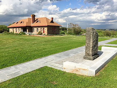
Brenton Point State Park Address: Atlantic Avenue street in Boston
Attractions near Brenton Point State Park
Budlong Station,Ocean Drive State Park,1,Budlong Stable (Restricted),Park Police Fire Tower,Mariners Memorial Foundation,Brenton's Point,1,Graves Point,Montrose Food & Wine,K67B,Smiling Sheep Needlepoint,Black Rock,Commonwealth Ave,Fire Alarm Service & Tstg LLC,Pirate's Cove,1,460 Harrison Ave,382 Ocean Ave,1How to get to popular attractions in Boston with public transit
Portsmouth, RI,The Capital Grille, Boston,Newport, RI,Bridgewater, MA, Bridgewater,Massachusetts, Medford,Hyatt Boston Harbor, Boston,Douzo, Boston,MBTA Commuter Rail South Attleboro, Attleboro,Bunker Hill Community College, Boston,Boston Medical Center, Boston,Rock Bottom Restaurant and Brewery, Boston,Hopkinton, MA, Hopkinton,Cityside Restaurant & Bar, Boston,Dillon's, Boston,Brighton Center, Boston,Picco, Boston,Five Horses Tavern, Somerville,Dave & Buster's,South Bay Mall, Boston,Inman Square, CambridgeGet around Boston by public transit!
Traveling around Boston has never been so easy. See step by step directions as you travel to any attraction, street or major public transit station. View bus and train schedules, arrival times, service alerts and detailed routes on a map, so you know exactly how to get to anywhere in Boston.
When traveling to any destination around Boston use Moovit's Live Directions with Get Off Notifications to know exactly where and how far to walk, how long to wait for your line, and how many stops are left. Moovit will alert you when it's time to get off — no need to constantly re-check whether yours is the next stop.
Wondering how to use public transit in Boston or how to pay for public transit in Boston? Moovit public transit app can help you navigate your way with public transit easily, and at minimum cost. It includes public transit fees, ticket prices, and costs. Looking for a map of Boston public transit lines? Moovit public transit app shows all public transit maps in Boston with all bus routes and stops on an interactive map.
Boston has 1 transit type(s), including: bus, operated by several transit agencies, including MBTA, MBTA, MBTA, Southeastern Regional Transit Authority, MetroWest Regional Transit Authority, Rhode Island Public Transit Authority, WRTA, Lowell Regional Transit Authority, Merrimack Valley Transit, Montachusett Regional Transit Authority, Cape Cod Regional Transit Authority, Brockton Area Transit Authority, Cape Cod Regional Transit Authority, Martha's Vineyard Transit Authority and the WAVE - Nantucket Regional Transit Authority