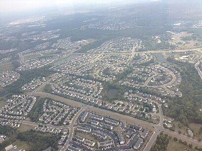
Directions to Bristow, Virginia (Prince William County) with public transportation
The following transit lines have routes that pass near Bristow, Virginia
How to get to Bristow, Virginia by train?
Click on the train route to see step by step directions with maps, line arrival times and updated time schedules.
Train stations near Bristow, Virginia in Prince William County
- Broad Run Station, 46 min walk,
What are the closest stations to Bristow, Virginia?
The closest stations to Bristow, Virginia are:
- Broad Run Station is 3913 yards away, 46 min walk.
Which train line stops near Bristow, Virginia?
MANASSAS LINE
What time is the first train to Bristow, Virginia in Prince William County?
The MANASSAS LINE is the first train that goes to Bristow, Virginia in Prince William County. It stops nearby at 5:01 AM.
What time is the last train to Bristow, Virginia in Prince William County?
The MANASSAS LINE is the last train that goes to Bristow, Virginia in Prince William County. It stops nearby at 8:19 PM.
See Bristow, Virginia, Prince William County, on the map
Public Transit to Bristow, Virginia in Prince William County
Wondering how to get to Bristow, Virginia in Prince William County, United States? Moovit helps you find the best way to get to Bristow, Virginia with step-by-step directions from the nearest public transit station.
Moovit provides free maps and live directions to help you navigate through your city. View schedules, routes, timetables, and find out how long does it take to get to Bristow, Virginia in real time.
Looking for the nearest stop or station to Bristow, Virginia? Check out this list of stops closest to your destination: Broad Run Station.
Train: MANASSAS LINE.
Want to see if there’s another route that gets you there at an earlier time? Moovit helps you find alternative routes or times. Get directions from and directions to Bristow, Virginia easily from the Moovit App or Website.
We make riding to Bristow, Virginia easy, which is why over 1.5 million users, including users in Prince William County, trust Moovit as the best app for public transit. You don’t need to download an individual bus app or train app, Moovit is your all-in-one transit app that helps you find the best bus time or train time available.
For information on prices of bus, train and metro, costs and ride fares to Bristow, Virginia, please check the Moovit app.
Use the app to navigate to popular places including to the airport, hospital, stadium, grocery store, mall, coffee shop, school, college, and university.
Bristow, Virginia Address: Prince William, VA street in Prince William County
Attractions near Bristow, Virginia
Bristow Bristow VA-619,Bristow Rd,Bristow Bristow VA-28,Bristow Station Dr,Bristow Bristow Village Bristow Station Dr,Robert E Lee Dr,Grizzlies Sport Complex (Gainsville Grizzlies Sports Complex),HMS Plumbing, LLC,Bidlion,Clarks Mountain Rd,Clara Barton Crider Ct,Village Clarks Mountain Rd,Andrea Gess Wellness,11903 Bristow Village Blvd,Hill Ct Clara Barton Dr,Barton Hill Ct,10820 Clara Barton Dr,12000 General Cooke Dr,10061 Woolen Kilt Ct,Maid To ShineHow to get to popular attractions in Prince William County with public transit
Oak Hill, VA, Fairfax County,Northwestern High School, Prince George's County,Camden Potomac Yard Apartments, Arlington County,Brent Elementary School, Washington,Argyle Middle School, Montgomery County,Logistics Management Institute (LMI), Fairfax County,Parkdale High School, Prince George's County,Hybla Valley, Fairfax County,Wyndham Old Town Alexandria, Alexandria,Liberty Crossing, Fairfax County,Tysons-Pimmit Regional Library, Fairfax County,The Brig, Washington,Northeast Regional Recreation Center (NERRC), Baltimore County,St. Andrews Episcopal School, Montgomery County,Edmondson High School, Baltimore,Francis C. Hammond Middle School, Alexandria,Residence Inn Tysons Corner, Fairfax County,La Chaumiere, Washington,Franklin High School, Baltimore County,Wilde Lake High School, Howard CountyGet around Washington, D.C. - Baltimore, MD by public transit!
Traveling around Washington, D.C. - Baltimore, MD has never been so easy. See step by step directions as you travel to any attraction, street or major public transit station. View bus and train schedules, arrival times, service alerts and detailed routes on a map, so you know exactly how to get to anywhere in Washington, D.C. - Baltimore, MD.
When traveling to any destination around Washington, D.C. - Baltimore, MD use Moovit's Live Directions with Get Off Notifications to know exactly where and how far to walk, how long to wait for your line, and how many stops are left. Moovit will alert you when it's time to get off — no need to constantly re-check whether yours is the next stop.
Wondering how to use public transit in Washington, D.C. - Baltimore, MD or how to pay for public transit in Washington, D.C. - Baltimore, MD? Moovit public transit app can help you navigate your way with public transit easily, and at minimum cost. It includes public transit fees, ticket prices, and costs. Looking for a map of Washington, D.C. - Baltimore, MD public transit lines? Moovit public transit app shows all public transit maps in Washington, D.C. - Baltimore, MD with all Bus, Train, Metro, Light Rail and Ferry routes and stops on an interactive map.
Washington, D.C. - Baltimore, MD has 5 transit type(s), including: Bus, Train, Metro, Light Rail and Ferry, operated by several transit agencies, including WMATA, Montgomery County Ride On, Fairfax Connector, TheBus, PRTC, DC Circulator, DASH - Alexandria, Arlington Transit (ART), DC Streetcar, RTA of Central Maryland, FRED, MDOT MTA, Marc, Virginia Railway Express (VRE), University of Maryland Shuttle-UM