See Broad Channel Station, Queens, on the map
Directions to Broad Channel Station (Queens) with public transportation
The following transit lines have routes that pass near Broad Channel Station
 Bus:
Bus: - Subway:
How to get to Broad Channel Station by bus?
Click on the bus route to see step by step directions with maps, line arrival times and updated time schedules.
How to get to Broad Channel Station by subway?
Click on the subway route to see step by step directions with maps, line arrival times and updated time schedules.
Bus stations near Broad Channel Station in Queens
- Cross Bay Bl/Noel Rd,5 min walk,
Bus lines to Broad Channel Station in Queens
- QM16,Neponsit - Midtown Express,
- QM17,Far Rockaway - Midtown Express,
- Q52-SBS,Elmhurst - Arverne,
- Q53-SBS,Woodside - Rockaway Park,
What are the closest stations to Broad Channel Station?
The closest stations to Broad Channel Station are:
- Cross Bay Bl/Noel Rd is 313 yards away, 5 min walk.
Which bus lines stop near Broad Channel Station?
These bus lines stop near Broad Channel Station: Q52-SBS, Q53-SBS.
Which subway line stops near Broad Channel Station?
A
What’s the nearest bus stop to Broad Channel Station in Queens?
The nearest bus stop to Broad Channel Station in Queens is Cross Bay Bl/Noel Rd. It’s a 5 min walk away.
See Broad Channel Station, Queens, on the map
Public Transit to Broad Channel Station in Queens
Wondering how to get to Broad Channel Station in Queens, United States? Moovit helps you find the best way to get to Broad Channel Station with step-by-step directions from the nearest public transit station.
Moovit provides free maps and live directions to help you navigate through your city. View schedules, routes, timetables, and find out how long does it take to get to Broad Channel Station in real time.
Looking for the nearest stop or station to Broad Channel Station? Check out this list of stops closest to your destination: Cross Bay Bl/Noel Rd.
Bus:Subway:
Want to see if there’s another route that gets you there at an earlier time? Moovit helps you find alternative routes or times. Get directions from and directions to Broad Channel Station easily from the Moovit App or Website.
We make riding to Broad Channel Station easy, which is why over 1.5 million users, including users in Queens, trust Moovit as the best app for public transit. You don’t need to download an individual bus app or train app, Moovit is your all-in-one transit app that helps you find the best bus time or train time available.
For information on prices of subway and bus, costs and ride fares to Broad Channel Station, please check the Moovit app.
Use the app to navigate to popular places including to the airport, hospital, stadium, grocery store, mall, coffee shop, school, college, and university.
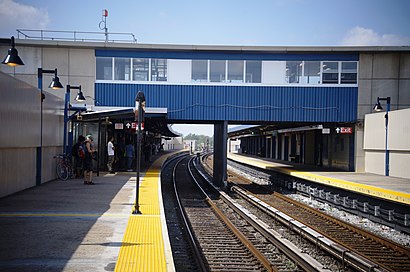
Broad Channel Station Address: West Road street in Queens
Attractions near Broad Channel Station
MTA Subway - Broad Channel (A / S),614 West Rd,Far Rockaway Beach - 91st Street,MTA Subway - S Rockaway Park Shuttle,West Rd,Noel Rd and West Rd,Broad Channel,Shinga Hot Springs,600,West Rd West Rd,West 6th Rd,MTA-Broad Channel,E 8th Rd (west 8th),West 8th,8th Rd,333 E 8th Rd ,Gene Gray Playground,155 E 6th Rd ,Walton Rd,Walton Rd (walton noel),Mark SoniccomHow to get to popular attractions in Queens with public transit
Hair of the Dog, Manhattan,Barrage, Manhattan,Gregory's Coffee, Manhattan,Beauty & Essex, Manhattan,Ace Hotel Lobby Bar, Manhattan,The Standard Grill, Manhattan,The Dutch, Manhattan,Hotel Chantelle, Manhattan,Sheep Meadow, Manhattan,MTA Subway - 42nd St / Bryant Park (B / D/F / M/7), Manhattan,Roberta's Pizza,Shake Shack, Manhattan,The Meatball Shop,Mission Dolores,Ferrara Bakery, Manhattan,The Stumble Inn, Manhattan,Freehold Raceway Mall, Freehold Township,Rattle N Hum, Manhattan,Nan Xiang Xiao Long Bao, Queens,Virgin America Ticket Counter, Elizabeth, NjGet around Queens by public transit!
Traveling around Queens has never been so easy. See step by step directions as you travel to any attraction, street or major public transit station. View bus and train schedules, arrival times, service alerts and detailed routes on a map, so you know exactly how to get to anywhere in Queens.
When traveling to any destination around Queens use Moovit's Live Directions with Get Off Notifications to know exactly where and how far to walk, how long to wait for your line, and how many stops are left. Moovit will alert you when it's time to get off — no need to constantly re-check whether yours is the next stop.
Wondering how to use public transit in Queens or how to pay for public transit in Queens? Moovit public transit app can help you navigate your way with public transit easily, and at minimum cost. It includes public transit fees, ticket prices, and costs. Looking for a map of Queens public transit lines? Moovit public transit app shows all public transit maps in Queens with all subway or bus routes and stops on an interactive map.
Queens has 2 transit type(s), including: subway or bus, operated by several transit agencies, including MTA Subway, Metro-North Railroad, LIRR, PATH, Shore Line East, MTA Bus Company, MTA New York City Transit - Express routes, MTA Bus, NJ Transit, NYC Ferry, NICE bus, Bee-Line Bus, NJ Transit Rail, NJ Transit Rail and Norwalk Transit District