See Broadway–City Hall, Vancouver, on the map
Directions to Broadway–City Hall (Vancouver) with public transportation
The following transit lines have routes that pass near Broadway–City Hall
 Bus:
Bus: - SkyTrain:
- Ferry:
How to get to Broadway–City Hall by bus?
Click on the bus route to see step by step directions with maps, line arrival times and updated time schedules.
How to get to Broadway–City Hall by SkyTrain?
Click on the SkyTrain route to see step by step directions with maps, line arrival times and updated time schedules.
Bus stations near Broadway–City Hall in Vancouver
- Eastbound W Broadway @ Cambie St,2 min walk,
- Broadway-City Hall Station @ Bay 2,4 min walk,
- Broadway-City Hall Station @ Bay 1,4 min walk,
- Olympic Village Station @ Bay 1,6 min walk,
Ferry stations near Broadway–City Hall in Vancouver
- Stamps Landing,5 min walk,
Skytrain stations near Broadway–City Hall in Vancouver
- Olympic Village Station,40 min walk,
Bus lines to Broadway–City Hall in Vancouver
- 9,Commercial-Broadway Station,
- 15,Olympic Village Station,
- 17,Oak,
- N15,Downtown Nightbus,
- 99,Commercial-Broadway Station,
- N9,Coquitlam Central Station,
- 50,Waterfront Station,
- 84,VCC-Clark Station,
What are the closest stations to Broadway–City Hall?
The closest stations to Broadway–City Hall are:
- Eastbound W Broadway @ Cambie St is 149 meters away, 2 min walk.
- Broadway-City Hall Station @ Bay 2 is 224 meters away, 4 min walk.
- Broadway-City Hall Station @ Bay 1 is 240 meters away, 4 min walk.
- Stamps Landing is 342 meters away, 5 min walk.
- Olympic Village Station @ Bay 1 is 382 meters away, 6 min walk.
- Olympic Village Station is 3107 meters away, 40 min walk.
Which bus lines stop near Broadway–City Hall?
These bus lines stop near Broadway–City Hall: 15, 19, 99.
Which SkyTrain line stops near Broadway–City Hall?
CANADA LINE
What’s the nearest bus stop to Broadway–City Hall in Vancouver?
The nearest bus stop to Broadway–City Hall in Vancouver is Eastbound W Broadway @ Cambie St. It’s a 2 min walk away.
What’s the nearest ferry station to Broadway–City Hall in Vancouver?
The nearest ferry station to Broadway–City Hall in Vancouver is Stamps Landing. It’s a 5 min walk away.
What time is the first SkyTrain to Broadway–City Hall in Vancouver?
The CANADA LINE is the first SkyTrain that goes to Broadway–City Hall in Vancouver. It stops nearby at 4:54 AM.
What time is the last SkyTrain to Broadway–City Hall in Vancouver?
The CANADA LINE is the last SkyTrain that goes to Broadway–City Hall in Vancouver. It stops nearby at 1:21 AM.
What time is the first bus to Broadway–City Hall in Vancouver?
The 99 is the first bus that goes to Broadway–City Hall in Vancouver. It stops nearby at 3:07 AM.
What time is the last bus to Broadway–City Hall in Vancouver?
The N9 is the last bus that goes to Broadway–City Hall in Vancouver. It stops nearby at 3:18 AM.
What time is the first ferry to Broadway–City Hall in Vancouver?
The AQUABUS is the first ferry that goes to Broadway–City Hall in Vancouver. It stops nearby at 6:55 AM.
What time is the last ferry to Broadway–City Hall in Vancouver?
The AQUABUS is the last ferry that goes to Broadway–City Hall in Vancouver. It stops nearby at 10:18 PM.
How much is the bus fare to Broadway–City Hall?
The bus fare to Broadway–City Hall costs about $2.60.
See Broadway–City Hall, Vancouver, on the map
Public Transit to Broadway–City Hall in Vancouver
Wondering how to get to Broadway–City Hall in Vancouver, Canada? Moovit helps you find the best way to get to Broadway–City Hall with step-by-step directions from the nearest public transit station.
Moovit provides free maps and live directions to help you navigate through your city. View schedules, routes, timetables, and find out how long does it take to get to Broadway–City Hall in real time.
Looking for the nearest stop or station to Broadway–City Hall? Check out this list of stops closest to your destination: Eastbound W Broadway @ Cambie St; Broadway-City Hall Station @ Bay 2; Broadway-City Hall Station @ Bay 1; Stamps Landing; Olympic Village Station @ Bay 1; Olympic Village Station.
Bus:SkyTrain:Ferry:
Want to see if there’s another route that gets you there at an earlier time? Moovit helps you find alternative routes or times. Get directions from and directions to Broadway–City Hall easily from the Moovit App or Website.
We make riding to Broadway–City Hall easy, which is why over 1.5 million users, including users in Vancouver, trust Moovit as the best app for public transit. You don’t need to download an individual bus app or train app, Moovit is your all-in-one transit app that helps you find the best bus time or train time available.
For information on prices of bus and SkyTrain, costs and ride fares to Broadway–City Hall, please check the Moovit app.
Use the app to navigate to popular places including to the airport, hospital, stadium, grocery store, mall, coffee shop, school, college, and university.
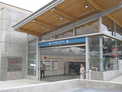
Broadway–City Hall Address: West Broadway street in Vancouver
Attractions near Broadway–City Hall
Broadway - City Hall SkyTrain Station,Broadway-City Hall,Cambie Street,Bard on the Beach Shakespeare Festival,Walking Figures – Cambie at Broadway,Free Visitor Parking compliments of City of Van,10th & Cambie,Rickshaw,Yukon St,Whole Foods Market,Winners / HOMESENSE,The Home Depot,Winners,Drake Medox College,Yolks Breakfast,abbotsford,BC Liquor Store,PNB Global Remit,Jean C Barber Lodge - Canadian Cancer Society,False Creek Surgical CenterHow to get to popular attractions in Vancouver with public transit
Robson Street, Vancouver,High Street Shopping Centre, Abbotsford,Best Buy Canada CHQ, Burnaby,Patterson SkyTrain Station, Burnaby,Fisherman's Terrace Seafood 釣魚台海鮮酒家, Richmond,Douglas College New Westminster Campus, New Westminster,English Bay Beach, Vancouver,XXI Forever 21, Richmond,Costco Wholesale, Abbotsford,Haney Place Bus Station, Maple Ridge,Oakridge Centre, Vancouver,Heritage Woods Secondary School, Port Moody,City of Abbotsford, Abbotsford,Burnaby Mountain Secondary School, Burnaby,Douglas College - Coquitlam Campus, Coquitlam,The Sandbar Seafood Restaurant, Vancouver,Glowbal, Vancouver,Bus 257 Horseshoe Bay / Vancouver Express, West Vancouver,Listel Hotel, Vancouver,Lido Restaurant 麗都餐廳, RichmondGet around Vancouver by public transit!
Traveling around Vancouver has never been so easy. See step by step directions as you travel to any attraction, street or major public transit station. View bus and train schedules, arrival times, service alerts and detailed routes on a map, so you know exactly how to get to anywhere in Vancouver.
When traveling to any destination around Vancouver use Moovit's Live Directions with Get Off Notifications to know exactly where and how far to walk, how long to wait for your line, and how many stops are left. Moovit will alert you when it's time to get off — no need to constantly re-check whether yours is the next stop.
Wondering how to use public transit in Vancouver or how to pay for public transit in Vancouver? Moovit public transit app can help you navigate your way with public transit easily, and at minimum cost. It includes public transit fees, ticket prices, and costs. Looking for a map of Vancouver public transit lines? Moovit public transit app shows all public transit maps in Vancouver with all bus or SkyTrain routes and stops on an interactive map.
Vancouver has 2 transit type(s), including: bus or SkyTrain, operated by several transit agencies, including TransLink, TransLink, TransLink, TransLink, False Creek Ferries, BC Ferries, Aquabus, BC Transit - Central Fraser Valley Transit System, BCTransit, BC Transit - Comox Valley Transit System, BC Transit - Aggasiz-Harrison and Hope Transit System, BC Transit - Chilliwack Transit System, BC Transit - Squamish, BC Transit - Whistler Transit System and BC Transit - Cowichan Valley Regional Transit System