Broadway / 7th stop - Thursday schedule
| Line | Direction | Time |
|---|---|---|
| 4 | Santa Monica | 4:34 AM |
| 4 | Santa Monica | 4:54 AM |
| 45 | Lincoln Heights | 5:06 AM |
| 4 | Santa Monica | 5:13 AM |
| 4 | Santa Monica | 5:25 AM |
| 45 | Lincoln Heights | 5:26 AM |
| 4 | Santa Monica | 5:37 AM |
| 45 | Lincoln Heights | 5:46 AM |
| 4 | Santa Monica | 5:48 AM |
| 4 | West LA - Sepulveda Blvd | 5:58 AM |
| 45 | Lincoln Heights | 6:04 AM |
| 4 | Santa Monica | 6:05 AM |
| 4 | West LA - Sepulveda Blvd | 6:12 AM |
| 4 | Santa Monica | 6:19 AM |
| 45 | Lincoln Heights | 6:22 AM |
| 4 | West LA - Sepulveda Blvd | 6:24 AM |
| 4 | Santa Monica | 6:32 AM |
| 45 | Lincoln Heights | 6:35 AM |
| 4 | West LA - Sepulveda Blvd | 6:38 AM |
| 4 | Santa Monica | 6:45 AM |
| 45 | Lincoln Heights | 6:47 AM |
| 4 | West LA - Sepulveda Blvd | 6:52 AM |
| 45 | Lincoln Heights | 6:56 AM |
| 4 | Santa Monica | 6:59 AM |
| 45 | Lincoln Heights | 7:04 AM |
Directions to Broadway / 7th stop (Downtown) with public transit
The following transit lines have routes that pass near Broadway / 7th
 Bus: 16, 20, 4, 707, 720.
- Subway: B LINE, D LINE, E LINE, A LINE.
- Funicular: ANGELS FLIGHT.
How to get to Broadway / 7th stop by bus?
Click on the bus route to see step by step directions with maps, line arrival times and updated time schedules.
How to get to Broadway / 7th stop by subway?
Click on the subway route to see step by step directions with maps, line arrival times and updated time schedules.
Bus stops near Broadway / 7th stop in Downtown
- 7th / Broadway, 1 min walk,
- Broadway / 7th, 2 min walk,
- Hill / 7th, 2 min walk,
- Hill St & 7th St (Northbound), 2 min walk,
- 6th / Broadway, 2 min walk,
- 7th / Spring, 2 min walk,
- Spring / 7th, 3 min walk,
Subway stations near Broadway / 7th station in Downtown
- Pershing Square Station, 4 min walk,
- 7th Street / Metro Center, 8 min walk,
Funicular stations near Broadway / 7th station in Downtown
- Angels Flight Top Station, 8 min walk,
Bus lines to Broadway / 7th stop in Downtown
- 799, Los Angeles,
- 30, Pico - Rimpau,
- 40, LAX / Metro Transit Center,
- 35/38, Downtown LA - Spring - 7th,
- 81, Figueroa - LA Loma,
- CE419, Southbound,
- DASH E, Westlake/Fashion District,
- 51, Cal State Dominguez Hills,
- 16, Downtown LA - West Hollywood,
- 18, Wilshire Western STA-Montebello,
- 53, Downtown LA - Csu Domiguez Hills,
- 55, Downtown LA – Willowbrook STA,
- 60, Downtown LA - Artesia Station -,
- 62, Downtown LA - Hawaiian Gardens,
- 460, Downtown LA - Disneyland,
- 66, Commerce Center,
- DASH D, Dash D / South Park,
- 20, Downtown LA - 6th - Main,
- 720, Downtown LA - 6th - Central,
- 28, Cesar Chavez - Vignes,
What are the closest stations to Broadway / 7th?
The closest stations to Broadway / 7th are:
- 7th / Broadway is 60 yards away, 1 min walk.
- Broadway / 7th is 82 yards away, 2 min walk.
- Hill / 7th is 83 yards away, 2 min walk.
- Hill St & 7th St (Northbound) is 97 yards away, 2 min walk.
- 6th / Broadway is 126 yards away, 2 min walk.
- 7th / Spring is 162 yards away, 2 min walk.
- Spring / 7th is 168 yards away, 3 min walk.
- Pershing Square Station is 248 yards away, 4 min walk.
- Angels Flight Top Station is 617 yards away, 8 min walk.
- 7th Street / Metro Center is 650 yards away, 8 min walk.
Which bus lines stop near Broadway / 7th?
These bus lines stop near Broadway / 7th: 16, 20, 4, 707, 720, 799, DASH D.
Which subway lines stop near Broadway / 7th?
These subway lines stop near Broadway / 7th: B LINE, D LINE, E LINE.
What’s the nearest subway station to Broadway / 7th in Downtown?
The nearest subway station to Broadway / 7th in Downtown is Pershing Square Station. It’s a 4 min walk away.
What’s the nearest bus station to Broadway / 7th in Downtown?
The nearest bus station to Broadway / 7th in Downtown is 7th / Broadway. It’s a 1 min walk away.
What’s the nearest funicular station to Broadway / 7th in Downtown?
The nearest funicular station to Broadway / 7th in Downtown is Angels Flight Top Station. It’s a 8 min walk away.
What time is the first subway to Broadway / 7th in Downtown?
The E LINE is the first subway that goes to Broadway / 7th in Downtown. It stops nearby at 3:54 AM.
What time is the last subway to Broadway / 7th in Downtown?
The A LINE is the last subway that goes to Broadway / 7th in Downtown. It stops nearby at 12:52 AM.
What time is the first bus to Broadway / 7th in Downtown?
The 4 is the first bus that goes to Broadway / 7th in Downtown. It stops nearby at 3:00 AM.
What time is the last bus to Broadway / 7th in Downtown?
The 4 is the last bus that goes to Broadway / 7th in Downtown. It stops nearby at 4:10 AM.
What time is the first funicular to Broadway / 7th in Downtown?
The ANGELS FLIGHT is the first funicular that goes to Broadway / 7th in Downtown. It stops nearby at 6:45 AM.
What time is the last funicular to Broadway / 7th in Downtown?
The ANGELS FLIGHT is the last funicular that goes to Broadway / 7th in Downtown. It stops nearby at 10:05 PM.
Broadway / 7th station
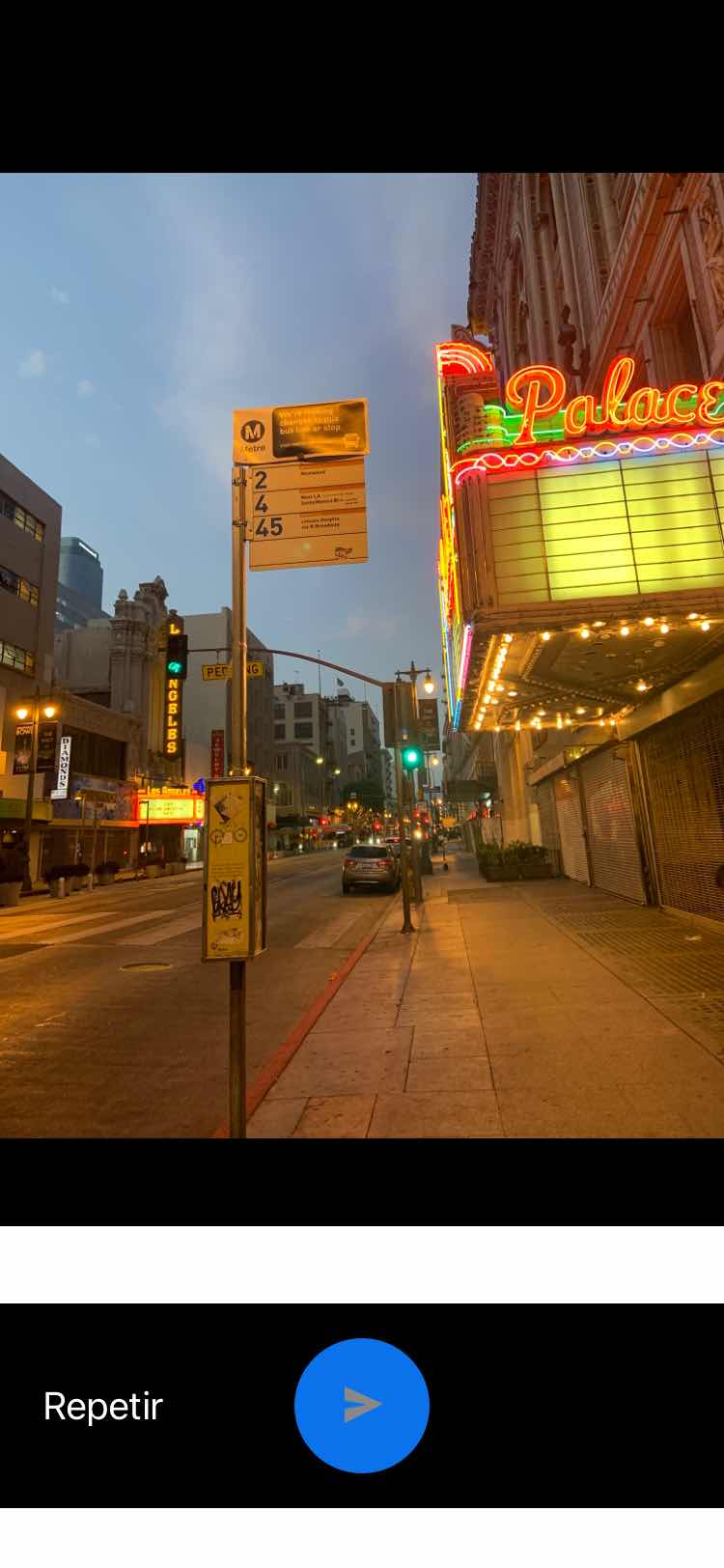 Taken by Maira P.
See Broadway / 7th stop, Downtown, on the map
Public transit to Broadway / 7th stop (ID: 16947) in Downtown
Looking for directions to Broadway / 7th in Downtown, United States?
Download the Moovit App to find the current schedule and step-by-step directions for Bus or Subway routes that pass through Broadway / 7th.
Looking for the nearest stops closest to Broadway / 7th ? Check out this list of closest stops to your destination: 7th / Broadway; Broadway / 7th; Hill / 7th; Hill St & 7th St (Northbound); 6th / Broadway; 7th / Spring; Spring / 7th; Pershing Square Station; Angels Flight Top Station; 7th Street / Metro Center.
Bus: 16, 20, 4, 707, 720, 799, DASH D, 30, 40, 35/38, 81.Subway: B LINE, D LINE, E LINE, A LINE.Funicular: ANGELS FLIGHT.
We make riding on public transit to Broadway / 7th easy, which is why over 1.5 million users, including users in Downtown trust Moovit as the best app for public transit.
Get to Broadway / 7th with public transit and pay for the ride in the Moovit app. In addition to all info you may need for your trip to Broadway / 7th, including live directions, real-time arrivals and fare prices, you can also buy public transit passes for your rides. No need for cash or paper tickets to get to Broadway / 7th - everything you need is accessible in the app with a click of the button.
Use the app to navigate to popular places including to the airport, hospital, stadium, grocery store, mall, coffee shop, school, college, and university.
Broadway / 7th stop’s code is 16947
The first line to this stop is 4, at 4:34 AM, and the last line is 4 at 4:12 AM.
646 S Broadway, Los Angeles, CA, USA
This stop serves Metro’s lines
Popular routes from Broadway / 7th stop, Downtown
- 7th / Broadway,
- Broadway / 7th,
- Hill / 7th,
- Hill St & 7th St (Northbound),
- 6th / Broadway,
- 7th / Spring,
- Spring / 7th
Bus stops near Broadway / 7th stop
- Pershing Square Station,
- 7th Street / Metro Center
Subway stations near Broadway / 7th station
- Angels Flight Top Station
Funicular station near Broadway / 7th station
- Alameda / Arcadia,
- Carson & Atlantic SE,
- Riggin / Atlantic,
- Van Ness / Gage,
- Badillo St and Citrus Ave,
- Atlantic / Carlin,
- Alondra / Trojan,
- Sherman Way / Van Nuys,
- Magnolia / Hollywood Way,
- Universal / Studio City Station,
- Compton / Wilmington,
- UCLA Gateway Plaza,
- Ramona Blvd. and Durfee Ave.,
- Wilshire / Western Station,
- Avalon / Alondra,
- Pacific Coast Highway / Topanga Canyon,
- Walnut St & Fair Oaks Ave,
- 1st Street Station,
- Aviation/Imperial
Popular public transit stations in Downtown
Get around Downtown by public transit!
Traveling around Downtown has never been so easy. See step by step directions as you travel to any attraction, street or major public transit station. View bus and train schedules, arrival times, service alerts and detailed routes on a map, so you know exactly how to get to anywhere in Downtown.
When traveling to any destination around Downtown use Moovit's Live Directions with Get Off Notifications to know exactly where and how far to walk, how long to wait for your line, and how many stops are left. Moovit will alert you when it's time to get off — no need to constantly re-check whether yours is the next stop.
Wondering how to use public transit in Downtown or how to pay for public transit in Downtown? Moovit public transit app can help you navigate your way with public transit easily, and at minimum cost. It includes public transit fees, ticket prices, and costs. Looking for a map of Downtown public transit lines? Moovit public transit app shows all public transit maps in Downtown with all Bus, Train, Subway, Ferry and Funicular routes and stops on an interactive map.
Los Angeles has 5 transit type(s), including: Bus, Train, Subway, Ferry and Funicular, operated by several transit agencies, including Metro, Alhambra Community Transit, Arcadia Transit, Artesia Transit, AVTA, Baldwin Park Transit, Beach Cities Transit, Beaumont Transit, Bell Gardens Town Trolley, Bellflower Bus, Big Blue Bus, Burbank Bus, Calabasas Trolley, Camarillo Area Transit and Carson Circuit