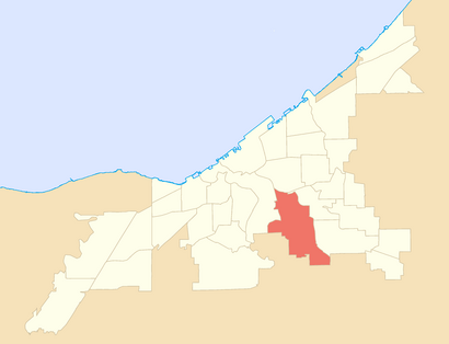
See Broadway Slavic Village, Cleveland, on the map
Directions to Broadway Slavic Village (Cleveland) with public transportation
The following transit lines have routes that pass near Broadway Slavic Village
 Bus:
Bus: - Subway:
How to get to Broadway Slavic Village by bus?
Click on the bus route to see step by step directions with maps, line arrival times and updated time schedules.
How to get to Broadway Slavic Village by subway?
Click on the subway route to see step by step directions with maps, line arrival times and updated time schedules.
Bus stations near Broadway Slavic Village in Cleveland
- Fleet Av & E 65th St,4 min walk,
- Broadway & E 65th St,7 min walk,
Subway stations near Broadway Slavic Village in Cleveland
- E.55 Station,25 min walk,
Bus lines to Broadway Slavic Village in Cleveland
- 16,16 East 55 To Steelyard,
- 18,18 W 98-Garfield To Marymount Hosp,
- 2,2 East 79 To Steelyard,
- 19-19A-19B,19b Broadway To Downtown,
What are the closest stations to Broadway Slavic Village?
The closest stations to Broadway Slavic Village are:
- Fleet Av & E 65th St is 222 yards away, 4 min walk.
- Broadway & E 65th St is 525 yards away, 7 min walk.
- E.55 Station is 2077 yards away, 25 min walk.
Which bus lines stop near Broadway Slavic Village?
These bus lines stop near Broadway Slavic Village: 15, 16, 18, 19-19A-19B, 2.
Which subway line stops near Broadway Slavic Village?
RED
What’s the nearest subway station to Broadway Slavic Village in Cleveland?
The nearest subway station to Broadway Slavic Village in Cleveland is E.55 Station. It’s a 25 min walk away.
What’s the nearest bus stop to Broadway Slavic Village in Cleveland?
The nearest bus stop to Broadway Slavic Village in Cleveland is Fleet Av & E 65th St. It’s a 4 min walk away.
What time is the first subway to Broadway Slavic Village in Cleveland?
The RED is the first subway that goes to Broadway Slavic Village in Cleveland. It stops nearby at 3:14 AM.
What time is the last subway to Broadway Slavic Village in Cleveland?
The RED is the last subway that goes to Broadway Slavic Village in Cleveland. It stops nearby at 1:01 AM.
What time is the first bus to Broadway Slavic Village in Cleveland?
The 19-19A-19B is the first bus that goes to Broadway Slavic Village in Cleveland. It stops nearby at 3:31 AM.
What time is the last bus to Broadway Slavic Village in Cleveland?
The 19-19A-19B is the last bus that goes to Broadway Slavic Village in Cleveland. It stops nearby at 2:42 AM.
How much is the subway fare to Broadway Slavic Village?
The subway fare to Broadway Slavic Village costs about $2.50.
How much is the bus fare to Broadway Slavic Village?
The bus fare to Broadway Slavic Village costs about $2.50.
See Broadway Slavic Village, Cleveland, on the map
Public Transit to Broadway Slavic Village in Cleveland
Wondering how to get to Broadway Slavic Village in Cleveland, United States? Moovit helps you find the best way to get to Broadway Slavic Village with step-by-step directions from the nearest public transit station.
Moovit provides free maps and live directions to help you navigate through your city. View schedules, routes, timetables, and find out how long does it take to get to Broadway Slavic Village in real time.
Looking for the nearest stop or station to Broadway Slavic Village? Check out this list of stops closest to your destination: Fleet Av & E 65th St; Broadway & E 65th St; E.55 Station.
Bus:Subway:
Want to see if there’s another route that gets you there at an earlier time? Moovit helps you find alternative routes or times. Get directions from and directions to Broadway Slavic Village easily from the Moovit App or Website.
We make riding to Broadway Slavic Village easy, which is why over 1.5 million users, including users in Cleveland, trust Moovit as the best app for public transit. You don’t need to download an individual bus app or train app, Moovit is your all-in-one transit app that helps you find the best bus time or train time available.
For information on prices of bus and subway, costs and ride fares to Broadway Slavic Village, please check the Moovit app.
Use the app to navigate to popular places including to the airport, hospital, stadium, grocery store, mall, coffee shop, school, college, and university.
Location: Cleveland
Popular routes to Broadway Slavic Village, Cleveland
Popular routes from Broadway Slavic Village, Cleveland
Attractions near Broadway Slavic Village
Slavic Village Bi-Rite,Fleet Avenue Super Wash,Chiropractic Auto Accident Services,Polish Legion of American Veterans, Lincoln Post 13,Ben S Stefanski II Stadium at Morgana Park,Matthew Kirlough, DDS,By the Grace of God Barbershop LLC.,Rudowsky Automotive & Tow,MetroHealth Broadway Health Care Center Dental Clinic,O'Reilly Auto Parts,Hosmer Ave Building 6603,Steven Mastroianni Photography,Kingsbury run,ATM,Famous Fries,Sunny & Fine's Breakfast Burritos,Fried or die Chicken,Domestic Travel Auto Sales (Travels Domestic),Fleet Ave / Broadway Ave,Hosmer Ave Building 5815How to get to popular attractions in Cleveland with public transit
I-271 Exit 26A / B - I-480W Rockside Rd Cleveland, Bedford Heights,Ian N. Friedman, Cleveland,Cleveland State University Wolstein Center, Cleveland,CM Massotherapy, Shaker Heights,Hyatt Regency Cleveland at the Arcade, Cleveland,CWRU, Cleveland,Louis Stokes Cleveland Va Medical Center, Cleveland,Granada Gardens Apartments, Warrensville Heights,Metroparks South Mastick Picnic Area, Fairview Park,Hero Park, Euclid,Snider-Blake | Independence, Independence,Solon, Solon,FLEX Cleveland, Cleveland,Superior Spine Care, North Olmsted,MetroHealth Medical Center Cleveland Heights, Cleveland Heights,RTA Central Rail Facility, Cleveland,I-90 Exit 162 - Hilliard Blvd, Rocky River,Archwood Street Sale, Cleveland,Algart Health Care, Cleveland,Cleveland RTA - Woodhill Facility, ClevelandGet around Cleveland by public transit!
Traveling around Cleveland has never been so easy. See step by step directions as you travel to any attraction, street or major public transit station. View bus and train schedules, arrival times, service alerts and detailed routes on a map, so you know exactly how to get to anywhere in Cleveland.
When traveling to any destination around Cleveland use Moovit's Live Directions with Get Off Notifications to know exactly where and how far to walk, how long to wait for your line, and how many stops are left. Moovit will alert you when it's time to get off — no need to constantly re-check whether yours is the next stop.
Wondering how to use public transit in Cleveland or how to pay for public transit in Cleveland? Moovit public transit app can help you navigate your way with public transit easily, and at minimum cost. It includes public transit fees, ticket prices, and costs. Looking for a map of Cleveland public transit lines? Moovit public transit app shows all public transit maps in Cleveland with all bus or subway routes and stops on an interactive map.
Cleveland has 2 transit type(s), including: bus or subway, operated by several transit agencies, including RTA, RTA, RTA, METRO, Laketran, Stark Area Regional Transit Authority (SARTA), Portage Area Regional Transit Authority (PARTA), Amtrak, Medina County Public Transit, Cuyahoga Valley Scenic Railroad, FlixBus-us and Greyhound-us