See Brockton Point Lighthouse, Vancouver, on the map
Directions to Brockton Point Lighthouse (Vancouver) with public transportation
The following transit lines have routes that pass near Brockton Point Lighthouse
 Bus:
Bus: - SkyTrain:
How to get to Brockton Point Lighthouse by bus?
Click on the bus route to see step by step directions with maps, line arrival times and updated time schedules.
How to get to Brockton Point Lighthouse by SkyTrain?
Click on the SkyTrain route to see step by step directions with maps, line arrival times and updated time schedules.
Skytrain stations near Brockton Point Lighthouse in Vancouver
- Burrard Station,44 min walk,
- Vancouver City Centre Station,49 min walk,
- Waterfront Station,50 min walk,
What are the closest stations to Brockton Point Lighthouse?
The closest stations to Brockton Point Lighthouse are:
- Burrard Station is 3395 meters away, 44 min walk.
- Vancouver City Centre Station is 3766 meters away, 49 min walk.
- Waterfront Station is 3897 meters away, 50 min walk.
Which bus lines stop near Brockton Point Lighthouse?
These bus lines stop near Brockton Point Lighthouse: 19, 246.
Which SkyTrain lines stop near Brockton Point Lighthouse?
These SkyTrain lines stop near Brockton Point Lighthouse: CANADA LINE, EXPO LINE.
What time is the first SkyTrain to Brockton Point Lighthouse in Vancouver?
The CANADA LINE is the first SkyTrain that goes to Brockton Point Lighthouse in Vancouver. It stops nearby at 4:48 AM.
What time is the last SkyTrain to Brockton Point Lighthouse in Vancouver?
The CANADA LINE is the last SkyTrain that goes to Brockton Point Lighthouse in Vancouver. It stops nearby at 1:22 AM.
What time is the first train to Brockton Point Lighthouse in Vancouver?
The WEST COAST EXPRESS is the first train that goes to Brockton Point Lighthouse in Vancouver. It stops nearby at 6:39 AM.
What time is the last train to Brockton Point Lighthouse in Vancouver?
The WEST COAST EXPRESS is the last train that goes to Brockton Point Lighthouse in Vancouver. It stops nearby at 6:20 PM.
What time is the first ferry to Brockton Point Lighthouse in Vancouver?
The SEABUS is the first ferry that goes to Brockton Point Lighthouse in Vancouver. It stops nearby at 5:59 AM.
What time is the last ferry to Brockton Point Lighthouse in Vancouver?
The SEABUS is the last ferry that goes to Brockton Point Lighthouse in Vancouver. It stops nearby at 1:22 AM.
How much is the bus fare to Brockton Point Lighthouse?
The bus fare to Brockton Point Lighthouse costs about $2.60.
See Brockton Point Lighthouse, Vancouver, on the map
Public Transit to Brockton Point Lighthouse in Vancouver
Wondering how to get to Brockton Point Lighthouse in Vancouver, Canada? Moovit helps you find the best way to get to Brockton Point Lighthouse with step-by-step directions from the nearest public transit station.
Moovit provides free maps and live directions to help you navigate through your city. View schedules, routes, timetables, and find out how long does it take to get to Brockton Point Lighthouse in real time.
Looking for the nearest stop or station to Brockton Point Lighthouse? Check out this list of stops closest to your destination: Burrard Station; Vancouver City Centre Station; Waterfront Station.
Bus:SkyTrain:
Want to see if there’s another route that gets you there at an earlier time? Moovit helps you find alternative routes or times. Get directions from and directions to Brockton Point Lighthouse easily from the Moovit App or Website.
We make riding to Brockton Point Lighthouse easy, which is why over 1.5 million users, including users in Vancouver, trust Moovit as the best app for public transit. You don’t need to download an individual bus app or train app, Moovit is your all-in-one transit app that helps you find the best bus time or train time available.
For information on prices of bus and SkyTrain, costs and ride fares to Brockton Point Lighthouse, please check the Moovit app.
Use the app to navigate to popular places including to the airport, hospital, stadium, grocery store, mall, coffee shop, school, college, and university.
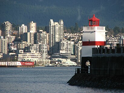
Brockton Point Lighthouse Address: Stanley Park Drive street in Vancouver
Attractions near Brockton Point Lighthouse
Totem Poles in Stanley Park,Totem Poles,Stanley Park - Totem Poles,Deadman's Island,Brockton Oval,Royal Vancouver Yacht Club (Coal Harbour),Stanley Park - Vancouver Aquarium,Polar Bear Compound,Vancouver Aquarium Gift Shop,Vancouver Aquarium,Vancouver Aquarium,845 Avison Way,amazon rainforest,Gumboot Bank,Vancouver Harbour,Bus 246 Lonsdale Quay / Highland / Vancouver,Stanley Park Information Booth,Stanley Park Information,Vancouver Harbour Flight Centre (CXH),Harbour Air Seaplanes / Westcoast AirHow to get to popular attractions in Vancouver with public transit
Oak Street Bridge, Vancouver,Gotham Steakhouse & Cocktail Bar, Vancouver,English Bay Beach, Vancouver,Steamworks Brewing Company, Vancouver,Columbia College, Vancouver,Tap & Barrel, Vancouver,Huntingdon / Sumas Border Crossing, Abbotsford,Salt Tasting Room, Vancouver,Purolator head office, Richmond,Bus 257 Horseshoe Bay / Vancouver Express, West Vancouver,Aphrodite's Organic Café & Pie Shop, Vancouver,Stepho's Souvlaki Greek Taverna, Vancouver,Douglas College - Coquitlam Campus, Coquitlam,168 Chadwick, North Vancouver City,Downtown, Vancouver,Park Royal Shopping Centre, Capilano 5,Scotiabank Theatre Vancouver, Vancouver,Summer Night Market, Richmond,Starbucks, Burnaby,Best Buy Canada CHQ, BurnabyGet around Vancouver by public transit!
Traveling around Vancouver has never been so easy. See step by step directions as you travel to any attraction, street or major public transit station. View bus and train schedules, arrival times, service alerts and detailed routes on a map, so you know exactly how to get to anywhere in Vancouver.
When traveling to any destination around Vancouver use Moovit's Live Directions with Get Off Notifications to know exactly where and how far to walk, how long to wait for your line, and how many stops are left. Moovit will alert you when it's time to get off — no need to constantly re-check whether yours is the next stop.
Wondering how to use public transit in Vancouver or how to pay for public transit in Vancouver? Moovit public transit app can help you navigate your way with public transit easily, and at minimum cost. It includes public transit fees, ticket prices, and costs. Looking for a map of Vancouver public transit lines? Moovit public transit app shows all public transit maps in Vancouver with all bus or SkyTrain routes and stops on an interactive map.
Vancouver has 2 transit type(s), including: bus or SkyTrain, operated by several transit agencies, including TransLink, TransLink, TransLink, TransLink, False Creek Ferries, BC Ferries, Aquabus, BC Transit - Central Fraser Valley Transit System, BCTransit, BC Transit - Comox Valley Transit System, BC Transit - Aggasiz-Harrison and Hope Transit System, BC Transit - Chilliwack Transit System, BC Transit - Squamish, BC Transit - Whistler Transit System and BC Transit - Cowichan Valley Regional Transit System