Directions to Brooklyn Amity School with public transportation
The following transit lines have routes that pass near Brooklyn Amity School
How to get to Brooklyn Amity School by bus?
Click on the bus route to see step by step directions with maps, line arrival times and updated time schedules.
How to get to Brooklyn Amity School by subway?
Click on the subway route to see step by step directions with maps, line arrival times and updated time schedules.
Bus stations near Brooklyn Amity School
- Shore Pky/Bragg St,3 min walk,
- Shore Pkwy/Knapp St,3 min walk,
- Knapp St/Shore Pky,3 min walk,
Subway stations near Brooklyn Amity School
- Neck Rd [Q],38 min walk,
- Brighton Beach [B,Q],39 min walk,
Bus lines to Brooklyn Amity School
- BM3,Midtown 57 St Via Church St Via Madison Av,
- B4,Sheepshead Bay Knapp St,
- B44-SBS,Sbs Sheepshead Bay Knapp St Via Nostrand,
- B44,Emmons Av,
What are the closest stations to Brooklyn Amity School?
The closest stations to Brooklyn Amity School are:
- Shore Pky/Bragg St is 133 yards away, 3 min walk.
- Shore Pkwy/Knapp St is 152 yards away, 3 min walk.
- Knapp St/Shore Pky is 200 yards away, 3 min walk.
- Neck Rd [Q] is 3124 yards away, 38 min walk.
- Brighton Beach [B,Q] is 3313 yards away, 39 min walk.
Which bus lines stop near Brooklyn Amity School?
These bus lines stop near Brooklyn Amity School: B4, B44-SBS.
Which subway lines stop near Brooklyn Amity School?
These subway lines stop near Brooklyn Amity School: B, Q.
What’s the nearest bus stop to Brooklyn Amity School?
The nearest bus stops to Brooklyn Amity School are Shore Pky/Bragg St, Shore Pkwy/Knapp St and Knapp St/Shore Pky. The closest one is a 3 min walk away.
See Brooklyn Amity School on the map
Public Transportation to Brooklyn Amity School
Wondering how to get to Brooklyn Amity School, United States? Moovit helps you find the best way to get to Brooklyn Amity School with step-by-step directions from the nearest public transit station.
Moovit provides free maps and live directions to help you navigate through your city. View schedules, routes, timetables, and find out how long does it take to get to Brooklyn Amity School in real time.
Looking for the nearest stop or station to Brooklyn Amity School? Check out this list of stops closest to your destination: Shore Pky/Bragg St; Shore Pkwy/Knapp St; Knapp St/Shore Pky; Neck Rd [Q]; Brighton Beach [B,Q].
Bus:B4B44-SBSBM3B44Subway:BQ
Want to see if there’s another route that gets you there at an earlier time? Moovit helps you find alternative routes or times. Get directions from and directions to Brooklyn Amity School easily from the Moovit App or Website.
We make riding to Brooklyn Amity School easy, which is why over 1.5 million users, including users in Brooklyn, trust Moovit as the best app for public transit. You don’t need to download an individual bus app or train app, Moovit is your all-in-one transit app that helps you find the best bus time or train time available.
For information on prices of bus and subway, costs and ride fares to Brooklyn Amity School, please check the Moovit app.
Use the app to navigate to popular places including to the airport, hospital, stadium, grocery store, mall, coffee shop, school, college, and university.
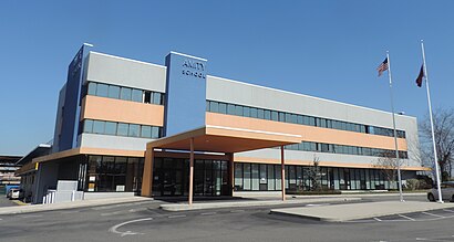
Brooklyn Amity School Address: 3867 Shore Pkwy (Knapp Street) street in Brooklyn
Brooklyn Amity School (also known as Amity) is a UPK-12 private school that was founded in 1999. As of 2016, 256 students were enrolled.Wiki
Attractions near Brooklyn Amity School
Boston,karenin dolabi,knapp st,Knapp St / Harkness,Knapp St Harkne,Exit 9 - Belt Parkway,Dunkin',Shore Bri St,Ua Sheepshead Bay 14,Shore Pky/Brigham St,Voorhies Av & Shore Parkway (Voorhies Avenue and Shore Parkway Owners),Knapp St and Voorhies Ave,Shore Pkwy (knapp st / Shore Pkwy),Knapp St Shore,2840 Knapp St,Sheepshead Bay Nursing Home,Sheepshead Nursing & Rehabilitation Center,Kingsborough,7 Sense Psychic,2790 Bragg StHow to get to popular attractions in Brooklyn with public transit
The Biergarten at The Standard, Manhattan,The Dead Rabbit, Manhattan,Café Habana, Manhattan,Woorijip, Manhattan,I-80 (Interstate 80), Paterson, Nj,Tacombi at Fonda Nolita, Manhattan,Long Island, NY, Huntington Station, Ny,MTA Subway - Broadway (N/W), Queens,5 Napkin Burger, Manhattan,The Dutch, Manhattan,Rubirosa Ristorante, Manhattan,New Jersey Turnpike - Newark, Newark, Nj,The Tippler, Manhattan,Gyu-Kaku Japanese BBQ, Manhattan,Gregory's Coffee, Manhattan,J.G. Melon, Manhattan,Tom & Jerry's, Manhattan,Red Rooster, Manhattan,Stamford Transportation Center : Bus / Train (STM) Metro North & Amtrak, Stamford, Ct,LIRR - Babylon Station, Babylon, NyGet around Brooklyn by public transit!
Traveling around Brooklyn has never been so easy. See step by step directions as you travel to any attraction, street or major public transit station. View bus and train schedules, arrival times, service alerts and detailed routes on a map, so you know exactly how to get to anywhere in Brooklyn.
When traveling to any destination around Brooklyn use Moovit's Live Directions with Get Off Notifications to know exactly where and how far to walk, how long to wait for your line, and how many stops are left. Moovit will alert you when it's time to get off — no need to constantly re-check whether yours is the next stop.
Wondering how to use public transit in Brooklyn or how to pay for public transit in Brooklyn? Moovit public transit app can help you navigate your way with public transit easily, and at minimum cost. It includes public transit fees, ticket prices, and costs. Looking for a map of Brooklyn public transit lines? Moovit public transit app shows all public transit maps in Brooklyn with all bus or subway routes and stops on an interactive map.
Brooklyn has 2 transit type(s), including: bus or subway, operated by several transit agencies, including MTA Subway, Metro-North Railroad, LIRR, PATH, Shore Line East, MTA Bus Company, MTA New York City Transit - Express routes, MTA Bus, NJ Transit, NYC Ferry, NICE bus, Bee-Line Bus, NJ Transit Rail, NJ Transit Rail and Norwalk Transit District