Directions to Broomall, PA (Marple) with public transportation
The following transit lines have routes that pass near Broomall, PA
How to get to Broomall, PA by bus?
Click on the bus route to see step by step directions with maps, line arrival times and updated time schedules.
Bus stops near Broomall, PA in Marple
- West Chester Pk & Berkley Rd, 1 min walk,
Bus lines to Broomall, PA in Marple
- 104, Newtown Square,
- 112, Delaware County Community College,
- 115, Airport,
- 120, Cheyney University,
What are the closest stations to Broomall, PA?
The closest stations to Broomall, PA are:
- West Chester Pk & Berkley Rd is 19 yards away, 1 min walk.
Which bus lines stop near Broomall, PA?
These bus lines stop near Broomall, PA: 104, 112, 115, 123.
What’s the nearest bus stop to Broomall, PA in Marple?
The nearest bus stop to Broomall, PA in Marple is West Chester Pk & Berkley Rd. It’s a 1 min walk away.
What time is the first bus to Broomall, PA in Marple?
The 104 is the first bus that goes to Broomall, PA in Marple. It stops nearby at 4:20 AM.
What time is the last bus to Broomall, PA in Marple?
The 104 is the last bus that goes to Broomall, PA in Marple. It stops nearby at 2:14 AM.
See Broomall, PA, Marple, on the map
Public Transit to Broomall, PA in Marple
Wondering how to get to Broomall, PA in Marple, United States? Moovit helps you find the best way to get to Broomall, PA with step-by-step directions from the nearest public transit station.
Moovit provides free maps and live directions to help you navigate through your city. View schedules, routes, timetables, and find out how long does it take to get to Broomall, PA in real time.
Looking for the nearest stop or station to Broomall, PA? Check out this list of stops closest to your destination: West Chester Pk & Berkley Rd.
Bus: 104, 112, 115, 123, 120.
Want to see if there’s another route that gets you there at an earlier time? Moovit helps you find alternative routes or times. Get directions from and directions to Broomall, PA easily from the Moovit App or Website.
We make riding to Broomall, PA easy, which is why over 1.5 million users, including users in Marple, trust Moovit as the best app for public transit. You don’t need to download an individual bus app or train app, Moovit is your all-in-one transit app that helps you find the best bus time or train time available.
For information on prices of bus, light rail, subway and train, costs and ride fares to Broomall, PA, please check the Moovit app.
Use the app to navigate to popular places including to the airport, hospital, stadium, grocery store, mall, coffee shop, school, college, and university.
Location: Marple, Philadelphia
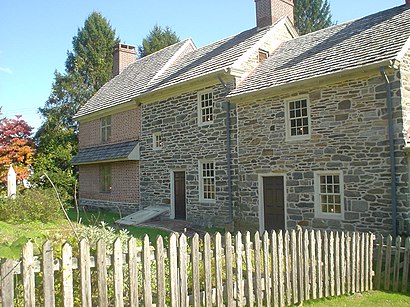
Broomall is a census-designated place (CDP) in Marple Township, Delaware County, Pennsylvania, United States. The population was 10,789 at the 2010 census.Wiki
Popular routes to Broomall, PA, Marple
- From Kensington Av & Allegheny AvFrom Roosevelt Blvd & Cottman Av - FSFrom Roosevelt Blvd & 5th StFrom 11th St & Market StFrom Camden Walter Rand Trans CenterFrom Cheltenham Av & Ogontz Av - FsFrom Oregon Av & Broad St - FsFrom 17th St & Market StFrom Wynnefield AvenueFrom Pier 70 Walmart & Home Depot
Popular routes from Broomall, PA, Marple
Attractions near Broomall, PA
West Chester Pike,My Mobility Pros,Broomall, Pennsylvania,Palotv Country Squire,H&K Business Assoc,Shopperschoice2581,Ranieri & Kerns Associates,Hair West,Melanie Williams - Intuit Turbotax Verified Pro,K&G Speed Shop,Flower Delivery by Leary's Florist,Prestige Nursing Administrative Services,Optometric Extension Program Foundation,LPL Financial,West Chester Pike,Splash LLC,Mischo Electric,A Broomall Garage Door Repair,Coinstar,Bill Doyle LawHow to get to popular attractions in Marple with public transit
PA Turnpike Route 1 Exit, Bensalem,Trenton, NJ, Trenton,Snyder Avenue & South 20th Street, Philadelphia,SEPTA: Yeadon Loop, Yeadon,The Restaurant School At Walnut Hill College, Philadelphia,SEPTA Bus Route 4, Philadelphia,CMI Media, Philadelphia,Philadelphia Police Department: Special Victims Unit, Philadelphia,River Line Camden To Trenton, Bordentown,The Bellevue, Philadelphia,3700 Market Street Science Center, Philadelphia,Robbinsville,Merck B53 Health Services, Upper Gwynedd,39th & Powelton, Philadelphia,Septa Chestnut Hill Loop, Philadelphia,Fox Chase Cancer Center, Philadelphia,National Wholesale Liquidators, Philadelphia,Cassie's Brothel, Philadelphia,Bccc, Lower Makefield,Einstein Gratz Building, PhiladelphiaGet around Philadelphia by public transit!
Traveling around Philadelphia has never been so easy. See step by step directions as you travel to any attraction, street or major public transit station. View bus and train schedules, arrival times, service alerts and detailed routes on a map, so you know exactly how to get to anywhere in Philadelphia.
When traveling to any destination around Philadelphia use Moovit's Live Directions with Get Off Notifications to know exactly where and how far to walk, how long to wait for your line, and how many stops are left. Moovit will alert you when it's time to get off — no need to constantly re-check whether yours is the next stop.
Wondering how to use public transit in Philadelphia or how to pay for public transit in Philadelphia? Moovit public transit app can help you navigate your way with public transit easily, and at minimum cost. It includes public transit fees, ticket prices, and costs. Looking for a map of Philadelphia public transit lines? Moovit public transit app shows all public transit maps in Philadelphia with all Bus, Train, Subway, Light Rail and Cable Car routes and stops on an interactive map.
Philadelphia has 5 transit type(s), including: Bus, Train, Subway, Light Rail and Cable Car, operated by several transit agencies, including SEPTA Subway, SEPTA Trolley, SEPTA Rail, SEPTA, NJ TRANSIT RAIL-Rail, NJ TRANSIT RAIL-Tram, NJ TRANSIT BUS, Port Authority Transit Corporation, Navy Yard, Penn Transit, Drexel University, Pottstown Area Rapid Transit (PART), Fullington Tours, Chescobus, Amtrak