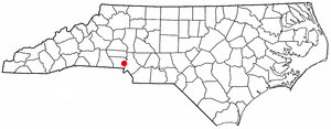
See Brown Town, North Carolina, Charlotte, on the map
Directions to Brown Town, North Carolina (Charlotte) with public transportation
The following transit lines have routes that pass near Brown Town, North Carolina
 Bus:
Bus:
How to get to Brown Town, North Carolina by bus?
Click on the bus route to see step by step directions with maps, line arrival times and updated time schedules.
Bus stations near Brown Town, North Carolina in Charlotte
- Abbey Plaza,13 min walk,
Bus lines to Brown Town, North Carolina in Charlotte
- 85X,Inbound,
What are the closest stations to Brown Town, North Carolina?
The closest stations to Brown Town, North Carolina are:
- Abbey Plaza is 1025 yards away, 13 min walk.
Which bus line stops near Brown Town, North Carolina?
85X
What’s the nearest bus stop to Brown Town, North Carolina in Charlotte?
The nearest bus stop to Brown Town, North Carolina in Charlotte is Abbey Plaza. It’s a 13 min walk away.
What time is the first bus to Brown Town, North Carolina in Charlotte?
The 85X is the first bus that goes to Brown Town, North Carolina in Charlotte. It stops nearby at 6:57 AM.
What time is the last bus to Brown Town, North Carolina in Charlotte?
The 85X is the last bus that goes to Brown Town, North Carolina in Charlotte. It stops nearby at 5:55 PM.
See Brown Town, North Carolina, Charlotte, on the map
Public Transit to Brown Town, North Carolina in Charlotte
Wondering how to get to Brown Town, North Carolina in Charlotte, United States? Moovit helps you find the best way to get to Brown Town, North Carolina with step-by-step directions from the nearest public transit station.
Moovit provides free maps and live directions to help you navigate through your city. View schedules, routes, timetables, and find out how long does it take to get to Brown Town, North Carolina in real time.
Looking for the nearest stop or station to Brown Town, North Carolina? Check out this list of stops closest to your destination: Abbey Plaza.
Bus:
Want to see if there’s another route that gets you there at an earlier time? Moovit helps you find alternative routes or times. Get directions from and directions to Brown Town, North Carolina easily from the Moovit App or Website.
We make riding to Brown Town, North Carolina easy, which is why over 1.5 million users, including users in Charlotte, trust Moovit as the best app for public transit. You don’t need to download an individual bus app or train app, Moovit is your all-in-one transit app that helps you find the best bus time or train time available.
For information on prices of bus and light rail, costs and ride fares to Brown Town, North Carolina, please check the Moovit app.
Use the app to navigate to popular places including to the airport, hospital, stadium, grocery store, mall, coffee shop, school, college, and university.
Brown Town, North Carolina Address: Belmont, NC 28012 street in Charlotte
Attractions near Brown Town, North Carolina
39 Dunn St,Faith Freewill Baptist,Textile Lanes,Roses (Rose's),Legends Sports Academy,Abbey Plaza Shopping Center,Shooters Express,Banks Apartments,Walmart Supercenter,I-85,10240 Old Dowd Road,Oakley,Dmsi,Amazon CLT2,Amazon Fulfillment Center - CLT2,Tony's,U-Haul Moving & Storage of Wilkinson Blvd,Greenline Turf Management,Memo's Waterproofing,3830 Parrott DriveHow to get to popular attractions in Charlotte with public transit
Ruth's Chris Steak House, Charlotte,Courtyard Hooligans, Charlotte,Boy Scouts of America Supply Group (National Distribution Center), Charlotte,485 Exit 57, Charlotte,University Terrace North Apartments, Charlotte,Hair Klaudt, Charlotte,Eastway & Shamrock, Charlotte,Dragon Court Chinese Restaurant, Charlotte,Montford Mile, Charlotte,Denny Building - UNC Charlotte, Charlotte,Mallard Creek Church Rd & Mallard Creek Rd, Charlotte,Charlotte Transportation Center, Charlotte,AEBN, Charlotte,Eastland Community Transit Center, Charlotte,CPCC STUDENT PARKING DECK 3, Charlotte,Mac's Speed Shop, Charlotte,South Tryon, Charlotte,Food Lion Grocery Store, Charlotte,Lash Group CC3, Charlotte,Bank of America (SOACC), CharlotteGet around Charlotte by public transit!
Traveling around Charlotte has never been so easy. See step by step directions as you travel to any attraction, street or major public transit station. View bus and train schedules, arrival times, service alerts and detailed routes on a map, so you know exactly how to get to anywhere in Charlotte.
When traveling to any destination around Charlotte use Moovit's Live Directions with Get Off Notifications to know exactly where and how far to walk, how long to wait for your line, and how many stops are left. Moovit will alert you when it's time to get off — no need to constantly re-check whether yours is the next stop.
Wondering how to use public transit in Charlotte or how to pay for public transit in Charlotte? Moovit public transit app can help you navigate your way with public transit easily, and at minimum cost. It includes public transit fees, ticket prices, and costs. Looking for a map of Charlotte public transit lines? Moovit public transit app shows all public transit maps in Charlotte with all bus or light rail routes and stops on an interactive map.
Charlotte has 2 transit type(s), including: bus or light rail, operated by several transit agencies, including CATS, CATS, Rider Transit, Amtrak, Megabus, FlixBus-us and Greyhound-us