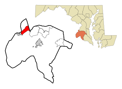
See Bryans Road, Charles County, on the map
Directions to Bryans Road (Charles County) with public transportation
The following transit lines have routes that pass near Bryans Road
Bus:
How to get to Bryans Road by Bus?
Click on the Bus route to see step by step directions with maps, line arrival times and updated time schedules.
Which Bus lines stop near Bryans Road?
These Bus lines stop near Bryans Road: 301 PARK & RIDE TRANSFER POINT - WALDORF TRANSFER POINT
How much is the Train fare to Bryans Road?
The Train fare to Bryans Road costs about $3.50 - $10.00.
How much is the Bus fare to Bryans Road?
The Bus fare to Bryans Road costs about $2.00 - $4.25.
See Bryans Road, Charles County, on the map

Public Transit to Bryans Road in Charles County
Wondering how to get to Bryans Road in Charles County, United States? Moovit helps you find the best way to get to Bryans Road with step-by-step directions from the nearest public transit station.
Moovit provides free maps and live directions to help you navigate through your city. View schedules, routes, timetables, and find out how long does it take to get to Bryans Road in real time.
Bus:
Want to see if there’s another route that gets you there at an earlier time? Moovit helps you find alternative routes or times. Get directions from and directions to Bryans Road easily from the Moovit App or Website.
We make riding to Bryans Road easy, which is why over 1.5 million users, including users in Charles County, trust Moovit as the best app for public transit. You don’t need to download an individual bus app or train app, Moovit is your all-in-one transit app that helps you find the best bus time or train time available.
For information on prices of Bus and Train, costs and ride fares to Bryans Road, please check the Moovit app.
Use the app to navigate to popular places including to the airport, hospital, stadium, grocery store, mall, coffee shop, school, college, and university.
Bryans Road Address: MD 20616 street in Charles County

Attractions near Bryans Road
- Cristian Painting
- Midnight Craft
- Events by Mi D'g'E
- Too Much Life
- SUBWAY
- Business
- BRSC Community Outreach Center
- Western Union
- Commercial Hvac
- Lands End Ct & Waters Edge Ct
- Circuit & District Court
- Lunch Box
- Bryans Road
- 20616
- Bar 210
- Credit Union 1
- Livingston Rd (Shell Gas Station)
- Atm Dash in #1522 - Bryans Road
- ATM CVS
- ATM 034 Inc
How to get to popular attractions in Charles County with public transit
- Looney's Pub, Baltimore
- Ebenezers Coffeehouse, Washington
- Owings Mills, Maryland, Baltimore County
- Bar Louie, Washington
- P.J. Clarke's, Washington
- Union Pub, Washington
- Fogo de Chao, Washington
- Intercounty Connector (ICC) / MD 200, Montgomery County
- Toki Underground, Washington
- Dave & Buster's, Anne Arundel County
- Herndon, Virginia, Fairfax County
- Smith Commons, Washington
- Maryland State Fairgrounds, Baltimore County
- Mt. Pleasant, Washington
- Dundalk, Maryland, Baltimore County
- Walmart Supercenter, Baltimore County
- Agora, Washington
- The Hippodrome Theatre at the France-Merrick Performing Arts Center, Baltimore
- Bureau of Engraving and Printing, Washington
- Crystal City Sports Pub, Arlington County