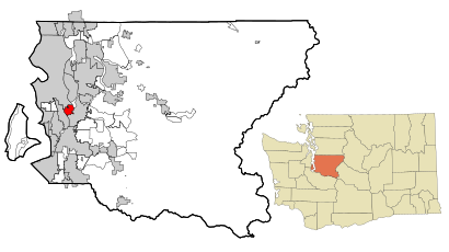
See Bryn Mawr-Skyway on the map
Directions to Bryn Mawr-Skyway with public transportation
The following transit lines have routes that pass near Bryn Mawr-Skyway
 Bus:
Bus:
How to get to Bryn Mawr-Skyway by bus?
Click on the bus route to see step by step directions with maps, line arrival times and updated time schedules.
Bus stations near Bryn Mawr-Skyway
- Renton Ave S & 75th Ave S,5 min walk,
Bus lines to Bryn Mawr-Skyway
- 106,International District Chinatown Station Rainier Beach Station,
What are the closest stations to Bryn Mawr-Skyway?
The closest stations to Bryn Mawr-Skyway are:
- Renton Ave S & 75th Ave S is 372 yards away, 5 min walk.
Which bus line stops near Bryn Mawr-Skyway?
106
What’s the nearest bus stop to Bryn Mawr-Skyway?
The nearest bus stop to Bryn Mawr-Skyway is Renton Ave S & 75th Ave S. It’s a 5 min walk away.
See Bryn Mawr-Skyway on the map
Public Transportation to Bryn Mawr-Skyway
Wondering how to get to Bryn Mawr-Skyway, United States? Moovit helps you find the best way to get to Bryn Mawr-Skyway with step-by-step directions from the nearest public transit station.
Moovit provides free maps and live directions to help you navigate through your city. View schedules, routes, timetables, and find out how long does it take to get to Bryn Mawr-Skyway in real time.
Looking for the nearest stop or station to Bryn Mawr-Skyway? Check out this list of stops closest to your destination: Renton Ave S & 75th Ave S.
Bus:
Want to see if there’s another route that gets you there at an earlier time? Moovit helps you find alternative routes or times. Get directions from and directions to Bryn Mawr-Skyway easily from the Moovit App or Website.
We make riding to Bryn Mawr-Skyway easy, which is why over 1.5 million users, including users in Bryn Mawr-Skyway, trust Moovit as the best app for public transit. You don’t need to download an individual bus app or train app, Moovit is your all-in-one transit app that helps you find the best bus time or train time available.
For information on prices of bus and light rail, costs and ride fares to Bryn Mawr-Skyway, please check the Moovit app.
Use the app to navigate to popular places including to the airport, hospital, stadium, grocery store, mall, coffee shop, school, college, and university.
Bryn Mawr-Skyway Address: Seattle, WA street in Bryn Mawr-Skyway
Attractions near Bryn Mawr-Skyway
Eri,12005 76th Avenue South,12005 76th Ave S,77th Avenue South,Moms Daycare Center,7573,S 122nd St S 122nd St,7632 S 120th St,San Miguel Carpet & Vinyl Services,11812 75th Ave S,Hydro Hygienics LLC,Nice Painting Co,Riteway Electrical & Cnstr,77th Ave S,Assurance Electric,7709,S 120th St S 120th St,Prismatic Prospects,12070 Renton Ave S,12070 Renton Ave S ,Skyway Roofing Service,Roger's Auto SalonHow to get to popular attractions in Bryn Mawr-Skyway with public transit
Ringers Pub & Grill, Mountlake Terrace,Providence Southgate II, Renton,Costco Wholesale, Everett,Hotel Murano, Tacoma,Boeing Field / King County International Airport (BFI), Seattle,Fred Meyer, Everett,Eastgate Freeway Station, Bellevue,Safeway, South Hill,Shoreline Community College, Shoreline,Seattle Central College, Seattle,City of University Place, University Place,Red Roof Inn Seattle Airport - SEATAC, Seatac,North Bend, WA, North Bend,Renton Highlands Connector Stop, Renton,Zulily - Elliott Office, Seattle,Downtown Tacoma, Tacoma,Sumner Station, Sumner,Marketplace At Factoria, Bellevue,Starbucks, Lynnwood,Fremont Troll, SeattleGet around Bryn Mawr-Skyway by public transit!
Traveling around Bryn Mawr-Skyway has never been so easy. See step by step directions as you travel to any attraction, street or major public transit station. View bus and train schedules, arrival times, service alerts and detailed routes on a map, so you know exactly how to get to anywhere in Bryn Mawr-Skyway.
When traveling to any destination around Bryn Mawr-Skyway use Moovit's Live Directions with Get Off Notifications to know exactly where and how far to walk, how long to wait for your line, and how many stops are left. Moovit will alert you when it's time to get off — no need to constantly re-check whether yours is the next stop.
Wondering how to use public transit in Bryn Mawr-Skyway or how to pay for public transit in Bryn Mawr-Skyway? Moovit public transit app can help you navigate your way with public transit easily, and at minimum cost. It includes public transit fees, ticket prices, and costs. Looking for a map of Bryn Mawr-Skyway public transit lines? Moovit public transit app shows all public transit maps in Bryn Mawr-Skyway with all bus or light rail routes and stops on an interactive map.
Bryn Mawr-Skyway has 2 transit type(s), including: bus or light rail, operated by several transit agencies, including Sound Transit, Seattle Streetcar, Sound Transit, Metro Transit, Metro Transit, Sound Transit, Whatcom Transportation Authority, Mason Transit Authority, Snoqualmie Valley Transportation (SVT), Snoqualmie Valley Transportation, Amtrak, Island Transit, Kitsap Transit, Intercity Transit and Everett Transit