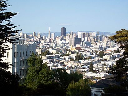
Directions to Buena Vista Park (Haight Ashbury, Sf) with public transportation
The following transit lines have routes that pass near Buena Vista Park
How to get to Buena Vista Park by bus?
Click on the bus route to see step by step directions with maps, line arrival times and updated time schedules.
How to get to Buena Vista Park by BART?
Click on the BART route to see step by step directions with maps, line arrival times and updated time schedules.
Bus stations near Buena Vista Park in Haight Ashbury, Sf
- Upper Ter & Buena Vista Ave West, 5 min walk,
- Masonic Ave & Frederick St, 6 min walk,
- Haight St & Buena Vista East Ave, 8 min walk,
Light Rail stations near Buena Vista Park in Haight Ashbury, Sf
- Duboce St/Noe St/Duboce Park, 22 min walk,
- Metro Castro Station/Outbound, 37 min walk,
- 17th St & Castro St, 38 min walk,
Bus lines to Buena Vista Park in Haight Ashbury, Sf
- 37, Masonic + Haight,
- 6, Van Ness + Market,
- N BUS, Judah Bus,
- N OWL, Owl Judah,
- 7, Haight - Noriega,
What are the closest stations to Buena Vista Park?
The closest stations to Buena Vista Park are:
- Upper Ter & Buena Vista Ave West is 312 yards away, 5 min walk.
- Masonic Ave & Frederick St is 480 yards away, 6 min walk.
- Haight St & Buena Vista East Ave is 616 yards away, 8 min walk.
- Duboce St/Noe St/Duboce Park is 1860 yards away, 22 min walk.
- Metro Castro Station/Outbound is 3145 yards away, 37 min walk.
- 17th St & Castro St is 3218 yards away, 38 min walk.
Which bus lines stop near Buena Vista Park?
These bus lines stop near Buena Vista Park: 24, 37, 6, 7.
Which BART lines stop near Buena Vista Park?
These BART lines stop near Buena Vista Park: BLUE, RED, YELLOW.
Which light rail line stops near Buena Vista Park?
N
What’s the nearest light rail station to Buena Vista Park in Haight Ashbury, Sf?
The nearest light rail station to Buena Vista Park in Haight Ashbury, Sf is Duboce St/Noe St/Duboce Park. It’s a 22 min walk away.
What’s the nearest bus stop to Buena Vista Park in Haight Ashbury, Sf?
The nearest bus stop to Buena Vista Park in Haight Ashbury, Sf is Upper Ter & Buena Vista Ave West. It’s a 5 min walk away.
What time is the first light rail to Buena Vista Park in Haight Ashbury, Sf?
The N is the first light rail that goes to Buena Vista Park in Haight Ashbury, Sf. It stops nearby at 4:52 AM.
What time is the last light rail to Buena Vista Park in Haight Ashbury, Sf?
The N is the last light rail that goes to Buena Vista Park in Haight Ashbury, Sf. It stops nearby at 1:01 AM.
What time is the first bus to Buena Vista Park in Haight Ashbury, Sf?
The N OWL is the first bus that goes to Buena Vista Park in Haight Ashbury, Sf. It stops nearby at 3:07 AM.
What time is the last bus to Buena Vista Park in Haight Ashbury, Sf?
The N OWL is the last bus that goes to Buena Vista Park in Haight Ashbury, Sf. It stops nearby at 3:07 AM.
See Buena Vista Park, Haight Ashbury, Sf, on the map
Public Transit to Buena Vista Park in Haight Ashbury, Sf
Wondering how to get to Buena Vista Park in Haight Ashbury, Sf, United States? Moovit helps you find the best way to get to Buena Vista Park with step-by-step directions from the nearest public transit station.
Moovit provides free maps and live directions to help you navigate through your city. View schedules, routes, timetables, and find out how long does it take to get to Buena Vista Park in real time.
Looking for the nearest stop or station to Buena Vista Park? Check out this list of stops closest to your destination: Upper Ter & Buena Vista Ave West; Masonic Ave & Frederick St; Haight St & Buena Vista East Ave; Duboce St/Noe St/Duboce Park; Metro Castro Station/Outbound; 17th St & Castro St.
Bus: 24, 37, 6, 7, N BUS, N OWL.BART: BLUE, RED, YELLOW.Light Rail: N.
Want to see if there’s another route that gets you there at an earlier time? Moovit helps you find alternative routes or times. Get directions from and directions to Buena Vista Park easily from the Moovit App or Website.
We make riding to Buena Vista Park easy, which is why over 1.5 million users, including users in Haight Ashbury, Sf, trust Moovit as the best app for public transit. You don’t need to download an individual bus app or train app, Moovit is your all-in-one transit app that helps you find the best bus time or train time available.
For information on prices of bus, BART and light rail, costs and ride fares to Buena Vista Park, please check the Moovit app.
Use the app to navigate to popular places including to the airport, hospital, stadium, grocery store, mall, coffee shop, school, college, and university.
Buena Vista Park Address: Buena Vista Avenue East street in Haight Ashbury, Sf
Attractions near Buena Vista Park
815 Buena Vista Avenue West,Buena Vista Park Summit,Buena Vista Park Tennis Courts,Power Sewing,Buena Vista Terrace & Roosevelt Way,Upper Terrace & Masonic Avenue,Blue Sky Photography,Alexander Signing Service,Texas Real Estate Commission,More Energy for Workouts,Delmar Consulting Group,MUNI Bus Stop #14958 - Haight & Masonic - INBOUND,So-So Supermarket,All Saints Episcopal Church (Protestant Episcopal Church in the Diocese of California),Sean Heskett Urban Arborist,270 Henry Street 102,Ava Apple & Co Latin Dance,Ericka Leder,Positively Haight Street,ChevronHow to get to popular attractions in Haight Ashbury, Sf with public transit
Santa Clara, CA, Santa Clara,Apple Palo Alto, Palo Alto,South Hayward BART Station, Hayward,AMC Saratoga 14, San Jose,Kaiser Permanente Medical Center, Santa Clara,Trader Joe's, Oakland,City of Rohnert Park, Rohnert Park,Costco Gasoline, Sunnyvale,City of Milpitas, Milpitas,Alameda County Fairgrounds, Pleasanton,Stanford Dish Trail,Santa Rosa Plaza, Santa Rosa,URL's Cafe at Yahoo!, Sunnyvale,City of Morgan Hill, Morgan Hill,Campbell, CA, Campbell,City of Redwood City, Redwood City,24 Hour Fitness Super Sport Club, Fremont,Downtown San Jose, San Jose,Costco Wholesale,San Antonio Caltrain StationGet around San Francisco - San Jose, CA by public transit!
Traveling around San Francisco - San Jose, CA has never been so easy. See step by step directions as you travel to any attraction, street or major public transit station. View bus and train schedules, arrival times, service alerts and detailed routes on a map, so you know exactly how to get to anywhere in San Francisco - San Jose, CA.
When traveling to any destination around San Francisco - San Jose, CA use Moovit's Live Directions with Get Off Notifications to know exactly where and how far to walk, how long to wait for your line, and how many stops are left. Moovit will alert you when it's time to get off — no need to constantly re-check whether yours is the next stop.
Wondering how to use public transit in San Francisco - San Jose, CA or how to pay for public transit in San Francisco - San Jose, CA? Moovit public transit app can help you navigate your way with public transit easily, and at minimum cost. It includes public transit fees, ticket prices, and costs. Looking for a map of San Francisco - San Jose, CA public transit lines? Moovit public transit app shows all public transit maps in San Francisco - San Jose, CA with all Bus, Train, BART, Light Rail, Ferry and Cable Car routes and stops on an interactive map.
San Francisco - San Jose, CA has 6 transit type(s), including: Bus, Train, BART, Light Rail, Ferry and Cable Car, operated by several transit agencies, including BART, Bay Area Rapid Transit, Muni Metro, Caltrain, VTA, Capitol Corridor, Sonoma Marin Area Rail Transit, MUNI, SF Cable Car, AC Transit, Dumbarton Express, Golden Gate Transit, County Connection, SamTrans, SamTrans / City of Menlo Park