How to get to Bug Assistance Formation by bus?
Click on the bus route to see step by step directions with maps, line arrival times and updated time schedules.
From 72700, Pruillé-Le-Chétif
42 minFrom Champagné, Champagné
48 minFrom Lycée Claude Chappe, Arnage
38 minFrom Optimhome Brochard Sophie Mandataire Indépendant, Mulsanne
47 minFrom Centre Commercial Auchan, La Chapelle-Saint-Aubin
48 minFrom Kiabi, Ruaudin
46 minFrom Pouic Cochon, Mulsanne
43 minFrom Socamaine, Champagné
53 minFrom 72470, Champagné
48 min
Bus stops near Bug Assistance Formation in Le Mans
Bus lines to Bug Assistance Formation in Le Mans
- 16, Lycee Sud,VIEW
- 5, Gazonfier,VIEW
- 14, Parc Manceau,VIEW
- 35, Sécurité Sociale,VIEW
- 4, St-Georges / St-Joseph – Bellevue-Hauts de C.,VIEW
- 7, Éperon par Auchan,VIEW
- 11, Le Cadran / St-Aubin - Closerie,VIEW
- 17, Gallière - Eperon,VIEW
- 20, Éperon - Aigné,VIEW
- T1, Antarès-Stade Marie Marvingt - Université,VIEW
- T2, Bellevue - Hauts De Coulaines,VIEW
- 6, République - St-Martin,VIEW
- 23, République - Yvré-l'Évêque,VIEW
- 25, République - Champagné,VIEW
- 25EX, République - La Baronnière,VIEW
- 111, Lycée Montesquieu,VIEW
- 120, Lycée Washington,VIEW
What are the closest stations to Bug Assistance Formation?
The closest stations to Bug Assistance Formation are:
- Bobillot is 23 meters away, 1 min walk.
- Chanzy is 151 meters away, 2 min walk.
- Yourcenar is 172 meters away, 3 min walk.
- Lafayette is 540 meters away, 8 min walk.
- Viaducs is 775 meters away, 10 min walk.
- Mazagran is 915 meters away, 12 min walk.
- Lycée Washington is 926 meters away, 12 min walk.
Which bus lines stop near Bug Assistance Formation?
These bus lines stop near Bug Assistance Formation: 111, 14, 5, T3.
Which light rail line stops near Bug Assistance Formation?
T1 (Universite)
What’s the nearest bus station to Bug Assistance Formation in Le Mans?
The nearest bus station to Bug Assistance Formation in Le Mans is Bobillot. It’s a 1 min walk away.
What time is the first light rail to Bug Assistance Formation in Le Mans?
The T2 is the first light rail that goes to Bug Assistance Formation in Le Mans. It stops nearby at 5:08 AM.
What time is the last light rail to Bug Assistance Formation in Le Mans?
The T1 is the last light rail that goes to Bug Assistance Formation in Le Mans. It stops nearby at 1:13 AM.
What time is the first bus to Bug Assistance Formation in Le Mans?
The 5 is the first bus that goes to Bug Assistance Formation in Le Mans. It stops nearby at 6:00 AM.
What time is the last bus to Bug Assistance Formation in Le Mans?
The 5 is the last bus that goes to Bug Assistance Formation in Le Mans. It stops nearby at 11:47 PM.
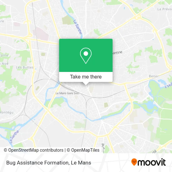
See Bug Assistance Formation, Le Mans, on the map
Public Transit to Bug Assistance Formation in Le Mans
Wondering how to get to Bug Assistance Formation in Le Mans? Moovit helps you find the best way to get to Bug Assistance Formation with step-by-step directions from the nearest public transit station.
Moovit provides free maps and live directions to help you navigate through your city. View schedules, routes, timetables, and find out how long does it take to get to Bug Assistance Formation in real time.
Looking for the nearest stop or station to Bug Assistance Formation? Check out this list of stops closest to your destination: Bobillot; Chanzy; Yourcenar; Lafayette; Viaducs; Mazagran; Lycée Washington.
Bus: 111, 14, 5, T3, 16, 35, 4, 7, 11, 17, 20, T2, 6, 23, 25, 25EX.Light Rail: T1.
Want to see if there’s another route that gets you there at an earlier time? Moovit helps you find alternative routes or times. Get directions from and directions to Bug Assistance Formation easily from the Moovit App or Website.
We make riding to Bug Assistance Formation easy, which is why over 1.5 million users, including users in Le Mans, trust Moovit as the best app for public transit. You don’t need to download an individual bus app or train app, Moovit is your all-in-one transit app that helps you find the best bus time or train time available.
For information on prices of bus and light rail, costs and ride fares to Bug Assistance Formation, please check the Moovit app.
Use the app to navigate to popular places including to the airport, hospital, stadium, grocery store, mall, coffee shop, school, college, and university.
Bug Assistance Formation Address: 186 Rue Nationale 72000 Le Mans street in Le Mans
- Annagram Washington - Epicerie Vrac le Mans,
- Service Travail. et Auxil. Familia,
- Boucherie Dezecot,
- Admr,
- Les Vins Vivants,
- Restaurant Grand Bassam,
- Grand Bassam,
- Sds Serrurerie,
- Barrault Colette,
- Epicerie de la Place,
- Creat'Aire,
- La Glacière,
- Grill Istanbul,
- La Maison Du Kebab,
- Appartement Cosy Paisible Coeur de Ville,
- Saint-Denis,
- Dr. Famery Patrice,
- Jardins de la Préfecture,
- Kiosque a Musique,
- P'Ty Breizh Crêpier
Places Near Bug Assistance Formation (Le Mans)
- Family Village, Ruaudin,
- E.Leclerc, Le Mans,
- Hôpital, Le Mans,
- Centre Hospitalier Du Mans, Le Mans,
- Parc Des Expositions, Le Mans,
- Camp du 2e RIMa, Champagné,
- Coulaines, Coulaines,
- Circuit des 24 Heures du Mans, Le Mans,
- La Chapelle-Saint-Aubin, La Chapelle-Saint-Aubin,
- Maison D'Arrêt Le Mans - Les Croisettes, Coulaines,
- Clinique Du Pré, Le Mans,
- Saint-Saturnin, Saint-Saturnin,
- Pôle Santé Sud-Elsan, Le Mans,
- Avenue Bollée, Le Mans,
- Clinique Pôle Santé Sud, Le Mans,
- Auchan le Mans, La Chapelle-Saint-Aubin,
- Place des Jacobins (le Mans), Le Mans,
- Changé, Changé,
- Université, Le Mans,
- Gare SNCF du Mans, Le Mans
How to get to popular places in Le Mans with public transit
Get around Le Mans by public transit!
Traveling around Le Mans has never been so easy. See step by step directions as you travel to any attraction, street or major public transit station. View bus and train schedules, arrival times, service alerts and detailed routes on a map, so you know exactly how to get to anywhere in Le Mans.
When traveling to any destination around Le Mans use Moovit's Live Directions with Get Off Notifications to know exactly where and how far to walk, how long to wait for your line, and how many stops are left. Moovit will alert you when it's time to get off — no need to constantly re-check whether yours is the next stop.
Wondering how to use public transit in Le Mans or how to pay for public transit in Le Mans? Moovit public transit app can help you navigate your way with public transit easily, and at minimum cost. It includes public transit fees, ticket prices, and costs. Looking for a map of Le Mans public transit lines? Moovit public transit app shows all public transit maps in Le Mans with all Bus and Light Rail routes and stops on an interactive map.
Le Mans has 2 transit type(s), including: Bus and Light Rail, operated by several transit agencies, including SETRAM