Directions to Bulfinch Hotel (Boston) with public transportation
The following transit lines have routes that pass near Bulfinch Hotel
 Bus: 14, 39, 41, 66, GREEN LINE E SHUTTLE.
- Train: PROVIDENCE/STOUGHTON.
- Subway: GREEN LINE E, ORANGE LINE.
How to get to Bulfinch Hotel by bus?
Click on the bus route to see step by step directions with maps, line arrival times and updated time schedules.
From Boston Harborwalk, Boston
52 minFrom Highland Ave Somerville MA, Somerville
79 minFrom Everett, MA, Everett
86 minFrom Canopy-Boston, Boston
54 minFrom Hyatt Place Medford, Medford
73 minFrom Canobie Lake Park, Chelsea
90 minFrom Fidelity Investments, Boston
56 minFrom Medford Square, Medford
91 minFrom Laugh Boston, Boston
54 minFrom Constitution Beach, Boston
89 min
How to get to Bulfinch Hotel by train?
Click on the train route to see step by step directions with maps, line arrival times and updated time schedules.
How to get to Bulfinch Hotel by subway?
Click on the subway route to see step by step directions with maps, line arrival times and updated time schedules.
Bus stops near Bulfinch Hotel in Boston
Subway stations near Bulfinch Hotel in Boston
Bus lines to Bulfinch Hotel in Boston
What are the closest stations to Bulfinch Hotel?
The closest stations to Bulfinch Hotel are:
- Heath St @ Walden St is 248 yards away, 4 min walk.
- Centre St @ Sunnyside St is 498 yards away, 7 min walk.
- Heath St @ S Huntington Ave is 629 yards away, 8 min walk.
- Fenwood Road is 850 yards away, 11 min walk.
- Jackson Square is 2119 yards away, 26 min walk.
Which bus lines stop near Bulfinch Hotel?
These bus lines stop near Bulfinch Hotel: 14, 39, 41, 66.
Which train line stops near Bulfinch Hotel?
PROVIDENCE/STOUGHTON (#825 | Providence)
Which subway lines stop near Bulfinch Hotel?
These subway lines stop near Bulfinch Hotel: GREEN LINE E, ORANGE LINE.
What’s the nearest subway station to Bulfinch Hotel in Boston?
The nearest subway station to Bulfinch Hotel in Boston is Fenwood Road. It’s a 11 min walk away.
What’s the nearest bus station to Bulfinch Hotel in Boston?
The nearest bus station to Bulfinch Hotel in Boston is Heath St @ Walden St. It’s a 4 min walk away.
What time is the first subway to Bulfinch Hotel in Boston?
The ORANGE LINE is the first subway that goes to Bulfinch Hotel in Boston. It stops nearby at 5:20 AM.
What time is the last subway to Bulfinch Hotel in Boston?
The GREEN LINE E is the last subway that goes to Bulfinch Hotel in Boston. It stops nearby at 2:01 AM.
What time is the first bus to Bulfinch Hotel in Boston?
The 41 is the first bus that goes to Bulfinch Hotel in Boston. It stops nearby at 5:20 AM.
What time is the last bus to Bulfinch Hotel in Boston?
The 41 is the last bus that goes to Bulfinch Hotel in Boston. It stops nearby at 9:28 PM.
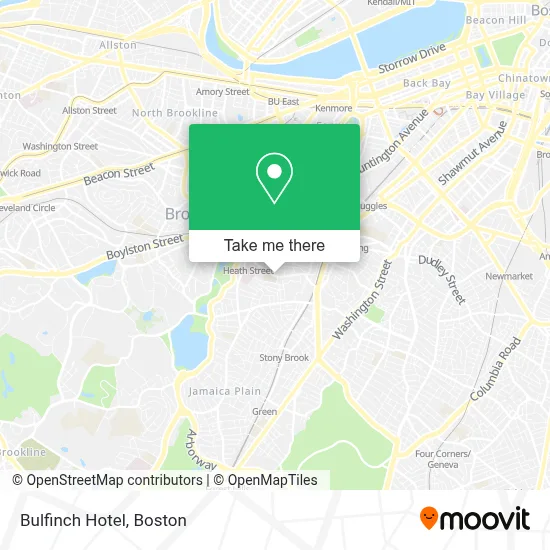
See Bulfinch Hotel, Boston, on the map
Public Transit to Bulfinch Hotel in Boston
Wondering how to get to Bulfinch Hotel in Boston? Moovit helps you find the best way to get to Bulfinch Hotel with step-by-step directions from the nearest public transit station.
Moovit provides free maps and live directions to help you navigate through your city. View schedules, routes, timetables, and find out how long does it take to get to Bulfinch Hotel in real time.
Looking for the nearest stop or station to Bulfinch Hotel? Check out this list of stops closest to your destination: Heath St @ Walden St; Centre St @ Sunnyside St; Heath St @ S Huntington Ave; Fenwood Road; Jackson Square.
Bus: 14, 39, 41, 66, GREEN LINE E SHUTTLE, GREEN LINE E SHUTTLE.Train: PROVIDENCE/STOUGHTON.Subway: GREEN LINE E, ORANGE LINE.
Want to see if there’s another route that gets you there at an earlier time? Moovit helps you find alternative routes or times. Get directions from and directions to Bulfinch Hotel easily from the Moovit App or Website.
We make riding to Bulfinch Hotel easy, which is why over 1.7 million users, including users in Boston, trust Moovit as the best app for public transit. You don’t need to download an individual bus app or train app, Moovit is your all-in-one transit app that helps you find the best bus time or train time available.
For information on prices of bus, subway and train, costs and ride fares to Bulfinch Hotel, please check the Moovit app.
Use the app to navigate to popular places including to the airport, hospital, stadium, grocery store, mall, coffee shop, school, college, and university.
Bulfinch Hotel Address: 209 Heath St street in Boston
- JP Corner Store,
- Other Apartments for Rent,
- Heath St Building 170,
- Roxbury Preparatory Charter School,
- Edgar P. Benjamin Healthcare Center,
- Roxbury Prep Charter School ,
- Walden Garden,
- Jp Convenience Store,
- Keating Total Fitness,
- Horan Way Building 57,
- Gas Leak Detection Plumbing,
- Mission Hill Link,
- Legit Locksmith,
- Backbaydrumming,
- Elshaddai Market,
- Baptist Hospital,
- Eric J Woodard MD (Robert J Banco MD),
- Gordon Tree & Landscaping,
- Citibank,
- Medical Center of Boston
Places Near Bulfinch Hotel (Boston)
- Prudential Center, Boston,
- Leader Bank Pavilion (Leader Bank Pavillion), Boston,
- Td Garden, Boston,
- Wang Theater, Boston,
- Massachusetts General Hospital, Boston,
- Isabella Stewart Gardner Museum, Boston,
- Museum Of Science, Boston,
- Boston Children's Hospital, Boston,
- Mgm Music Hall, Boston,
- Quincy Market, Boston,
- Wilbur Theatre, Boston,
- Boston Convention & Exhibition Center, Boston,
- North End, Boston,
- Cheers, Boston,
- Seaport District, Boston,
- Faneuil Hall, Boston,
- House Of Blues, Boston,
- Boston Medical Center, Boston,
- Boston Common, Boston,
- Castle Island, Boston
How to get to popular places in Boston with public transit
Get around Boston by public transit!
Traveling around Boston has never been so easy. See step by step directions as you travel to any attraction, street or major public transit station. View bus and train schedules, arrival times, service alerts and detailed routes on a map, so you know exactly how to get to anywhere in Boston.
When traveling to any destination around Boston use Moovit's Live Directions with Get Off Notifications to know exactly where and how far to walk, how long to wait for your line, and how many stops are left. Moovit will alert you when it's time to get off — no need to constantly re-check whether yours is the next stop.
Wondering how to use public transit in Boston or how to pay for public transit in Boston? Moovit public transit app can help you navigate your way with public transit easily, and at minimum cost. It includes public transit fees, ticket prices, and costs. Looking for a map of Boston public transit lines? Moovit public transit app shows all public transit maps in Boston with all Bus, Train, Subway and Ferry routes and stops on an interactive map.
Boston has 4 transit type(s), including: Bus, Train, Subway and Ferry, operated by several transit agencies, including MBTA, Southeastern Regional Transit Authority, MetroWest Regional Transit Authority, Rhode Island Public Transit Authority, WRTA, Lowell Regional Transit Authority, Merrimack Valley Transit, Montachusett Regional Transit Authority, Cape Cod Regional Transit Authority, Brockton Area Transit Authority, Martha's Vineyard Transit Authority, the WAVE - Nantucket Regional Transit Authority, GATRA, Cape Ann Transportation Authority and Massport