Directions to Burncoat High School (Worcester) with public transportation
The following transit lines have routes that pass near Burncoat High School
 Bus:
Bus:
How to get to Burncoat High School by bus?
Click on the bus route to see step by step directions with maps, line arrival times and updated time schedules.
Which bus line stops near Burncoat High School?
14
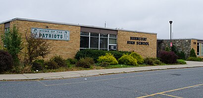
See Burncoat High School, Worcester, on the map
Public Transit to Burncoat High School in Worcester
Wondering how to get to Burncoat High School in Worcester, United States? Moovit helps you find the best way to get to Burncoat High School with step-by-step directions from the nearest public transit station.
Moovit provides free maps and live directions to help you navigate through your city. View schedules, routes, timetables, and find out how long does it take to get to Burncoat High School in real time.
Bus:
Want to see if there’s another route that gets you there at an earlier time? Moovit helps you find alternative routes or times. Get directions from and directions to Burncoat High School easily from the Moovit App or Website.
We make riding to Burncoat High School easy, which is why over 1.5 million users, including users in Worcester, trust Moovit as the best app for public transit. You don’t need to download an individual bus app or train app, Moovit is your all-in-one transit app that helps you find the best bus time or train time available.
For information on prices of bus and train, costs and ride fares to Burncoat High School, please check the Moovit app.
Use the app to navigate to popular places including to the airport, hospital, stadium, grocery store, mall, coffee shop, school, college, and university.
Burncoat High School Address: Burncoat Street street in Worcester
Attractions near Burncoat High School
179 Burncoat Street,Worcester Junior High School,Burncoat High School Library,Library,City of Worcester,Quinsigamond Community College,184 Burncoat St,Burncoat Middle School,Faith House,Burncoat St + Burncoat High School,Church Of The Nazarene,Burncoat Middle & High School,Burncoat St + Randolph Rd,Talent Search,Teen Care Program,Jobs For Bay State Graduates,Judge J Lawrence CPA PC,Us Bancorp,Burncoat St + Rexame Rd,Fitzgerald JohnHow to get to popular attractions in Worcester with public transit
Milford, MA, Milford,Hops n Scotch, Brookline,Hyatt Boston Harbor, Boston,Newton, MA, Newton,MBTA Commuter Rail South Attleboro, Attleboro,Brighton Center, Boston,Joe's American Bar & Grill, Boston,J.P. Licks Jamaica Plain, Boston,Warwick, RI,Bridgewater, MA, Bridgewater,Stephanie's On Newbury, Boston,Bell In Hand Tavern, Boston,North Shore Mall, Peabody,Planet Fitness, Malden,Portsmouth, RI,Samuel Adams Brewery, Boston,MET Back Bay, Boston,Union Station (WOR), Worcester,The Landing at Long Wharf, Boston,White Horse Tavern, BostonGet around Worcester by public transit!
Traveling around Worcester has never been so easy. See step by step directions as you travel to any attraction, street or major public transit station. View bus and train schedules, arrival times, service alerts and detailed routes on a map, so you know exactly how to get to anywhere in Worcester.
When traveling to any destination around Worcester use Moovit's Live Directions with Get Off Notifications to know exactly where and how far to walk, how long to wait for your line, and how many stops are left. Moovit will alert you when it's time to get off — no need to constantly re-check whether yours is the next stop.
Wondering how to use public transit in Worcester or how to pay for public transit in Worcester? Moovit public transit app can help you navigate your way with public transit easily, and at minimum cost. It includes public transit fees, ticket prices, and costs. Looking for a map of Worcester public transit lines? Moovit public transit app shows all public transit maps in Worcester with all bus or train routes and stops on an interactive map.
Worcester has 2 transit type(s), including: bus or train, operated by several transit agencies, including MBTA, MBTA, MBTA, Southeastern Regional Transit Authority, MetroWest Regional Transit Authority, Rhode Island Public Transit Authority, WRTA, Lowell Regional Transit Authority, Merrimack Valley Transit, Montachusett Regional Transit Authority, Cape Cod Regional Transit Authority, Brockton Area Transit Authority, Cape Cod Regional Transit Authority, Martha's Vineyard Transit Authority and the WAVE - Nantucket Regional Transit Authority