See Burtner House, Pittsburgh, on the map
Directions to Burtner House (Pittsburgh) with public transportation
The following transit lines have routes that pass near Burtner House
 Bus:
Bus:
How to get to Burtner House by bus?
Click on the bus route to see step by step directions with maps, line arrival times and updated time schedules.
Bus stations near Burtner House in Pittsburgh
- Freeport Rd + Poplar,16 min walk,
Bus lines to Burtner House in Pittsburgh
- P10,Outbound-Harrison,
What are the closest stations to Burtner House?
The closest stations to Burtner House are:
- Freeport Rd + Poplar is 1298 yards away, 16 min walk.
Which bus line stops near Burtner House?
P10
What time is the first bus to Burtner House in Pittsburgh?
The P10 is the first bus that goes to Burtner House in Pittsburgh. It stops nearby at 5:11 AM.
What time is the last bus to Burtner House in Pittsburgh?
The P10 is the last bus that goes to Burtner House in Pittsburgh. It stops nearby at 7:12 PM.
How much is the bus fare to Burtner House?
The bus fare to Burtner House costs about $2.75.
See Burtner House, Pittsburgh, on the map
Public Transit to Burtner House in Pittsburgh
Wondering how to get to Burtner House in Pittsburgh, United States? Moovit helps you find the best way to get to Burtner House with step-by-step directions from the nearest public transit station.
Moovit provides free maps and live directions to help you navigate through your city. View schedules, routes, timetables, and find out how long does it take to get to Burtner House in real time.
Looking for the nearest stop or station to Burtner House? Check out this list of stops closest to your destination: Freeport Rd + Poplar.
Bus:
Want to see if there’s another route that gets you there at an earlier time? Moovit helps you find alternative routes or times. Get directions from and directions to Burtner House easily from the Moovit App or Website.
We make riding to Burtner House easy, which is why over 1.5 million users, including users in Pittsburgh, trust Moovit as the best app for public transit. You don’t need to download an individual bus app or train app, Moovit is your all-in-one transit app that helps you find the best bus time or train time available.
For information on prices of bus, costs and ride fares to Burtner House, please check the Moovit app.
Use the app to navigate to popular places including to the airport, hospital, stadium, grocery store, mall, coffee shop, school, college, and university.
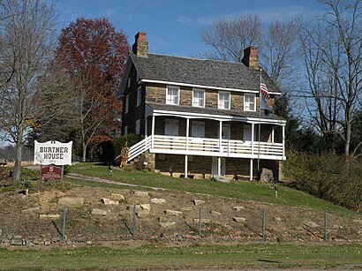
Burtner House Address: Burtner Road street in Pittsburgh
Attractions near Burtner House
Brackenridge Heights Golf Course,Tables on the Green,Janleehypnosis,Keep Up the Beat,Bundles of Balloons by Emily,Compton, Pennsylvania,Distinctive Painting,Sunshine's Cleaning Service,Personal Injury Chiropractors,Natrona Heights,Supik Home Inspections,Natrona Heights,Dial-A-Devotion,Goldngals,Freeport Rd at Spring Hill Rd,Coinflip Bitcoin Atm,Stop N Shop,Miyan Associates,Napa Auto PArts - Natrona Auto PArts - Closed,1274 Davis StHow to get to popular attractions in Pittsburgh with public transit
Mount Oliver, Mount Oliver,Foster Plaza Building 9, Green Tree,Giant Eagle,Sewickley, Sewickley,Tequila Cowboy, Pittsburgh,One Oxford Center, Pittsburgh,West Penn Hospital Parking Garage, Pittsburgh,Sharpsburg, Sharpsburg,Carnegie Science Center, Pittsburgh,Trader Joe's, Pittsburgh,Carnegie Museum Of Art, Pittsburgh,Pittsburgh Bottle Shop Cafe,Fineview Fitness Trail, Pittsburgh,Mckees Rocks, Mckees Rocks,Bidwell Training Center, Pittsburgh,Lawrenceville, Pittsburgh,Interstate 79 at Exit 66, Glenfield,Wharton Square, Pittsburgh,West Penn Hospital Heliport, Pittsburgh,Dick's Sporting Goods Pittsburgh Marathon, PittsburghGet around Pittsburgh by public transit!
Traveling around Pittsburgh has never been so easy. See step by step directions as you travel to any attraction, street or major public transit station. View bus and train schedules, arrival times, service alerts and detailed routes on a map, so you know exactly how to get to anywhere in Pittsburgh.
When traveling to any destination around Pittsburgh use Moovit's Live Directions with Get Off Notifications to know exactly where and how far to walk, how long to wait for your line, and how many stops are left. Moovit will alert you when it's time to get off — no need to constantly re-check whether yours is the next stop.
Wondering how to use public transit in Pittsburgh or how to pay for public transit in Pittsburgh? Moovit public transit app can help you navigate your way with public transit easily, and at minimum cost. It includes public transit fees, ticket prices, and costs. Looking for a map of Pittsburgh public transit lines? Moovit public transit app shows all public transit maps in Pittsburgh with all bus routes and stops on an interactive map.
Pittsburgh has 1 transit type(s), including: bus, operated by several transit agencies, including Pittsburgh Regional Transit, Pittsburgh Regional Transit, CamTran, Amtran, Mid Mon Valley Transit, BCTA, Butler Transit Authority, IndiGo, Area Transportation Authority, Freedom Transit, Pittsburgh Regional Transit, Mountain Line Transit Authority, Megabus, Greyhound-us and Fullington Trailways