How to get to CEHA by bus?
Click on the bus route to see step by step directions with maps, line arrival times and updated time schedules.
From Estrada Dos Tres Rios, Freguesia (Jacarepaguá)
58 minFrom Méier, Méier
55 minFrom Ilha do Fundão, Cidade Universitária (Fundão)
53 minFrom Avenida Athos da Silveira Ramos 149, Cidade Universitária (Fundão)
52 minFrom Brt Linha Expressa 41 Madureira X Recreio, Taquara
41 minFrom Nilópolis, Nilópolis
70 minFrom Vila São Luiz, Duque De Caxias
54 minFrom Mercado São Sebastião, Penha Circular
40 minFrom BRT - Olaria, Olaria
31 min
How to get to CEHA by train?
Click on the train route to see step by step directions with maps, line arrival times and updated time schedules.
Bus stops near CEHA in Irajá
Train station near CEHA in Irajá
- Rocha Miranda, 13 min walk,VIEW
Metro station near CEHA in Irajá
- Vicente De Carvalho, 23 min walk,VIEW
Bus lines to CEHA in Irajá
- 296, Irajá,VIEW
- 350, Castelo,VIEW
- 428L, Nova Aurora,VIEW
- 560L, Méier (Via Norte Shopping),VIEW
- 561, Freguesia,VIEW
- 568L, Caxias,VIEW
- 712, Cascadura,VIEW
- 774, Jardim América,VIEW
- SV 774, Madureira (via Terminal Margaridas),VIEW
- 775, Jardim América ↔ Madureira,VIEW
- 910, Bananal,VIEW
- 918, Bangu (Jardim Violeta),VIEW
- 926, Penha,VIEW
- 940, Ramos,VIEW
- 959, Metrô Vicente de Carvalho ↔ Terminal Margaridas,VIEW
- 688, Méier,VIEW
- 919, Maré (via Bonsucesso),VIEW
- SN 919, Pavuna (via Saída 7),VIEW
- 551, Nova Iguaçu,VIEW
- 687, Pavuna,VIEW
What are the closest stations to CEHA?
The closest stations to CEHA are:
- Rua Marquês De Aracati | Rua Visc. De Maceió (Todas As Linhas) is 351 meters away, 5 min walk.
- Rua Marquês De Aracati | Rua Cisplatina (Linhas Sentido Madureira) is 402 meters away, 6 min walk.
- Avenida Pastor Martin Luther King Junior, 7422-7500 is 420 meters away, 6 min walk.
- Rocha Miranda is 966 meters away, 13 min walk.
- Vicente De Carvalho is 1782 meters away, 23 min walk.
Which bus lines stop near CEHA?
These bus lines stop near CEHA: 428L, 551, 561, 688, 774, SV 774.
Which metro line stops near CEHA?
L2 (Pavuna)
Which train line stops near CEHA?
RAMAL BELFORD ROXO (Belford Roxo)
What’s the nearest metro station to CEHA in Irajá?
The nearest metro station to CEHA in Irajá is Vicente De Carvalho. It’s a 23 min walk away.
What’s the nearest train station to CEHA in Irajá?
The nearest train station to CEHA in Irajá is Rocha Miranda. It’s a 13 min walk away.
What’s the nearest bus station to CEHA in Irajá?
The nearest bus station to CEHA in Irajá is Rua Marquês De Aracati | Rua Visc. De Maceió (Todas As Linhas). It’s a 5 min walk away.
What time is the first metro to CEHA in Irajá?
The L2 is the first metro that goes to CEHA in Irajá. It stops nearby at 5:05 AM.
What time is the last metro to CEHA in Irajá?
The L2 is the last metro that goes to CEHA in Irajá. It stops nearby at 12:45 AM.
What time is the first train to CEHA in Irajá?
The RAMAL BELFORD ROXO is the first train that goes to CEHA in Irajá. It stops nearby at 5:05 AM.
What time is the last train to CEHA in Irajá?
The RAMAL BELFORD ROXO is the last train that goes to CEHA in Irajá. It stops nearby at 10:03 PM.
What time is the first bus to CEHA in Irajá?
The SN 919 is the first bus that goes to CEHA in Irajá. It stops nearby at 3:13 AM.
What time is the last bus to CEHA in Irajá?
The 568 is the last bus that goes to CEHA in Irajá. It stops nearby at 2:42 AM.
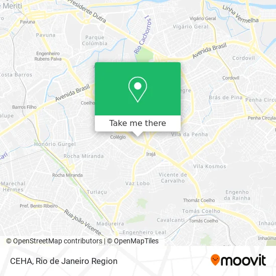
See CEHA, Irajá, on the map
Public Transit to CEHA in Irajá
Wondering how to get to CEHA in Irajá? Moovit helps you find the best way to get to CEHA with step-by-step directions from the nearest public transit station.
Moovit provides free maps and live directions to help you navigate through your city. View schedules, routes, timetables, and find out how long does it take to get to CEHA in real time.
Looking for the nearest stop or station to CEHA? Check out this list of stops closest to your destination: Rua Marquês De Aracati | Rua Visc. De Maceió (Todas As Linhas); Rua Marquês De Aracati | Rua Cisplatina (Linhas Sentido Madureira); Avenida Pastor Martin Luther King Junior; Rocha Miranda; Vicente De Carvalho.
Bus: 428L, 551, 561, 688, 774, SV 774, 296, 350, 560L, 919, SN 919, 687.Metro: L2.Train: RAMAL BELFORD ROXO.
Want to see if there’s another route that gets you there at an earlier time? Moovit helps you find alternative routes or times. Get directions from and directions to CEHA easily from the Moovit App or Website.
We make riding to CEHA easy, which is why over 1.5 million users, including users in Irajá, trust Moovit as the best app for public transit. You don’t need to download an individual bus app or train app, Moovit is your all-in-one transit app that helps you find the best bus time or train time available.
For information on prices of bus, train and metro, costs and ride fares to CEHA, please check the Moovit app.
Use the app to navigate to popular places including to the airport, hospital, stadium, grocery store, mall, coffee shop, school, college, and university.
CEHA Address: Rua Cisplatina, 148 - Irajá street in Irajá
- Centro Espírita Humildade E Amor (Ceha),
- Rua Cisplatina Irajá,
- G.R.B.C. Bohêmios de Irajá,
- Feira de Irajá,
- Praça Mato Grosso,
- Furacão 2000,
- Rua do Encanamento,
- Tenda Espírita Estrela do Mar,
- Ana Bolos, Doces e Salgados,
- Rcrj Comercio E Coleta De Oleo Vegetal,
- Julianne Lacerda da Costa,
- Rua Barbosa Pita,
- Rua Miranda e Brito,
- Feira de Domingo de Irajá,
- Tenda de Umbanda Caboclo Zumbi,
- Estação Colégio,
- Clínica Climesa,
- CE Mato Grosso,
- Escola Municipal Mato Grosso,
- Palazzo Del Sapore Restaurante E Pizzaria
Places Near CEHA (Irajá)
- Museu Do Amanhã, Centro,
- Niterói, Niterói,
- Avenida Venezuela 134, Saúde,
- Praia do Arpoador, Ipanema,
- Norte Shopping, Cachambi,
- Feira Livre da Gloria, Glória,
- Shopping RioSul, Botafogo,
- Shopping Downtown, Barra Da Tijuca,
- Hospital Federal Do Andaraí, Andaraí,
- Rua Ulysses Guimarães 16, Cidade Nova,
- Avenida Rio Branco, Centro,
- Hospital Municipal Ronaldo Gazolla, Acari,
- Rua Licínio Cardoso, São Francisco Xavier,
- Rio De Janeiro,
- Shopping Rio Sul, Botafogo,
- Rodoviária Novo Rio (Rodoviária do Rio de Janeiro), Santo Cristo,
- Feirão De Malhas, Duque De Caxias,
- Hospital Pedro Ernesto, Vila Isabel,
- Shopping Nova América, Del Castilho,
- Hospital Federal Cardoso Fontes, Jacarepaguá
How to get to popular places in Rio de Janeiro Region with public transit
Get around Irajá by public transit!
Traveling around Irajá has never been so easy. See step by step directions as you travel to any attraction, street or major public transit station. View bus and train schedules, arrival times, service alerts and detailed routes on a map, so you know exactly how to get to anywhere in Irajá.
When traveling to any destination around Irajá use Moovit's Live Directions with Get Off Notifications to know exactly where and how far to walk, how long to wait for your line, and how many stops are left. Moovit will alert you when it's time to get off — no need to constantly re-check whether yours is the next stop.
Wondering how to use public transit in Irajá or how to pay for public transit in Irajá? Moovit public transit app can help you navigate your way with public transit easily, and at minimum cost. It includes public transit fees, ticket prices, and costs. Looking for a map of Irajá public transit lines? Moovit public transit app shows all public transit maps in Irajá with all Bus, Train, Metro, Light Rail, Ferry, Cable Car, Gondola and Funicular routes and stops on an interactive map.
Rio de Janeiro Region has 8 transit type(s), including: Bus, Train, Metro, Light Rail, Ferry, Cable Car, Gondola and Funicular, operated by several transit agencies, including TrensRJ, Metrô Rio, VLT Carioca, Barcas Rio, BRT MOBI-Rio, Auto Viação Alpha, Auto Viação Tijuca, Gire Transportes, Transurb, Viação Nossa Senhora das Graças, Consórcio INTERSUL, Braso Lisboa (Municipal), Caprichosa Auto Ônibus, Auto Viação Três Amigos and Rodoviária Âncora Matias