Directions to CEPSA (Madrid) with public transportation
The following transit lines have routes that pass near CEPSA
How to get to CEPSA by bus?
Click on the bus route to see step by step directions with maps, line arrival times and updated time schedules.
How to get to CEPSA by train?
Click on the train route to see step by step directions with maps, line arrival times and updated time schedules.
How to get to CEPSA by metro?
Click on the metro route to see step by step directions with maps, line arrival times and updated time schedules.
Bus lines to CEPSA in Madrid
- 126,Barrio Del Pilar,
- 127,C. Periodistas,
- 132,Hospital La Paz,
- N21,Arroyo Fresno,
- 64,Pitis,
- 137,Puerta Hierro,
What are the closest stations to CEPSA?
The closest stations to CEPSA are:
- Antonio Machado - Sinesio Delgado is 54 meters away, 1 min walk.
- Sainz De Robles - Antonio Machado is 269 meters away, 4 min walk.
- Nueva Zelanda - Isla De Oza is 445 meters away, 6 min walk.
- Valdezarza is 491 meters away, 7 min walk.
- Estrecho is 2251 meters away, 29 min walk.
Which bus lines stop near CEPSA?
These bus lines stop near CEPSA: 126, 127, 132.
Which train line stops near CEPSA?
C4
Which metro line stops near CEPSA?
M-7
What’s the nearest metro station to CEPSA in Madrid?
The nearest metro station to CEPSA in Madrid is Valdezarza. It’s a 7 min walk away.
What’s the nearest bus stop to CEPSA in Madrid?
The nearest bus stop to CEPSA in Madrid is Antonio Machado - Sinesio Delgado. It’s a 1 min walk away.
See CEPSA, Madrid, on the map
Public Transit to CEPSA in Madrid
Wondering how to get to CEPSA in Madrid, Spain? Moovit helps you find the best way to get to CEPSA with step-by-step directions from the nearest public transit station.
Moovit provides free maps and live directions to help you navigate through your city. View schedules, routes, timetables, and find out how long does it take to get to CEPSA in real time.
Looking for the nearest stop or station to CEPSA? Check out this list of stops closest to your destination: Antonio Machado - Sinesio Delgado; Sainz De Robles - Antonio Machado; Nueva Zelanda - Isla De Oza; Valdezarza; Estrecho.
Bus: 126, 127, 132, N21, 64, 137.Train: C4.Metro: M-7, M-1.
Want to see if there’s another route that gets you there at an earlier time? Moovit helps you find alternative routes or times. Get directions from and directions to CEPSA easily from the Moovit App or Website.
We make riding to CEPSA easy, which is why over 1.5 million users, including users in Madrid, trust Moovit as the best app for public transit. You don’t need to download an individual bus app or train app, Moovit is your all-in-one transit app that helps you find the best bus time or train time available.
For information on prices of bus, metro and train, costs and ride fares to CEPSA, please check the Moovit app.
Use the app to navigate to popular places including to the airport, hospital, stadium, grocery store, mall, coffee shop, school, college, and university.
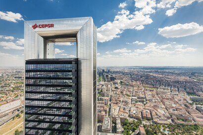
CEPSA Address: Calle de Antonio Machado 28035 Madrid street in Madrid
Attractions near CEPSA
Calle De Antonio Machádo,Pista de Patinaje,Centro Yogasalud Yoga Iyengar,Valdezarza,Uñas y Estética,Imprenta Pedragosa,Pedragosa,Antonio Machado - Isla de Oza,Alvarez Ongil, angel Luis,Lydia Cebrián Poch,Farmacia María Teres Domingo Domingo,Farmacia - Calle Antonio Machado 17,Calle de Federico Carlos Sainz de Robles / Calle de Antonio Machado,Supermercado,KUMON,Computronic Ordenadores,Bar 988,Bazar Mejor y Mas Cerca,Bazar Súper Saconia,Clínica Legos. Podología y Fisioterapia.How to get to popular attractions in Madrid with public transit
Calle Ruiz de Alarcón 3, Madrid,Hotel Axor Feria, Madrid,Boco Madrid 1, Madrid,Via Lusitana 21, Madrid,Calle Infanta Mercedes, Madrid,Universidad Camilo José Cela (UCJC), Villanueva De La Cañada,Hospital Universitario HM Montepríncipe, Boadilla Del Monte,Paseo de la Chopera, Madrid,Av America, Madrid,Valdebebas, Madrid,Autovía A-1 (Madrid-Burgos) km 24, San Sebastián De Los Reyes,Parquesur, Leganés,Hospital Militar Gómez Ulla, Madrid,Metro Avenida de América, Madrid,Cantoblanco, Madrid,Hospital Universitario Quirón, Pozuelo De Alarcón,Calle Duque de Rivas 5, Madrid,Hortaleza, Madrid,Calle Cea Bermúdez, Madrid,Calle del Nuncio, MadridGet around Madrid by public transit!
Traveling around Madrid has never been so easy. See step by step directions as you travel to any attraction, street or major public transit station. View bus and train schedules, arrival times, service alerts and detailed routes on a map, so you know exactly how to get to anywhere in Madrid.
When traveling to any destination around Madrid use Moovit's Live Directions with Get Off Notifications to know exactly where and how far to walk, how long to wait for your line, and how many stops are left. Moovit will alert you when it's time to get off — no need to constantly re-check whether yours is the next stop.
Wondering how to use public transit in Madrid or how to pay for public transit in Madrid? Moovit public transit app can help you navigate your way with public transit easily, and at minimum cost. It includes public transit fees, ticket prices, and costs. Looking for a map of Madrid public transit lines? Moovit public transit app shows all public transit maps in Madrid with all Bus, Train, Metro and Light Rail routes and stops on an interactive map.
Madrid has 4 transit type(s), including: Bus, Train, Metro and Light Rail, operated by several transit agencies, including Metro de Madrid, Metro Ligero, Tranvía de Parla, Renfe Cercanías - No en este proyecto, Renfe Cercanías, EMT, Interurbanos, Urbanos de Alcalá de Henares, Urbanos de Alcobendas, Urbanos de Alcorcón, Urbanos de Algete, Urbanos de Aranjuez, Urbanos de Arganda del Rey, Urbanos de Arroyomolinos, Urbanos de Boadilla del Monte