How to get to CMP by bus?
Click on the bus route to see step by step directions with maps, line arrival times and updated time schedules.
Bus stops near CMP in Le Mans
Bus lines to CMP in Le Mans
- 28, La Chapelle-St-Aubin,VIEW
- 33, Universite,VIEW
- T1, Ant-Circuit 24h,VIEW
- 160, Collège Épine,VIEW
- 161, Foresterie,VIEW
- 4, St-Georges / St-Joseph – Bellevue-Hauts de C.,VIEW
- 7, Éperon par Auchan,VIEW
- 11, Le Cadran / St-Aubin - Closerie,VIEW
- 14, Parc Manceau - St-Martin,VIEW
- 16, Lafayette - Californie,VIEW
- 17, Gallière - Eperon,VIEW
- 20, Éperon - Aigné,VIEW
What are the closest stations to CMP?
The closest stations to CMP are:
- Auric is 187 meters away, 3 min walk.
- Université is 576 meters away, 8 min walk.
- Barbara is 793 meters away, 11 min walk.
- Lafayette is 3245 meters away, 42 min walk.
Which bus lines stop near CMP?
These bus lines stop near CMP: 12, 13, 28.
Which light rail line stops near CMP?
T1 (Universite)
What’s the nearest bus station to CMP in Le Mans?
The nearest bus station to CMP in Le Mans is Auric. It’s a 3 min walk away.
What time is the first light rail to CMP in Le Mans?
The T1 is the first light rail that goes to CMP in Le Mans. It stops nearby at 5:24 AM.
What time is the last light rail to CMP in Le Mans?
The T1 is the last light rail that goes to CMP in Le Mans. It stops nearby at 1:03 AM.
What time is the first bus to CMP in Le Mans?
The 16 is the first bus that goes to CMP in Le Mans. It stops nearby at 6:30 AM.
What time is the last bus to CMP in Le Mans?
The 16 is the last bus that goes to CMP in Le Mans. It stops nearby at 8:26 PM.
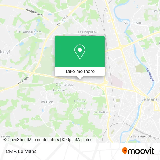
See CMP, Le Mans, on the map
Public Transit to CMP in Le Mans
Wondering how to get to CMP in Le Mans? Moovit helps you find the best way to get to CMP with step-by-step directions from the nearest public transit station.
Moovit provides free maps and live directions to help you navigate through your city. View schedules, routes, timetables, and find out how long does it take to get to CMP in real time.
Looking for the nearest stop or station to CMP? Check out this list of stops closest to your destination: Auric; Université; Barbara; Lafayette.
Bus: 12, 13, 28, 33, T1, 160, 161, 4, 7, 11, 14, 16.Light Rail: T1.
Want to see if there’s another route that gets you there at an earlier time? Moovit helps you find alternative routes or times. Get directions from and directions to CMP easily from the Moovit App or Website.
We make riding to CMP easy, which is why over 1.5 million users, including users in Le Mans, trust Moovit as the best app for public transit. You don’t need to download an individual bus app or train app, Moovit is your all-in-one transit app that helps you find the best bus time or train time available.
For information on prices of bus and light rail, costs and ride fares to CMP, please check the Moovit app.
Use the app to navigate to popular places including to the airport, hospital, stadium, grocery store, mall, coffee shop, school, college, and university.
CMP Address: 72 avenue Olivier Messiaen street in Le Mans
- Gsf,
- Université du Mans - Ufr Lettres, Langues et Sciences Humaines - Espe,
- Itemm,
- Campus Kebab,
- 6 Rue Léon Bourgeois Parking,
- Avenue Olivier Messiaen 78,
- Amphithéâtre Robert Garnier,
- Agc Perspectives,
- Freshmile,
- I.U.T. Chimie,
- Faculté De Droit,
- Université du Mans - Faculté des Lettres, Langues et Sciences Humaines,
- 72000,
- Université - Ribay,
- Résidence U' Bartholdi,
- France Travail (Ex Pôle Emploi),
- Louvre Hotels Group,
- 325 Av. Frédéric Auguste Bartholdi,
- Université du Maine,
- I.U.T. Amphis, Crl Et Reprographie
Places Near CMP (Le Mans)
- Coulaines, Coulaines,
- Circuit des 24 Heures du Mans, Le Mans,
- Gare SNCF du Mans, Le Mans,
- Auchan le Mans, La Chapelle-Saint-Aubin,
- Parc Des Expositions, Le Mans,
- Hôpital, Le Mans,
- Changé, Changé,
- Université, Le Mans,
- Family Village, Ruaudin,
- Clinique Pôle Santé Sud, Le Mans,
- Avenue Bollée, Le Mans,
- Maison D'Arrêt Le Mans - Les Croisettes, Coulaines,
- Centre Hospitalier Du Mans, Le Mans,
- Pôle Santé Sud-Elsan, Le Mans,
- Saint-Saturnin, Saint-Saturnin,
- E.Leclerc, Le Mans,
- Camp du 2e RIMa, Champagné,
- Clinique Du Pré, Le Mans,
- Place des Jacobins (le Mans), Le Mans,
- La Chapelle-Saint-Aubin, La Chapelle-Saint-Aubin
How to get to popular places in Le Mans with public transit
Get around Le Mans by public transit!
Traveling around Le Mans has never been so easy. See step by step directions as you travel to any attraction, street or major public transit station. View bus and train schedules, arrival times, service alerts and detailed routes on a map, so you know exactly how to get to anywhere in Le Mans.
When traveling to any destination around Le Mans use Moovit's Live Directions with Get Off Notifications to know exactly where and how far to walk, how long to wait for your line, and how many stops are left. Moovit will alert you when it's time to get off — no need to constantly re-check whether yours is the next stop.
Wondering how to use public transit in Le Mans or how to pay for public transit in Le Mans? Moovit public transit app can help you navigate your way with public transit easily, and at minimum cost. It includes public transit fees, ticket prices, and costs. Looking for a map of Le Mans public transit lines? Moovit public transit app shows all public transit maps in Le Mans with all Bus and Light Rail routes and stops on an interactive map.
Le Mans has 2 transit type(s), including: Bus and Light Rail, operated by several transit agencies, including SETRAM