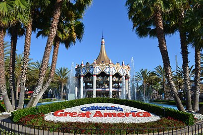
Directions to California’S Great America (Santa Clara) with public transportation
The following transit lines have routes that pass near California’S Great America
How to get to California’S Great America by bus?
Click on the bus route to see step by step directions with maps, line arrival times and updated time schedules.
How to get to California’S Great America by train?
Click on the train route to see step by step directions with maps, line arrival times and updated time schedules.
Light Rail stations near California’S Great America in Santa Clara
- Reamwood Station, 7 min walk,
- Lick Mill Station, 28 min walk,
Bus stations near California’S Great America in Santa Clara
- Agnew & Lakeshore (W), 10 min walk,
- Mission College & Burton (W), 12 min walk,
- Great America & Mission College (S), 19 min walk,
Train stations near California’S Great America in Santa Clara
- Great America-Santa Clara, 23 min walk,
Bus lines to California’S Great America in Santa Clara
- 20, Milpitas BART,
- ACE YELLOW, South Santa Clara,
- 59, Santa Clara Transit Ctr,
- 57, Old Ironsides Station,
- EXPRESS 121, Express Gilroy/Morgan Hill,
What are the closest stations to California’S Great America?
The closest stations to California’S Great America are:
- Reamwood Station is 582 yards away, 7 min walk.
- Agnew & Lakeshore (W) is 836 yards away, 10 min walk.
- Mission College & Burton (W) is 981 yards away, 12 min walk.
- Great America & Mission College (S) is 1543 yards away, 19 min walk.
- Great America-Santa Clara is 1939 yards away, 23 min walk.
- Lick Mill Station is 2357 yards away, 28 min walk.
Which bus lines stop near California’S Great America?
These bus lines stop near California’S Great America: 57, 59.
Which train line stops near California’S Great America?
CC
Which light rail line stops near California’S Great America?
ORANGE LINE
What’s the nearest light rail station to California’S Great America in Santa Clara?
The nearest light rail station to California’S Great America in Santa Clara is Reamwood Station. It’s a 7 min walk away.
What’s the nearest train station to California’S Great America in Santa Clara?
The nearest train station to California’S Great America in Santa Clara is Great America-Santa Clara. It’s a 23 min walk away.
What’s the nearest bus stop to California’S Great America in Santa Clara?
The nearest bus stop to California’S Great America in Santa Clara is Agnew & Lakeshore (W). It’s a 10 min walk away.
What time is the first light rail to California’S Great America in Santa Clara?
The ORANGE LINE is the first light rail that goes to California’S Great America in Santa Clara. It stops nearby at 6:30 AM.
What time is the last light rail to California’S Great America in Santa Clara?
The ORANGE LINE is the last light rail that goes to California’S Great America in Santa Clara. It stops nearby at 12:09 AM.
What time is the first train to California’S Great America in Santa Clara?
The ACE is the first train that goes to California’S Great America in Santa Clara. It stops nearby at 6:03 AM.
What time is the last train to California’S Great America in Santa Clara?
The CC is the last train that goes to California’S Great America in Santa Clara. It stops nearby at 9:39 PM.
What time is the first bus to California’S Great America in Santa Clara?
The 57 is the first bus that goes to California’S Great America in Santa Clara. It stops nearby at 7:26 AM.
What time is the last bus to California’S Great America in Santa Clara?
The 57 is the last bus that goes to California’S Great America in Santa Clara. It stops nearby at 8:30 PM.
See California’S Great America, Santa Clara, on the map
Public Transit to California’S Great America in Santa Clara
Wondering how to get to California’S Great America in Santa Clara, United States? Moovit helps you find the best way to get to California’S Great America with step-by-step directions from the nearest public transit station.
Moovit provides free maps and live directions to help you navigate through your city. View schedules, routes, timetables, and find out how long does it take to get to California’S Great America in real time.
Looking for the nearest stop or station to California’S Great America? Check out this list of stops closest to your destination: Reamwood Station; Agnew & Lakeshore (W); Mission College & Burton (W); Great America & Mission College (S); Great America-Santa Clara; Lick Mill Station.
Bus: 57, 59, 20, ACE YELLOW, EXPRESS 121.Train: CC.Light Rail: ORANGE LINE.
Want to see if there’s another route that gets you there at an earlier time? Moovit helps you find alternative routes or times. Get directions from and directions to California’S Great America easily from the Moovit App or Website.
We make riding to California’S Great America easy, which is why over 1.5 million users, including users in Santa Clara, trust Moovit as the best app for public transit. You don’t need to download an individual bus app or train app, Moovit is your all-in-one transit app that helps you find the best bus time or train time available.
For information on prices of bus, light rail and train, costs and ride fares to California’S Great America, please check the Moovit app.
Use the app to navigate to popular places including to the airport, hospital, stadium, grocery store, mall, coffee shop, school, college, and university.
Location: Santa Clara, San Francisco - San Jose, CA
Attractions near California’S Great America
2401 Agnew Road,Visitor Entrance,Thunder Raceway,Thunder Raceway,Eagle's Flight,Great America Hotdog and Snacks,Woodstock Express,Tiki Twirl,Sally's Love Buggies,Centrifuge,Pumpkin Patch,Great America Employee Parking,Peanuts Pirates,The Grizzly,Icee Mix It Up,Drop Zone,Snoopy Boutique,Leather Treaty,Character Carousel,Flying ACEHow to get to popular attractions in Santa Clara with public transit
Kaiser Permanente Medical Center, Santa Clara,City of Rohnert Park, Rohnert Park,San Antonio Caltrain Station,eBay Headquarters, San Jose,Safeway, San Jose,NASA Ames Research Center,Trader Joe's, Oakland,Napa Valley, Yountville,Stanford Dish Trail,Googleplex - Charlie's Cafe,Walmart Supercenter, American Canyon,City of Fremont, Fremont,IKEA, East Palo Alto,Fairfield, CA, Fairfield,Microsoft SVC,Campbell, CA, Campbell,Netflix, Inc., Los Gatos,Santa Clara, CA, Santa Clara,Google - Quad Campus,Mountain View, CAGet around San Francisco - San Jose, CA by public transit!
Traveling around San Francisco - San Jose, CA has never been so easy. See step by step directions as you travel to any attraction, street or major public transit station. View bus and train schedules, arrival times, service alerts and detailed routes on a map, so you know exactly how to get to anywhere in San Francisco - San Jose, CA.
When traveling to any destination around San Francisco - San Jose, CA use Moovit's Live Directions with Get Off Notifications to know exactly where and how far to walk, how long to wait for your line, and how many stops are left. Moovit will alert you when it's time to get off — no need to constantly re-check whether yours is the next stop.
Wondering how to use public transit in San Francisco - San Jose, CA or how to pay for public transit in San Francisco - San Jose, CA? Moovit public transit app can help you navigate your way with public transit easily, and at minimum cost. It includes public transit fees, ticket prices, and costs. Looking for a map of San Francisco - San Jose, CA public transit lines? Moovit public transit app shows all public transit maps in San Francisco - San Jose, CA with all Bus, Train, BART, Light Rail, Ferry and Cable Car routes and stops on an interactive map.
San Francisco - San Jose, CA has 6 transit type(s), including: Bus, Train, BART, Light Rail, Ferry and Cable Car, operated by several transit agencies, including BART, Bay Area Rapid Transit, Muni Metro, Caltrain, VTA, Capitol Corridor, Sonoma Marin Area Rail Transit, MUNI, SF Cable Car, AC Transit, Dumbarton Express, Golden Gate Transit, County Connection, SamTrans, SamTrans / City of Menlo Park