See Calle 146, Suba, on the map
Directions to Calle 146 (Suba) with public transportation
The following transit lines have routes that pass near Calle 146
 SITP:
SITP: - Transmilenio:
How to get to Calle 146 by SITP?
Click on the SITP route to see step by step directions with maps, line arrival times and updated time schedules.
How to get to Calle 146 by Transmilenio?
Click on the Transmilenio route to see step by step directions with maps, line arrival times and updated time schedules.
Sitp stations near Calle 146 in Suba
- Br. Santa Helena (Av. Villas - Cl 146a),4 min walk,
- Urbanización Bosque De La Colina (Av. Villas - Cl 145),5 min walk,
- Éxito Colina (Av. Boyacá - Cl 146b),6 min walk,
- Colegio Hijas De Cristo Rey (Ac 138 - Av. Villas),7 min walk,
- Br. Iberia Portoalegre (Cl 138 - Kr 58),7 min walk,
- Escuela De Carabineros (Av. Boyacá - Ac 147),8 min walk,
- Urbanización La Colina Campestre II Sector (Av. Villas - Cl 137a),10 min walk,
Transmilenio stations near Calle 146 in Suba
- Suba - Avenida Boyacá,12 min walk,
- Gratamira,13 min walk,
- Calle 142,20 min walk,
- Mazurén,28 min walk,
Sitp lines to Calle 146 in Suba
- C925,Estación Niza - Calle 127,
- B925,Estación Mazurén,
- E16A,Colina - Calle 153,
- E26B,Corpas,
- T53,Estación Alcalá ⇄ Colina,
- 330,La Estrellita,
- C401,Calle 170,
- B902,Calle 222,
- B903,Verbenal,
- T13,Villa Cindy,
- E61,Casablanca,
- C100,Casablanca,
- C118,Suba Berlín,
- C138,Bilbao,
- E61,Porciúncula,
- B100,Estación Alcalá,
- B118,San Cristóbal Norte,
- B138,Cedritos,
- E16A,Bosa San José,
- E26B,Cantón Norte,
What are the closest stations to Calle 146?
The closest stations to Calle 146 are:
- Br. Santa Helena (Av. Villas - Cl 146a) is 285 meters away, 4 min walk.
- Urbanización Bosque De La Colina (Av. Villas - Cl 145) is 329 meters away, 5 min walk.
- Éxito Colina (Av. Boyacá - Cl 146b) is 425 meters away, 6 min walk.
- Colegio Hijas De Cristo Rey (Ac 138 - Av. Villas) is 491 meters away, 7 min walk.
- Br. Iberia Portoalegre (Cl 138 - Kr 58) is 491 meters away, 7 min walk.
- Escuela De Carabineros (Av. Boyacá - Ac 147) is 600 meters away, 8 min walk.
- Urbanización La Colina Campestre II Sector (Av. Villas - Cl 137a) is 728 meters away, 10 min walk.
- Suba - Avenida Boyacá is 928 meters away, 12 min walk.
- Gratamira is 998 meters away, 13 min walk.
- Calle 142 is 1539 meters away, 20 min walk.
- Mazurén is 2146 meters away, 28 min walk.
Which SITP lines stop near Calle 146?
These SITP lines stop near Calle 146: 330, B903, B925, C401, E16A, E26B, T13.
Which Transmilenio lines stop near Calle 146?
These Transmilenio lines stop near Calle 146: C15, C25, G30, M84.
What’s the nearest SITP stop to Calle 146 in Suba?
The nearest SITP stop to Calle 146 in Suba is Br. Santa Helena (Av. Villas - Cl 146a). It’s a 4 min walk away.
What’s the nearest Transmilenio station to Calle 146 in Suba?
The nearest Transmilenio station to Calle 146 in Suba is Suba - Avenida Boyacá. It’s a 12 min walk away.
What time is the first SITP to Calle 146 in Suba?
The T13 is the first SITP that goes to Calle 146 in Suba. It stops nearby at 3:53 AM.
What time is the last SITP to Calle 146 in Suba?
The 330 is the last SITP that goes to Calle 146 in Suba. It stops nearby at 12:14 AM.
What time is the first Transmilenio to Calle 146 in Suba?
The C15 is the first Transmilenio that goes to Calle 146 in Suba. It stops nearby at 4:28 AM.
What time is the last Transmilenio to Calle 146 in Suba?
The 8 is the last Transmilenio that goes to Calle 146 in Suba. It stops nearby at 11:34 PM.
How much is the SITP fare to Calle 146?
The SITP fare to Calle 146 costs about $2950.00.
How much is the Transmilenio fare to Calle 146?
The Transmilenio fare to Calle 146 costs about $2950.00.
See Calle 146, Suba, on the map
Public Transit to Calle 146 in Suba
How to get to Calle 146 in Suba, Colombia?
It’s easy with Moovit. Type in your street address and Moovit’s route finder will locate the fastest way to get you there! Not sure where to get off on the street? Download the Moovit App to find live directions (including where to get off on Calle 146), see timetables and get the estimated arrival times for your favorite SITP or Transmilenio lines.
Looking for the nearest stop or station to Calle 146? Check out this list of closest stops available to your destination: Br. Santa Helena (Av. Villas - Cl 146a); Urbanización Bosque De La Colina (Av. Villas - Cl 145); Éxito Colina (Av. Boyacá - Cl 146b); Colegio Hijas De Cristo Rey (Ac 138 - Av. Villas); Br. Iberia Portoalegre (Cl 138 - Kr 58); Escuela De Carabineros (Av. Boyacá - Ac 147); Urbanización La Colina Campestre II Sector (Av. Villas - Cl 137a); Suba - Avenida Boyacá; Gratamira; Calle 142; Mazurén.
SITP:Transmilenio:
Download the Moovit App to see the current schedule and routes available for Suba. No need to install a special bus app to check the bus time or a train app to get train time. Moovit is the only all-in-one transit app that helps you get where you need to go.
We make riding on public transit to Calle 146 easy, which is why over 1.5 million users, including users in Suba trust Moovit as the best app for public transit.
Use the app to navigate to popular places including to the airport, hospital, stadium, grocery store, mall, coffee shop, school, college, and university.
Location: Suba, Bogota
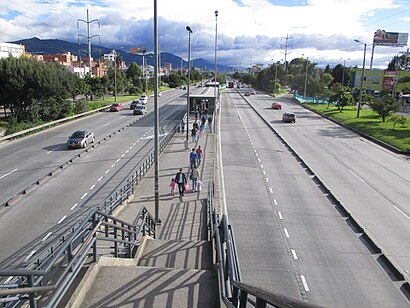
The simple station Calle 146 is part of the TransMilenio mass-transit system of Bogotá, Colombia, which opened in the year 2000.Wiki
Streets near Calle 146, Suba
Calle 137d, Suba,Calle 136a, Suba,Calle 135a, Suba,Carrera 72c, Suba,Carrera 55a, Suba,Calle 136, Suba,Calle 134a, Suba,Acceso Sótano, Suba,Carrera 57a, Suba,Carrera 73c, Suba,Carrera 54d, Suba,Calle 138, Suba,Carrera 59b Bis, Suba,Carrera 59a, Suba,Carrera 73, Suba,Calle 133, Suba,Carrera 73b, Suba,Calle 132a, Suba,Carrera 59c Bis, Suba,Carrera 73a, SubaHow to get to popular attractions in Suba with public transit
Fundación Cardio Infantil, Usaquén,Ciudad Alsacia, Kennedy,Calle 67 # Carrera 7, Chapinero,Universidad Jorge Tadeo Lozano, Santa Fe,Edificio Torre Pacific, Usaquén,Caracol Radio, Chapinero,Club El Nogal, Chapinero,Bavaria, Suba,Universidad El Bosque, Usaquén,Jumbo Hayuelos, Fontibón,Galerías, Teusaquillo,Parque Metropolitano Simón Bolívar, Teusaquillo,Centro Comercial Milenio Plaza, Kennedy,Pontificia Universidad Javeriana, Chapinero,Hayuelos, Fontibón,Calle 68 # Avenida Carrera 68, Engativá,Parque Ciudad Montes, Puente Aranda,Avenida Boyacá Carrera 72 # Calle 152b, Suba,Calle 34 # Carrera 7, Santa Fe,Castilla, KennedyGet around Suba by public transit!
Traveling around Suba has never been so easy. See step by step directions as you travel to any attraction, street or major public transit station. View bus and train schedules, arrival times, service alerts and detailed routes on a map, so you know exactly how to get to anywhere in Suba.
When traveling to any destination around Suba use Moovit's Live Directions with Get Off Notifications to know exactly where and how far to walk, how long to wait for your line, and how many stops are left. Moovit will alert you when it's time to get off — no need to constantly re-check whether yours is the next stop.
Wondering how to use public transit in Suba or how to pay for public transit in Suba? Moovit public transit app can help you navigate your way with public transit easily, and at minimum cost. It includes public transit fees, ticket prices, and costs. Looking for a map of Suba public transit lines? Moovit public transit app shows all public transit maps in Suba with all SITP or Transmilenio routes and stops on an interactive map.
Suba has 2 transit type(s), including: SITP or Transmilenio, operated by several transit agencies, including Buses Troncales, Buses Alimentadores, Buses Urbanos, Buses Complementarios, Buses Especiales, TransMiCable, Cerro de Monserrate, Aeropuerto El Dorado, Flota Chia LTDA, Auto Servicio Chía LTDA and Politécnico Grancolombiano