Directions to Calle 146 station (Usaquén) with public transit
The following transit lines have routes that pass near Calle 146
How to get to Calle 146 station by bus?
Click on the bus route to see step by step directions with maps, line arrival times and updated time schedules.
How to get to Calle 146 station by cable car?
Click on the cable car route to see step by step directions with maps, line arrival times and updated time schedules.
Cable Car stations near Calle 146 in Usaquén
- Calle 142 (Lado Sur), 4 min walk,
- Alcalá, 12 min walk,
- Clínica El Bosque (Ac 134 - Ak 7), 21 min walk,
- Calle 161 (Lado Norte), 30 min walk,
Bus stops near Calle 146 in Usaquén
- Br. Caobos Salazar (Ac 147 - Kr 12c), 5 min walk,
- Br. Cedro Bolívar II Sector (Ac 147 - Kr 14), 6 min walk,
- Br. Cedritos (Cl 142 - Kr 13), 10 min walk,
- Br. Parques De Lorena (Cl 151 - Kr 14b), 10 min walk,
Bus lines to Calle 146 station in Usaquén
- 19-6, Cedritos,
- B909, Mazurén,
- D909, Villas De Granada,
- 19-1, Auto Norte ⇄ Estación Alcalá,
- B926, Estación Mazurén,
What are the closest stations to Calle 146?
The closest stations to Calle 146 are:
- Calle 142 (Lado Sur) is 292 meters away, 4 min walk.
- Br. Caobos Salazar (Ac 147 - Kr 12c) is 346 meters away, 5 min walk.
- Br. Cedro Bolívar II Sector (Ac 147 - Kr 14) is 427 meters away, 6 min walk.
- Br. Cedritos (Cl 142 - Kr 13) is 732 meters away, 10 min walk.
- Br. Parques De Lorena (Cl 151 - Kr 14b) is 740 meters away, 10 min walk.
- Alcalá is 893 meters away, 12 min walk.
- Clínica El Bosque (Ac 134 - Ak 7) is 1573 meters away, 21 min walk.
- Calle 161 (Lado Norte) is 2296 meters away, 30 min walk.
Which bus lines stop near Calle 146?
These bus lines stop near Calle 146: 19-1, 19-6, 291, B309, B419, B909, T11.
Which cable car lines stop near Calle 146?
These cable car lines stop near Calle 146: 8, B12, B13, B50, B55, B75.
What’s the nearest bus stop to Calle 146 in Usaquén?
The nearest bus stop to Calle 146 in Usaquén is Br. Caobos Salazar (Ac 147 - Kr 12c). It’s a 5 min walk away.
What’s the nearest cable car station to Calle 146 in Usaquén?
The nearest cable car station to Calle 146 in Usaquén is Calle 142 (Lado Sur). It’s a 4 min walk away.
What time is the first bus to Calle 146 in Usaquén?
The 19-6 is the first bus that goes to Calle 146 in Usaquén. It stops nearby at 4:04 AM.
What time is the last bus to Calle 146 in Usaquén?
The 19-1 is the last bus that goes to Calle 146 in Usaquén. It stops nearby at 11:02 PM.
What time is the first cable car to Calle 146 in Usaquén?
The B46 is the first cable car that goes to Calle 146 in Usaquén. It stops nearby at 4:20 AM.
What time is the last cable car to Calle 146 in Usaquén?
The 8 is the last cable car that goes to Calle 146 in Usaquén. It stops nearby at 11:53 PM.
See Calle 146, Usaquén, on the map
Public Transit to Calle 146 in Usaquén
How to get to Calle 146 in Usaquén, Colombia?
It’s easy with Moovit. Type in your street address and Moovit’s route finder will locate the fastest way to get you there! Not sure where to get off on the street? Download the Moovit App to find live directions (including where to get off on Calle 146), see timetables and get the estimated arrival times for your favorite bus or cable car lines.
Looking for the nearest stop or station to Calle 146? Check out this list of closest stops available to your destination: Calle 142 (Lado Sur); Br. Caobos Salazar (Ac 147 - Kr 12c); Br. Cedro Bolívar II Sector (Ac 147 - Kr 14); Br. Cedritos (Cl 142 - Kr 13); Br. Parques De Lorena (Cl 151 - Kr 14b); Alcalá; Clínica El Bosque (Ac 134 - Ak 7); Calle 161 (Lado Norte).
Bus: 19-1, 19-6, 291, B309, B419, B909, T11, D909, B926.Cable Car: 8, B12, B13, B50, B55, B75, G12, B10, D10, B16, K16, B18.
Download the Moovit App to see the current schedule and routes available for Usaquén. No need to install a special bus app to check the bus time or a train app to get train time. Moovit is the only all-in-one transit app that helps you get where you need to go.
We make riding on public transit to Calle 146 easy, which is why over 1.5 million users, including users in Usaquén trust Moovit as the best app for public transit.
Use the app to navigate to popular places including to the airport, hospital, stadium, grocery store, mall, coffee shop, school, college, and university.
Location: Usaquén, Bogota
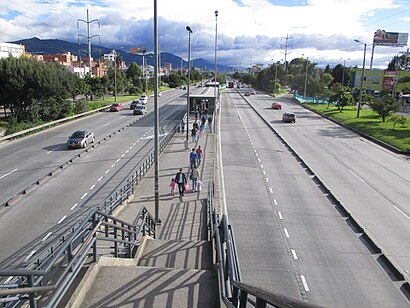
The simple station Calle 146 is part of the TransMilenio mass-transit system of Bogotá, Colombia, which opened in the year 2000.Wiki
Streets near Calle 146, Usaquén
Get around Usaquén by public transit!
Traveling around Usaquén has never been so easy. See step by step directions as you travel to any attraction, street or major public transit station. View bus and train schedules, arrival times, service alerts and detailed routes on a map, so you know exactly how to get to anywhere in Usaquén.
When traveling to any destination around Usaquén use Moovit's Live Directions with Get Off Notifications to know exactly where and how far to walk, how long to wait for your line, and how many stops are left. Moovit will alert you when it's time to get off — no need to constantly re-check whether yours is the next stop.
Wondering how to use public transit in Usaquén or how to pay for public transit in Usaquén? Moovit public transit app can help you navigate your way with public transit easily, and at minimum cost. It includes public transit fees, ticket prices, and costs. Looking for a map of Usaquén public transit lines? Moovit public transit app shows all public transit maps in Usaquén with all Bus, Cable Car and Funicular routes and stops on an interactive map.
Bogota has 3 transit type(s), including: Bus, Cable Car and Funicular, operated by several transit agencies, including Buses Troncales, TransMiZonal, Cerro de Monserrate, Aeropuerto El Dorado, TransMiCable, Flota Chia Ltda., Auto Servicio Chía Ltda. and Cootranscajicá Ltda.