Directions to Calle 40 Sur # Carrera 23c (Tunjuelito) with public transportation
The following transit lines have routes that pass near Calle 40 Sur # Carrera 23c
How to get to Calle 40 Sur # Carrera 23c by SITP?
Click on the SITP route to see step by step directions with maps, line arrival times and updated time schedules.
How to get to Calle 40 Sur # Carrera 23c by Transmilenio?
Click on the Transmilenio route to see step by step directions with maps, line arrival times and updated time schedules.
Sitp stations near Calle 40 Sur # Carrera 23c in Tunjuelito
- Urbanización Quiroga IX Etapa (Ak 24 - Cl 40 Sur),2 min walk,
- Br. Quiroga (Ak 24 - Cl 40 Sur),2 min walk,
- Br. Quiroga (Ak 24 - Ac 36 Sur),4 min walk,
- Parroquia San Luis Gonzaga (Ak 24 - Cl 42 Sur),6 min walk,
- Ied Manuel Del Socorro (Ac 44 Sur - Kr 23),10 min walk,
Transmilenio stations near Calle 40 Sur # Carrera 23c in Tunjuelito
- Santa Lucía,7 min walk,
- Olaya,9 min walk,
- Quiroga,12 min walk,
- Calle 40 Sur,19 min walk,
Sitp lines to Calle 40 Sur # Carrera 23c in Tunjuelito
- T12,San Joaquín,
- T25,Potosí,
- H408,Diana Turbay,
- H600,Jerusalén,
- H602,Galicia,
- H618,Santo Domingo,
- H620,La Estancia,
- 624,Verbenal Del Sur,
- H704,El Uval,
- H720,Ciudadela Usme,
- 796A,Mochuelo Bajo,
- T11,Calle 222,
- T12,Calle 100,
- T25,Terminal Norte,
- 7-3,Inglés,
- F408,Tierra Buena,
- A600,Chapinero,
- L602,Los Laches,
- B608,Calle 134,
- A618,Germania,
What are the closest stations to Calle 40 Sur # Carrera 23c?
The closest stations to Calle 40 Sur # Carrera 23c are:
- Urbanización Quiroga IX Etapa (Ak 24 - Cl 40 Sur) is 145 meters away, 2 min walk.
- Br. Quiroga (Ak 24 - Cl 40 Sur) is 148 meters away, 2 min walk.
- Br. Quiroga (Ak 24 - Ac 36 Sur) is 288 meters away, 4 min walk.
- Parroquia San Luis Gonzaga (Ak 24 - Cl 42 Sur) is 453 meters away, 6 min walk.
- Santa Lucía is 531 meters away, 7 min walk.
- Olaya is 656 meters away, 9 min walk.
- Ied Manuel Del Socorro (Ac 44 Sur - Kr 23) is 709 meters away, 10 min walk.
- Quiroga is 868 meters away, 12 min walk.
- Calle 40 Sur is 1403 meters away, 19 min walk.
Which SITP lines stop near Calle 40 Sur # Carrera 23c?
These SITP lines stop near Calle 40 Sur # Carrera 23c: B608, H408, H600, H620, H720, T12.
Which Transmilenio lines stop near Calle 40 Sur # Carrera 23c?
These Transmilenio lines stop near Calle 40 Sur # Carrera 23c: H13, H15, H20, H21, H54.
What’s the nearest SITP stop to Calle 40 Sur # Carrera 23c in Tunjuelito?
The nearest SITP stops to Calle 40 Sur # Carrera 23c in Tunjuelito are Urbanización Quiroga IX Etapa (Ak 24 - Cl 40 Sur) and Br. Quiroga (Ak 24 - Cl 40 Sur). The closest one is a 2 min walk away.
What’s the nearest Transmilenio station to Calle 40 Sur # Carrera 23c in Tunjuelito?
The nearest Transmilenio station to Calle 40 Sur # Carrera 23c in Tunjuelito is Santa Lucía. It’s a 7 min walk away.
What time is the first SITP to Calle 40 Sur # Carrera 23c in Tunjuelito?
The T25 is the first SITP that goes to Calle 40 Sur # Carrera 23c in Tunjuelito. It stops nearby at 3:16 AM.
What time is the last SITP to Calle 40 Sur # Carrera 23c in Tunjuelito?
The 7-1 is the last SITP that goes to Calle 40 Sur # Carrera 23c in Tunjuelito. It stops nearby at 12:40 AM.
What time is the first Transmilenio to Calle 40 Sur # Carrera 23c in Tunjuelito?
The D21 is the first Transmilenio that goes to Calle 40 Sur # Carrera 23c in Tunjuelito. It stops nearby at 4:03 AM.
What time is the last Transmilenio to Calle 40 Sur # Carrera 23c in Tunjuelito?
The H75 is the last Transmilenio that goes to Calle 40 Sur # Carrera 23c in Tunjuelito. It stops nearby at 11:43 PM.
See Calle 40 Sur # Carrera 23c, Tunjuelito, on the map
Public Transit to Calle 40 Sur # Carrera 23c in Tunjuelito
Wondering how to get to Calle 40 Sur # Carrera 23c in Tunjuelito, Colombia? Moovit helps you find the best way to get to Calle 40 Sur # Carrera 23c with step-by-step directions from the nearest public transit station.
Moovit provides free maps and live directions to help you navigate through your city. View schedules, routes, timetables, and find out how long does it take to get to Calle 40 Sur # Carrera 23c in real time.
Looking for the nearest stop or station to Calle 40 Sur # Carrera 23c? Check out this list of stops closest to your destination: Urbanización Quiroga IX Etapa (Ak 24 - Cl 40 Sur); Br. Quiroga (Ak 24 - Cl 40 Sur); Br. Quiroga (Ak 24 - Ac 36 Sur); Parroquia San Luis Gonzaga (Ak 24 - Cl 42 Sur); Santa Lucía; Olaya; Ied Manuel Del Socorro (Ac 44 Sur - Kr 23); Quiroga; Calle 40 Sur.
SITP:B608H408H600H620H720T12T11T257-3F408T25H6027-17-239K721953Transmilenio:H13H15H20H21H5433C17H17D21
Want to see if there’s another route that gets you there at an earlier time? Moovit helps you find alternative routes or times. Get directions from and directions to Calle 40 Sur # Carrera 23c easily from the Moovit App or Website.
We make riding to Calle 40 Sur # Carrera 23c easy, which is why over 1.5 million users, including users in Tunjuelito, trust Moovit as the best app for public transit. You don’t need to download an individual bus app or train app, Moovit is your all-in-one transit app that helps you find the best bus time or train time available.
For information on prices of SITP and Transmilenio, costs and ride fares to Calle 40 Sur # Carrera 23c, please check the Moovit app.
Use the app to navigate to popular places including to the airport, hospital, stadium, grocery store, mall, coffee shop, school, college, and university.
Location: Tunjuelito, Bogota
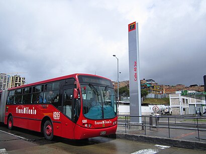
The intermediate station Calle 40 Sur is part of the TransMilenio mass-transit system of Bogotá, Colombia, opened in the year 2000.Wiki
Attractions near Calle 40 Sur # Carrera 23c
25 Calle 40 Sur 23C,Colegio San Luis Gonzaga,Parroquia San Luis Gonzaga,colegio Restrepo Millan IED,Calle 40 Sur 23C-50,Colegio Nacional Restrepo Millãn Sede A,Polideportivo Quiroga,Caps Future Rooms - Kensy,Christ Blesses Barber Shop,Carrera 23 # Calle 40 Sur,Convención Jas Sano 2018 - Bogotá Sur,Calle 40 24-55,Colegio Parroquial San Luis Gonzaga,Carrera 23 39-15,97 Carrera 23 37 S,Restaurante Tantalo,Apapacha,Avenida Mariscal Sucre Carrera 24 # Calle 40 Sur,Colegio Bravo Paez,Calle 41 Sur # Carrera 23cHow to get to popular attractions in Tunjuelito with public transit
Avenida Calle 82 # Carrera 7, Chapinero,Centro Comercial Mallplaza NQS, Los Mártires,Éxito, Usaquén,Hospital El Tunal, Tunjuelito,Centro Comercial Cedritos, Usaquén,Calle 34 # Carrera 7, Santa Fe,Centro Comercial Milenio Plaza, Kennedy,Parque Ciudad Montes, Puente Aranda,Sala VIP Avianca, Engativá,El Tambor, Usaquén,Avenida Boyacá Carrera 72 # Calle 152b, Suba,Calle 113 # Carrera 7, Usaquén,Centro Comercial Santafé Bogotá, Suba,Centro Comercial Parque La Colina, Suba,Boitá, Kennedy,Avenida Carrera 15 # Glorieta Calle 100, Usaquén,Supercade Cad, Teusaquillo,Universidad De San Buenaventura, Usaquén,Uniagustiniana, Kennedy,Club El Nogal, ChapineroGet around Tunjuelito by public transit!
Traveling around Tunjuelito has never been so easy. See step by step directions as you travel to any attraction, street or major public transit station. View bus and train schedules, arrival times, service alerts and detailed routes on a map, so you know exactly how to get to anywhere in Tunjuelito.
When traveling to any destination around Tunjuelito use Moovit's Live Directions with Get Off Notifications to know exactly where and how far to walk, how long to wait for your line, and how many stops are left. Moovit will alert you when it's time to get off — no need to constantly re-check whether yours is the next stop.
Wondering how to use public transit in Tunjuelito or how to pay for public transit in Tunjuelito? Moovit public transit app can help you navigate your way with public transit easily, and at minimum cost. It includes public transit fees, ticket prices, and costs. Looking for a map of Tunjuelito public transit lines? Moovit public transit app shows all public transit maps in Tunjuelito with all SITP or Transmilenio routes and stops on an interactive map.
Tunjuelito has 2 transit type(s), including: SITP or Transmilenio, operated by several transit agencies, including Buses Troncales, Buses Alimentadores, Buses Urbanos, Buses Complementarios, Buses Especiales, TransMiCable, Cerro de Monserrate, Aeropuerto El Dorado, Flota Chia LTDA, Auto Servicio Chía LTDA and Politécnico Grancolombiano